
Sandy Cove in Nova Scotia
Sandy Cove is a community of the Halifax Regional Municipality in the Canadian province of Nova Scotia on the Chebucto Peninsula.
Sandy Cove is a community of the Halifax Regional Municipality in the Canadian province of Nova Scotia on the Chebucto Peninsula.
| Climate data for Sandy Cove (1981–2010) | |||||||||||||
|---|---|---|---|---|---|---|---|---|---|---|---|---|---|
| Month | Jan | Feb | Mar | Apr | May | Jun | Jul | Aug | Sep | Oct | Nov | Dec | Year |
| Record high °C (°F) | 12.5 (54.5) | 10.6 (51.1) | 15.6 (60.1) | 25.0 (77.0) | 25.5 (77.9) | 30.0 (86.0) | 29.0 (84.2) | 33.0 (91.4) | 28.0 (82.4) | 21.5 (70.7) | 18.0 (64.4) | 12.8 (55.0) | 33.0 (91.4) |
| Average high °C (°F) | 0.4 (32.7) | 0.5 (32.9) | 2.9 (37.2) | 7.0 (44.6) | 11.2 (52.2) | 16.0 (60.8) | 19.2 (66.6) | 20.4 (68.7) | 18.1 (64.6) | 13.2 (55.8) | 8.4 (47.1) | 3.1 (37.6) | 10.0 (50.0) |
| Daily mean °C (°F) | −3.9 (25.0) | −3.6 (25.5) | −0.7 (30.7) | 3.5 (38.3) | 7.6 (45.7) | 12.3 (54.1) | 15.6 (60.1) | 16.7 (62.1) | 14.3 (57.7) | 9.4 (48.9) | 4.7 (40.5) | −1.0 (30.2) | 6.2 (43.2) |
| Average low °C (°F) | −8.1 (17.4) | −7.6 (18.3) | −4.3 (24.3) | −0.1 (31.8) | 3.8 (38.8) | 8.4 (47.1) | 11.7 (53.1) | 12.9 (55.2) | 10.3 (50.5) | 5.5 (41.9) | 1.0 (33.8) | −5.1 (22.8) | 2.4 (36.3) |
| Record low °C (°F) | −26.5 (−15.7) | −23.0 (−9.4) | −20.5 (−4.9) | −11.0 (12.2) | −5.6 (21.9) | 1.0 (33.8) | 5.0 (41.0) | 4.0 (39.2) | −2.0 (28.4) | −6.1 (21.0) | −11.1 (12.0) | −25.0 (−13.0) | −26.5 (−15.7) |
| Average precipitation mm (inches) | 118.1 (4.65) | 103.6 (4.08) | 115.2 (4.54) | 117.7 (4.63) | 115.1 (4.53) | 115.1 (4.53) | 110.5 (4.35) | 97.8 (3.85) | 107.0 (4.21) | 117.1 (4.61) | 132.3 (5.21) | 134.7 (5.30) | 1,384 (54.49) |
| Average rainfall mm (inches) | 85.2 (3.35) | 74.2 (2.92) | 91.9 (3.62) | 112.6 (4.43) | 114.6 (4.51) | 115.1 (4.53) | 110.5 (4.35) | 97.8 (3.85) | 107.0 (4.21) | 117.0 (4.61) | 126.9 (5.00) | 117.2 (4.61) | 1,269.9 (50.00) |
| Average snowfall cm (inches) | 32.9 (13.0) | 29.4 (11.6) | 23.3 (9.2) | 5.1 (2.0) | 0.5 (0.2) | 0.0 (0.0) | 0.0 (0.0) | 0.0 (0.0) | 0.0 (0.0) | 0.1 (0.0) | 5.4 (2.1) | 17.5 (6.9) | 114.2 (45.0) |
| Average precipitation days (≥ 0.2 mm) | 13.4 | 11.0 | 13.5 | 15.4 | 17.2 | 15.3 | 13.9 | 14.2 | 13.2 | 14.1 | 15.6 | 13.8 | 170.5 |
| Average rainy days (≥ 0.2 mm) | 9.1 | 7.1 | 10.4 | 15.0 | 17.2 | 15.3 | 13.9 | 14.2 | 13.2 | 14.1 | 14.9 | 11.7 | 156.0 |
| Average snowy days (≥ 0.2 cm) | 5.7 | 5.0 | 4.3 | 1.2 | 0.15 | 0.0 | 0.0 | 0.0 | 0.0 | 0.05 | 1.1 | 3.3 | 20.8 |
| Mean monthly sunshine hours | 101.9 | 111.9 | 132.3 | 134.2 | 166.8 | 181.7 | 202.6 | 190.0 | 181.6 | 145.1 | 98.7 | 89.9 | 1,736.5 |
| Percent possible sunshine | 35.5 | 38.3 | 35.9 | 33.3 | 36.4 | 39.1 | 43.1 | 43.7 | 48.2 | 42.5 | 34.1 | 32.5 | 38.6 |
| Source: Environment Canada [1] [2] | |||||||||||||
Coordinates: 44°28′13.07″N63°33′32.7″W / 44.4702972°N 63.559083°W

Louisbourg is an unincorporated community and former town in Cape Breton Regional Municipality, Nova Scotia.
Truro is a town in central Nova Scotia, Canada. Truro is the shire town of Colchester County and is located on the south side of the Salmon River floodplain, close to the river's mouth at the eastern end of Cobequid Bay.

Kentville is an incorporated town in Nova Scotia. It is the most populous town in the Annapolis Valley. As of 2021, the town's population was 6,630. Its census agglomeration is 26,929.

Liverpool is a Canadian community and former town located along the Atlantic Ocean of the Province of Nova Scotia's South Shore. It is situated within the Region of Queens Municipality which is the local governmental unit that comprises all of Queens County, Nova Scotia.

Halifax is the capital and largest municipality of the Canadian province of Nova Scotia, and the largest municipality in Atlantic Canada. Halifax is one of Canada's fastest growing municipalities, and as of 2022, it is estimated that the CMA population of Halifax was 480,582,with 348,634 people in its urban area. The regional municipality consists of four former municipalities that were amalgamated in 1996: Halifax, Dartmouth, Bedford, and Halifax County.
Greenwood is a village located in the western part of Kings County in Nova Scotia's Annapolis Valley.
Debert is an unincorporated farming community in Nova Scotia, Canada. Located in the central-western part of Colchester County, it is approximately 20 km (12 mi) west of Truro.

District of Shelburne, officially named the Municipality of the District of Shelburne, is a district municipality comprising the eastern section of Shelburne County, Nova Scotia, Canada, but does not include the Towns of Shelburne or Lockeport. Statistics Canada classifies the district municipality as a municipal district. It is home to the Bowers Meadows Wilderness Area.
The Halifax Regional Municipality (HRM) in Nova Scotia, Canada has a widely varied geography.
Upper Stewiacke is a small community located in Colchester County in central Nova Scotia. Upper Stewiacke can be reached by road via Route 289. Upper Stewiacke was founded in 1783 by Matthew Johnson, son of James Johnson, a Grantee of Truro, Nova Scotia. Johnson's supplies had come from Truro, some 20 miles away. In 1983, a special event and reenactment was held to mark the 200th Anniversary of the arrival of Matthew Johnson and his wife Ruth.

Middle Musquodoboit is a rural community in the Musquodoboit Valley region of Nova Scotia, Canada within the Halifax Regional Municipality, along the Musquodoboit River at the junction of Route 357 with Route 224, 78 kilometres (48 mi) from Dartmouth, Nova Scotia. The community's name comes from the First Nations' word Mooskoduboogwek, which means to suddenly widen out after a narrow entrance at a mouth. For a time after 1883, Middle Musquodoboit was called Laytonville, but at some point reverted to its former name.

The Municipality of the District of Chester is a Nova Scotia district municipality occupying the northeastern half of Lunenburg County, Canada.
Mill Village is a Canadian rural community in the Region of Queens Municipality, Nova Scotia. It developed in relation to the lumber industry. Located inland from the Atlantic coast, Mill Village was the site of Canada's first satellite earth station constructed in the 1960s.
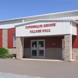
Cornwallis Square is a Canadian village in Kings County, Nova Scotia. It is located on the Cornwallis River.
St. Margarets Bay is a community of the Halifax Regional Municipality in the Canadian province of Nova Scotia.
Charlesville is a community in the Canadian province of Nova Scotia, located in the Municipality of the District of Barrington of Shelburne County.
Sandy Cove is a community in the Canadian province of Nova Scotia, located in the Municipality of the District of Digby. in Digby County on Digby Neck. The community is the birthplace of Laurence Bradford Dakin.
Pockwock is one of four Black Nova Scotian settlements in Upper Hammonds Plains. People in this area are mostly descendants of War of 1812 refugees. It is located in the Halifax Regional Municipality in the Canadian province of Nova Scotia. The Halifax Regional Water Commission uses Pockwock Lake as a source for water for the communities of Halifax, Bedford and Lower Sackville.
Farmington is a community in the Canadian province of Nova Scotia, located in the Lunenburg Municipal District in Lunenburg County.

Nova Scotia lies in the mid-temperate zone, and although the province is almost surrounded by water, the climate is closer to continental climate rather than maritime climate. The temperature extremes of the continental climate are moderated by the ocean.
| | This Halifax County, Nova Scotia location article is a stub. You can help Wikipedia by expanding it. |