
Hyderabad District, is a district of Sindh, Pakistan. Its capital is the city of Hyderabad. The district is the second most urbanized in Sindh, after Karachi, with 80% of its population residing in urban areas.

Khairpur District is a district in the Pakistani province of Sindh in Sukkur Division.

Sanghar District (Sindhi: ضلعو سانگھڙ, Urdu: ضلع سانگھڑ) is one of the largest districts of Sindh province, Pakistan. This district lies between 25058'13 N latitudes and 69024'4E longitudes. It was a village before Mallah tribe were settled there. This district has the largest Mallah population. It has an area of 9874 square kilometres. It is located in the centre of Sindh and is bounded to the east by India. The district capital, Sanghar, is itself a small city roughly 35 miles (56 km) east-south-east of the city of Nawabshah and the same distance north of Mirpur Khas. Its primary industry is agriculture.
Sanghar is a city in Sanghar District, Sindh, Pakistan. Sanghar is the headquarters of Sanghar District and Sanghar Taluka. The driving distance of Sangher from Karachi is 268 kilometers. It has road links with Hyderabad, Nawabshah, Mirpur Khas, Khairpur, Sukkur, Karachi and other major cities of Sindh.

Sukkur District is a district in Sindh Province in Pakistan. Two districts have been split off from the territory of Sukkur: Shikarpur in 1977 and Ghotki in 1993. According to 2023 Pakistani census population of Sukkur District is 1,625,467.

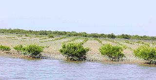
The Badin District is a district in the Sindh province of Pakistan. The total area of the district is 6,726 square kilometers. Headquartered at the city of Badin, the district is situated between 24°-5` to 25°-25` north latitude and 68 21’ to 69 20’ east longitude and is bounded on the north by the Tando Allahyar District, Northwest by Hyderabad District, on the east by Mirpur Khas and Tharparkar districts, on the south by the Kutch district of India, and on the west by Sujawal and Tando Muhammad Khan District.

Jacobabad District is a district in the province of Sindh, Pakistan. According to 2023 Census population of Jacobabad District is 1,174,097 It is located in the north of Sindh, by the provincial boundary with Balochistan. Its headquarters is the town of Jacobabad, which was founded by General John Jacob in 1847.

Mirpur Khas District is one of the districts of Mirpur Khas Division in the province of Sindh, Pakistan. Its capital is Mirpur Khas city. District Mirpur Khas became district by separating from Tharparkar District on 31 October 1990. According to 2023 Pakistani census population of Mirpur Khas district is 1,680,980.

Naushahro Feroze District is a district in the province of Sindh, Pakistan. Its capital is Naushahro Feroze city. Administratively subdivided into five talukas and 51 union councils, according to the 2017 census of Pakistan it had a population of 1,612,373. The Naushahro Feroze was given the status of District on 15 November 1989 and. Before, it was Taluka of Nawabshah District. On given status as district, Naushahro Feroze was placed under administrative control of Sukkur Division however, it has been placed under Shaheed Benazirabad Division during 2011.

Shaheed Benazirabad District previously known as Nawabshah District, is one of the districts in the province of Sindh, Pakistan.

Matiari District is a district in the Pakistani province of Sindh. Located on the left bank of the Indus River, Matiari became an independent district on 30 May 2004 under the military regime of Pervez Musharraf, when Hyderabad was divided into four districts — Tando Allahyar, Matiari, Tando Mohammad Khan and Hyderabad.
Ratodero Tehsil is a tehsil, located in the Larkana District in the Sindh province of Pakistan. It is about 28 km from the district capital Larkana. Before the partition of India, the city had a special reputation for its sweet products.

Jacobabad Tehsil is an administrative subdivision (tehsil) of Jacobabad District, Sindh, Pakistan. It is subdivided into 15 Union Councils, 8 of which comprise the capital Jacobabad

Hyderabad Tehsil (rural) is an administrative subdivision (tehsil) of Hyderabad District in the Sindh province of Pakistan. Hyderabad district is subdivided into 4 talukas, the Urban area around the capital Hyderabad is part of Hyderabad City Taluka.
Hyderabad City Tehsil is an administrative subdivision (tehsil) of Hyderabad District in the Sindh province of Pakistan. Hyderabad district is subdivided into 4 talukas, the Urban area around the capital Hyderabad is part of Hyderabad City Taluka.
Sinjhoro is a small town of Sanghar District, Sindh, Pakistan, around 12 kilometers to the west of Sanghar City. The Taluka Municipal Administration is based in Sinjhoro, and a Mukhtiarkar has been in charge of handling revenue issues since the times of British colonial rule.Rana Muhammed Anwar is said as king of Sinjhoro's politics but Waryam Faqeer from PML-F and GDA is MPA from last 10 years.
Samaro is a tehsil in the Sindh province of Pakistan. The town is the headquarters of a tehsil of Umarkot District.
Matiari Tehsil is an administrative subdivision, (Tehsil), of Matiari District in the Sindh province of Pakistan. As of the 2017 census, Matiari Taluka has a population of 340,677. The total population constitutes 297,553 rural and 43,124 urban population. Total area of this Taluka is 706 km2.
Kot Ghulam Muhammad is named after Ghulam Muhammad Khan Bhurgri, the Tehsil situated in south-east Mirpur Khas District of the Southern Province Sindh in Pakistan. Kot Ghlam Muhammad Bhurgri is situated west of Samaro and north of Digri. It is about 45 kilometres (28 mi) south of Mirpur Khas.
Sujawal District is a district of the Sindh province of Pakistan. It is located at 24°36'23" North and 68°4'19" East and is bordered in the northwest by the Indus River, which separates it from Thatta District. The district has an area of 7335 km2.
