Sangrul

Last updated
Sangrul
city
India Maharashtra location map.svg
Red pog.svg
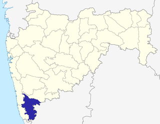
Sangrul
Location in Maharashtra, India
Coordinates: 16°40′59″N74°05′31″E / 16.6831235°N 74.0918827°E / 16.6831235; 74.0918827 Coordinates: 16°40′59″N74°05′31″E / 16.6831235°N 74.0918827°E / 16.6831235; 74.0918827
CountryFlag of India.svg  India
State Maharashtra
District Kolhapur
Languages
  Official Marathi
Time zone IST (UTC+5:30)

Sangrul is a small town in Karvir taluka of Kolhapur district in the Indian state of Maharashtra. Its Coordinates are: 16.6831235 N 74.0918827E. [1] and is located on Maharashtra State Highway 115 between Kolhapur and Gaganbawada town.

Kolhapur district District of Maharashtra in India

Kolhapur district is in Maharashtra state. The city of Kolhapur is the district headquarters. As of 2011, the district had population of 3,876,001, of which 33% were urban.

India Country in South Asia

India, also known as the Republic of India, is a country in South Asia. It is the seventh largest country by area and with more than 1.3 billion people, it is the second most populous country and the most populous democracy in the world. Bounded by the Indian Ocean on the south, the Arabian Sea on the southwest, and the Bay of Bengal on the southeast, it shares land borders with Pakistan to the west; China, Nepal, and Bhutan to the northeast; and Bangladesh and Myanmar to the east. In the Indian Ocean, India is in the vicinity of Sri Lanka and the Maldives, while its Andaman and Nicobar Islands share a maritime border with Thailand and Indonesia.

Maharashtra State in western, southern and central India

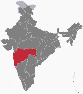
Maharashtra is a state considered to be part of western, central, southern and south-central India. It is the second-most populous state and third-largest state by area in India. Spread over 307,713 km2 (118,809 sq mi), it is bordered by the Arabian Sea to the west, the Indian states of Karnataka and Goa to the south, Telangana and Chhattisgarh to the east, Gujarat and Dadra and Nagar Haveli to the north west, and Madhya Pradesh to the north. It is also the world's second-most populous subnational entity. It was formed by merging the western and south-western parts of the Bombay State, Berar and Vidarbha, and the north-western parts of the Hyderabad State and splitting Saurashtra by the States Reorganisation Act. It has over 112 million inhabitants and its capital, Mumbai, has a population around 18 million making it the most populous urban area in India. Nagpur hosts the winter session of the state legislature. Pune is known as 'Oxford of the East' due to the presence of several well-known educational institutions.

Before the delimitation of constituency in 2008, Adyar was constituency number 282 of Maharashtra Legislative Assembly between 1977-2004. [2]

Related Research Articles

Kirloskarwadi Town in Maharashtra, India

Kirloskarwadi is an industrial township that developed around the Kirloskar Brothers Ltd factory in the Sangli district, in Maharashtra state, India. It is the second oldest industrial township in India. On 10 March 2010, Kirloskarwadi celebrated 100 years of its establishment. Kirloskarwadi is rapidly growing as satellite suburb of Sangli city. Famous holy place of God Datta Maharaj Audumbar is just 10 km away. Sagareshwar picnic spot is around 8-10 km away.Famous God Datta Maharaj holy place Audumbar is just about 11 Kms from this place.Other Nearby tourist places we can check on ixago and just dial website. Town has centric connectivity between Vita - Isalmapur - Palus - Tasgaon takulas.

Sadashivrao Dadoba Mandlik was a member of the 15th Lok Sabha of India from Kolhapur. He was a member of the Nationalist Congress Party (NCP) political party.

Kolhapur Airport airport

Kolhapur Airport(IATA: KLH, ICAO: VAKP) is an airport in Kolhapur, Maharashtra, India. It is situated at Ujlaiwadi, 9 km South-East from Kolhapur city. It is operated by the Airports Authority of India (AAI). The AAI is expanding the airport at a cost of Rs 274 Crore.

Peth Vadgaon city in Maharashtra, India

Peth Vadgaon) is a city and education hub in Kolhapur district in the Indian state of Maharashtra. It is governed by a municipal council.

Kolhapur Lok Sabha constituency is one of the 48 Lok Sabha (parliamentary) constituencies in Maharashtra state India.

Hatkanangle Lok Sabha constituency is one of the 48 Lok Sabha (parliamentary) constituencies in Maharashtra state in western India. This constituency was dissolved as a part of the implementation of delimitation in 1976. This constituency again came into existence in 2008 as a part of the implementation of delimitation of parliamentary constituencies based on the recommendations of the Delimitation Commission of India constituted on 12 July 2002. Vidhan Sabha segments from Sangli and Kolhapur districts have formed this new constituency.

Chandgad Vidhan Sabha constituency is one of the 288 Vidhan Sabha constituencies in Maharashtra state in western India.

Shirol Vidhan Sabha constituency is one of the 288 Vidhan Sabha constituencies in Maharashtra state in western India.

D. Y. Patil Governor of Tripura

Dnyandeo Yashwantrao Patil was Governor of Bihar state in eastern India from 29 May 2012 to 26 November 2014. He is an educator and was a leader of the Indian National Congress from Maharashtra state. He was appointed as the Governor of West Bengal. On 24 Dec 2018 he joined Nationalist Congress Party (NCP).

Walgaon Town in Maharashtra, India

Walgaon is a town in Amravati district in the Indian state of Maharashtra. Samadhi of Gadge Maharaj is located near this town.

Adyar, Bhandara Town in Maharashtra, India

Adyar or Adyal is a Census Town of Pauni Tahsil in Bhandara district in the Indian state of Maharashtra. As of 2010, the town's population was 11045.

Chausala city in Maharashtra, India

Chausala is a small village in Beed district in the Indian state of Maharashtra. It is located on the Dhule-Solapur National High Way No. 211. This village is politically very active. Its Coordinates are: 18.708692N 75.691595E. and is located on Maharashtra State road between Beed and Osmanabad town.

Dabhadi, Malegaon Town in Maharashtra, India

Dabhadi is a small town in Malegaon taluka of Nashik district in the Indian state of Maharashtra.

Pandegaon is a village in Belgaum district of Karnataka, India. Situated at the bank of Agrani river. Pandegaon is surrounded by Athani Taluka towards South, Miraj Taluka towards west, Jat Taluka towards East, Kavathe-Mahankal Taluka towards north & west.

Islampur Vidhan Sabha constituency is one of the 288 Vidhan Sabha constituencies of Maharashtra state in western India.

Radhanagari Vidhan Sabha constituency is one of the 288 Vidhan Sabha constituencies of Maharashtra state in western India.

Kagal Vidhan Sabha constituency is one of the 288 Vidhan Sabha constituencies of Maharashtra state in western India.

Kolhapur North is one of the 288 Vidhan Sabha constituencies of Maharashtra state, western India. This constituency is located in Kolhapur district.

Shahuwadi is one of the 288 Vidhan Sabha constituencies of Maharashtra state, western India. This constituency is located in Kolhapur district.

References

  1. "Map of Sangrul" . Retrieved 2010-01-05.
  2. "State elections 2004" . Retrieved 2010-01-05.