
Pithoragarh is the easternmost district in the state of Uttarakhand, India. It is located in the Himalayas and has an area of 7,110 km2 (2,750 sq mi) and a population of 483,439. The city of Pithoragarh, located in Saur Valley, is its headquarters. The district is within the Kumaon division of Uttarakhand state. The Tibet plateau is situated to the north and Nepal is to the east. The Kali River is formed by the joining of two headwaters near Gunji and flows south, forming the eastern border with Nepal. The Hindu pilgrimage route for Mount Kailash-Lake Manasarovar passes through this district via Lipulekh Pass in the greater Himalayas. The district is administratively divided into six tehsils: Munsyari; Dharchula; Didihat; Berinag; Gangolihat; and Pithoragarh. Naini Saini Airport is the nearest civil airport, but it does not have regular scheduled commercial passenger service. The mineral deposits present in the district are magnesium ore, copper ore, limestone and slate. There are 11 tehsil.

Om Parvat is a mountain in the Pithoragarh District, Uttarakhand, India and Darchula District, Sudurpashchim Pradesh, Nepal. It is close to Adi Kailash and the international border between Nepal and India runs across its summit point.

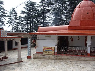
Dharchula is a town and a nagar panchayat in Pithoragarh district in the northern state of Uttarakhand, India. Dharchula is a major trading centre for the trans-Himalayan trade routes since medieval times. Situated at an elevation of 915 m above sea level, Dharchula is surrounded by Himalayan Peaks. The snow clad Panchachuli peaks located on the west of Dharchula separate it from the Johar valley and om parvat in East which it share with Nepal.Dharchula is situated on the bank of river Kali which originates from a place called kalapani, as it separates and form border between India and NepalThe hill station gets its name from ‘Darchyo’ and ‘la’; Darchyo is a white coloured traditional holy flag and la is an honorific term in Runglo. Thus got its name Darchyola later the word changed with time as Dharchula in India and Darchula in Nepal. Hence both of the region have the same name but different sounds in India and Nepal . It is situated in a valley, on the banks of the Kali River.
Gangolihat is a small Himalayan hill town in the Pithoragarh district of Uttarakhand, India. It is tehsil and sub divisional headquarters of the district. Gangolihat is known for its Shakti Peethas of Hat Kalika of goddess Kali. Nearby at 12 km 'Patal Bhubneshwar', caves are major tourist attraction. Also nearby are the tiny hill stations of Chaukori and Berinag from Gangolihat Panchachuli peaks and Nanda Devi are clearly visible.
Sin La is a high Himalayan mountain pass located in the eastern Kumaon in Pithoragarh District of Uttarakhand state in India.
Kuthi Valley is a Himalayan valley situated in the Pithoragarh District, Kumaon division of the Uttarakhand state of India. Located in the eastern part of Uttarakhand, it is the last valley before the border with Tibet. It runs along a NW to SE axis, formed by the river Kuthi Yankti, which is one of the headwaters of the Kali River that forms the boundary between India and Nepal in this region.
Sona Glacier is the Himalayan glacier situated in the eastern part of Uttarakhand in the Pithoragarh district of India.Sona Glacier is located at the base of five peaks of Panchchuli in the Lassar Yankti - Darma valley. With Meola glacier it forms the famous Panchchuli glacier as mixed glacial system. One can reach here as glacial trek through Tawaghat-Bailing-Son--Duktu-.Sona glacier and Meola glacier serves the route to climb Panchchuli peaks from east facing direction. Sona glacier is situated north to Meola Glacier. It is situated just below peaks like Ngalaphu 6,410 m and Panchchuli I.It is divided into Upper and Lower.The direction of the glacier is south west to north east. It is located on right hand side(East)to Panchchuli massif.

Burphu Dhura is a Himalayan mountain peak situated in the Pithoragarh district of Uttarakhand, India. The altitude of the summit is 6,334 m. It is situated at the end ridge over the Kalabaland Glacier in the eastern part of the district, left to the Milam Glacier. Kalabaland Dhura (6,105 m) is situated to the west of this peak on the same massif. Burphu Dhura massif is the part of divide between Kalabaland and Goriganga valleys. This peak was first of all climbed to summit in 2000 from south on 27 September 2000 by Loveraj Dharmashaktu, Balwant Singh Kapkoti and Ramesh by an Indian team led by Wing Cdr S S Puri. The peak has two approaches—one from the Kalabaland glacier above the icefall and another from Burphu village in the Milam valley.

Panchchuli Glacier is a Himalayan glacier, situated in the Pithoragarh district of Uttarakhand, India. It is located in the easternmost part of Kumaun. It is in the west and east of five peaks of Panchchuli on the Johar Valley and Darma valley. Uttari Balati glacier is situated north to it.

The Satopanth Glacier is situated in the Indian state of Uttarakhand.

Kalanag or Black Peak (6,387 m) is the highest peak in the Saraswati (Bandarpunch) mountain range, others being Saraswati Devi Parvat and Hanuman Parvat. It literally means "Black Cobra". It is close to the Ruinsara Valley. The peak was first summited in 1955 by Jack Gibson and students of The Doon School, Dehradun.

Hathi Parbat, also known as Elephant Peak, is a mountain in the Garhwal Himalayas in India. It is located in the Chamoli district of Uttarakhand state. Its summit has an elevation of 6,727 metres (22,070 ft).
Adi Kailash, also known as Shiva Kailash, Chota Kailash, Baba Kailash or Jonglingkong Peak, is a mountain located in the Himalayan mountain range in the Pithoragarh district of Uttarakhand, India.

Kalindi pass, or Kalindi khal is a high altitude mountain pass connecting Gangotri and Gastoli. It is situated at 5,950 metres (19,520 ft) elevation and is arguably the most famous trekking pass of the Garhwal Himalaya.

Vasuki Parbat or Vasuki Parvat is a mountain range of Garhwal Himalaya in Vasuki Glacier Uttarakhand India, It has a subsidiary peak Vasuki south. Vasuki Parbat standing majestically at 6792 meter and the south peak 6702 meter. Its the 35th highest located entirely within the uttrakhand India. Nanda Devi, is the highest mountain in this category.

Bidhan Parbat is a mountain of the northern Garhwal Himalaya in Uttarakhand India.The elevation of Bidhan Parbat is 6,520 metres (21,391 ft) and its prominence is 234 metres (768 ft). It is 84th highest located entirely within the Uttrakhand. Nanda Devi, is the highest mountain in this category. It is situated in the Zaskar Range. It lies 3 km west of Deoban 6,855 metres (22,490 ft) its nearest higher neighbor. Mandir Parbat 6,559 metres (21,519 ft) lies 8.3 km SW and it is 10.4 km SE of Kamet 7,756 metres (25,446 ft). It lies 6.6 km SE of Mana Peak 7,272 metres (23,858 ft).
Ishan Parbat is a mountain of the Kumaon Himalaya in Uttarakhand India also called Adi Kailash II. The elevation of Ishan Parbat is 6,120 metres (20,079 ft) and its prominence is 456 metres (1,496 ft). It is joint 154th highest located entirely within the Uttrakhand. Nanda Devi, is the highest mountain in this category. It lies 1.1km SW of Adi Kailash 5,945 metres (19,505 ft) and 4.9km NNW of Brammah Parvat 6,321 metres (20,738 ft) its nearest higher neighbor. It lies 12.7km NW of Rajay Jue 6,242 metres (20,479 ft). It is located 16.3km WSW of Sangthang 6,433 metres (21,106 ft) and 22km west lies Panchchuli II 6,907 metres (22,661 ft).
Bhrigu Parbat is a mountain of the Garhwal Himalaya in Uttarakhand India. It is situated in the Gangotri National Park. The elevation of Bhrigu Parbat is 6,041 metres (19,820 ft). It is joint 167th highest located entirely within the Uttrakhand. Nanda Devi, is the highest mountain in this category. It lies NNW to Manda I 6,491 metres (21,296 ft) its nearest higher neighbor.
Gorur Parbat is a mountain of the Garhwal Himalaya in Uttarakhand India. It is situated just outside of the northern rim of Nanda Devi Sanctuary. The elevation of Gorur Parbat is 6,504 metres (21,339 ft) and its prominence is 577 metres (1,893 ft). It is joint 88th highest located entirely within the Uttrakhand. Nanda Devi, is the highest mountain in this category. It lies 3.1 km SSE of Lampak I 6,325 metres (20,751 ft). Rishi Pahar 6,992 metres (22,940 ft) lies 8.6 km SSE and it is 6.6 km NNW of Hardeol 7,151 metres (23,461 ft). It lies 4.5 km NW of Tirsuli West 7,035 metres (23,081 ft).