
The River Mersey is a river in the North West of England. Its name is derived from Old English and means "boundary river", possibly referring to its having been a border between the ancient kingdoms of Mercia and Northumbria. For centuries it has formed part of the boundary between the historic counties of Lancashire and Cheshire.
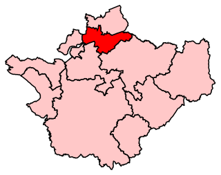
Warrington South is a constituency represented in the House of Commons of the UK Parliament since 2019 by Andy Carter, a Conservative Party politician.

Great Sankey is a civil parish in the Borough of Warrington, Cheshire, England. It is 2 miles (3.2 km) west of Warrington town centre and had a population of 24,211 in 2001 Census.It is often considered a suburb of Warrington due to it being contiguous with the town itself.
Penketh is a civil parish and suburb of Warrington in the Borough of Warrington, Cheshire, England. It is located about 3 miles (4.8 km) west of Warrington town centre. It has a population of 8,699. It is in the historic county of Cheshire.
The Metropolitan Borough of St Helens is a local government district with borough status in Merseyside, North West England. The borough is named after its largest settlement, St Helens but also includes neighbouring towns and villages such as Earlestown, Rainhill, Eccleston, Clock Face, Haydock, Billinge, Rainford and Newton-le-Willows.

The Sankey Canal in North West England, initially known as the Sankey Brook Navigation and later the St Helens Canal, is a former industrial canal, which when opened in 1757 was England's first of the Industrial revolution, and the first modern canal.

Bingley Five-Rise Locks is a staircase lock on the Leeds and Liverpool Canal at Bingley. As the name implies, a boat passing through the lock is lifted or lowered in five stages.

St Helens and Runcorn Gap Railway was an early railway line owned by a company of the same name in Lancashire, England, which opened in 1833. It was later known as St Helens Railway. It ran originally from the town of St Helens to the area which would later develop into the town of Widnes. Branches were opened to Garston, Warrington and Rainford. The company was taken over by the London and North Western Railway in 1864. The line from St Helens to Widnes and the branch to Rainford are now closed, the latter terminating at the Pilkington Glass' Cowley Hill works siding near Gerard's Bridge, but part of the lines to Garston and to Warrington are still in operation.

Bingley Three Rise Locks is a staircase of three locks on the Leeds and Liverpool Canal at Bingley, West Yorkshire, England. The locks are a Grade II* listed building.

Sankey railway station, also known as Sankey for Penketh, is a railway station in the west of Warrington, Cheshire, England, serving the Great Sankey, Penketh and Whittle Hall areas of the town. The station, and all trains serving it, are operated by Northern Trains. It is designated by English Heritage as a Grade II listed building.

The A574 is a road in England, running through the borough of Warrington before terminating at the end of Butts Bridge in Leigh. The route covers a distance of approximately 13 miles (21 km) and links Warrington town centre with the outer suburbs of Birchwood and Sankey.
Wootton Rivers Lock, also called Wootton Rivers Bottom Lock, is a lock on the Kennet and Avon Canal at Wootton Rivers, Wiltshire, England.
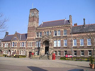
The Parr Hall is the only surviving professional concert hall venue in Warrington, Cheshire, England. It is recorded in the National Heritage List for England as a designated Grade II listed building.
Warrington Rural District was, from 1894 to 1974, a local government district in the administrative county of Lancashire.

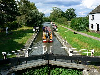
A large number of canals were built in Cheshire, England, during the early phases of the Industrial Revolution to transport goods and raw materials. This resulted in a significant canal network which is now enjoyed by holiday-makers, anglers, walkers, and others.

Warrington Corporation Tramways was the owner and operator of an electric tramway system in the early 20th century serving the town of Warrington, at the time a county borough of Lancashire, England.

Sankey Valley Park is a public park in Warrington, Cheshire. It occupies part of the Sankey Valley and the main park itself covers over 1½ miles between Sankey Bridges in the south and Callands in the north. The valley follows the course of Sankey Brook and the now disused Sankey Canal. The park is enjoyed by walkers, cyclists and anglers and the central section of the park is family orientated with children's play features, a maze and lawned areas. Bewsey Old Hall sits on the edge of the central section of the park. The Trans Pennine Trail passes around 500 yards (460 m) from the southern tip of the park.

The Mersey and Irwell Navigation was a river navigation in North West England, which provided a navigable route from the Mersey estuary to Salford and Manchester, by improving the course of the River Irwell and the River Mersey. Eight locks were constructed between 1724 and 1734, and the rivers were improved by the construction of new cuts several times subsequently. Use of the navigation declined from the 1870s, and it was ultimately superseded by the Manchester Ship Canal, the construction of which destroyed most of the Irwell section of the navigation and the long cut between Latchford and Runcorn.

The Runcorn to Latchford Canal ran from Runcorn, Cheshire to the Latchford area of Warrington, then in the historic county of Lancashire, England. It connected the Mersey and Irwell Navigation to the River Mersey at Runcorn.
Daresbury was a Mersey flat that is now in a ruinous condition. It lies, partly submerged, in Sutton Lock on River Weaver in Cheshire, England. The lock and its contents are designated as a Scheduled Ancient Monument.
