Santa Ana is the county seat and second most populous city in Orange County, California in the Los Angeles metropolitan area. The United States Census Bureau estimated its 2011 population at 329,427, making Santa Ana the 57th most-populous city in the United States.

El Oro is the southernmost of Ecuador's coastal provinces. It was named for its historically important gold production. Today it is one of the world's major exporters of bananas. The capital is Machala.

Vila de São Sebastião, commonly shortened to São Sebastião, is a civil parish in the municipality of Angra do Heroísmo, on the island of Terceira in the Portuguese archipelago of the Azores. The population in 2011 was 2,096, in an area of 23.93 square kilometres (9.24 sq mi). It is in the southeastern part of the island of Terceira.

The Roman Catholic Diocese of Orange is a particular church of the Latin Rite of the Roman Catholic Church whose territory comprises the whole of Orange County, California, in the United States. It may sometimes be referred to as the Diocese of Orange in California, to avoid confusion with the historical Diocese of Orange, France, which was dissolved in 1801.
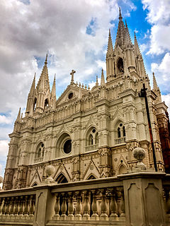
The Cathedral of Our Lady Saint Anne, is a neo-Gothic cathedral located in Santa Ana, El Salvador.

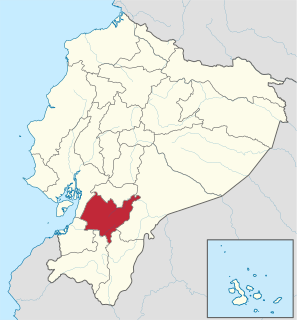
Gualaceo, nicknamed "El Jardin Del Azuay", is a canton in the south-central region of Ecuador. It belongs to Azuay Province, Ecuador. Its population is 42.000 inhabitants according to the official website visitagualaceo.com.
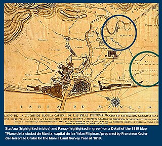
Namayan, also called Sapa, Maysapan or Nasapan, and sometimes Lamayan, was one of three independent polities that dominated the banks of the Pasig River in the Philippines during the 16th century, just prior to the Spanish colonization of the Philippines.
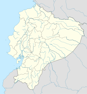
Tarqui is a parish (parroquia) in Cuenca Canton, Azuay, Ecuador.

El Pan Canton is a canton of Ecuador, located in the Azuay Province. Its capital is the town of El Pan. Its population at the 2001 census was 3,075.
Guachapala is a canton in the province of Azuay, Ecuador, was created in the presidency of the Architect Sixto Durán Ballén according to the Supplement to Official Gazette No. 623 of January 31, 1995. According to the last census conducted by the INEC, its population is approximately 3409 people, is famous for the religious shrine of Lord Andacocha, so many tourists get religious.
Oña Canton is a canton of Ecuador, located in the Azuay Province. Its capital is the town of Oña, Ecuador. Its population at the 2001 census was 3,231.
Santa Isabel Canton is a canton of Ecuador, located in the Azuay Province. Its capital is the town of Santa Isabel. Its population at the 2001 census was 18,015.
Sevilla de Oro Canton is a canton of Ecuador, located in the Azuay Province. Its capital is the town of Sevilla de Oro. Its population at the 2001 census was 5,234.
Checa or Jidcay is a town and parish in Cuenca Canton, Azuay Province, Ecuador. The parish covers an area of 64.5 km² and according to the 2001 Ecuadorian census it had a population total of 2,698.
Chiquintad is a town and parish in Cuenca Canton, Azuay Province, Ecuador. The parish covers an area of 92.1 km² and according to the 2001 Ecuadorian census it had a population total of 4,073.
Octavio Cordero Palacios is a town and parish in Cuenca Canton, Azuay Province, Ecuador. The parish covers an area of 20.4 km² and according to the 2011 Ecuadorian census it had a population total of 2,271. The town is named after the Ecuadorian writer and inventor Octavio Cordero Palacios.
Quingeo is a town and parish in Cuenca Canton, Azuay Province, Ecuador. The parish covers an area of 114.2 km² and according to the 2001 Ecuadorian census it had a population total of 5,646.
Chordeleg is a town and parish and seat of Chordeleg Canton, Azuay Province, Ecuador. The parish covers an area of 16.5 km2 (6.4 sq mi) and according to the 2001 Ecuadorian census it had a population total of 5,478.