Santa Fe, Isle of Youth

Last updated
Santa Fe
La Fe
Town
Isle of Pines - Santa Fe street.jpg
A street in Santa Fe in 1910
Santa Fe (Locator in Isla de la Juventud).png
Locator map of Santa Fe (in black)
within Isla de la Juventud
Cuba physical map.svg
Red pog.svg
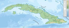
Santa Fe (La Fe)
Location of Santa Fe in Cuba
Coordinates: 21°44′40.9″N82°45′26.1″W / 21.744694°N 82.757250°W / 21.744694; -82.757250
CountryFlag of Cuba.svg  Cuba
Province Isla de la Juventud
Municipality Isla de la Juventud
Founded1809
Elevation
20 m (70 ft)
Time zone UTC-5 (EST)

Santa Fe, also named La Fe, [1] is the second largest town on Isla de la Juventud of Cuba.

Contents

Geography

The town is located 20 km south of Nueva Gerona, the island's seat and main town. It was the first settlement on the island, built around mineral springs. Santa fe is linked with Nueva Gerona with a 15 km-long expressway.

Personality

See also

Flag of Cuba.svg Cubaportal

References

  1. Source: Mapa de Carreteras de Cuba (Road map of Cuba). Ediciones GEO, Havana 2011 - ISBN   959-7049-21-X