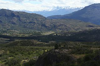
Santa María de Mingre Airport

Last updated
Santa María de Mingre Airport
Summary
Airport type Private
Serves San Javier, Chile
Elevation  AMSL 574 ft / 175 m
Coordinates 35°34′15″S72°00′15″W / 35.57083°S 72.00417°W / -35.57083; -72.00417 (Santa María de Mingre Airport (San Javier)) Coordinates: 35°34′15″S72°00′15″W / 35.57083°S 72.00417°W / -35.57083; -72.00417 (Santa María de Mingre Airport (San Javier))
Map
Chile location map.svg
Airplane silhouette.svg
SCMG
Location of Santa María de Mingre Airport in Chile
Runways
Direction Length Surface
m ft
01/19 810 2,657 Grass
Sources: GCM [1] Google Maps [2]

Santa María de Mingre Airport( ICAO : SCMG) is an airport in the western Maule Region of Chile. The airport is 24 kilometres (15 mi) west of San Javier.

ICAO airport code four-letter code designating many airports around the world

The ICAOairport code or location indicator is a four-letter code designating aerodromes around the world. These codes, as defined by the International Civil Aviation Organization and published in ICAO Document 7910: Location Indicators, are used by air traffic control and airline operations such as flight planning.

Maule Region Region of Chile

The Maule Region is one of Chile's 16 first order administrative divisions. Its capital is Talca. The region derives its name from the Maule River which, running westward from the Andes, bisects the region and spans a basin of about 20,600 km2. The Maule river is of considerable historic interest because, among other reasons, it marked the southern limits of the Inca Empire.

Chile republic in South America

Chile, officially the Republic of Chile, is a South American country occupying a long, narrow strip of land between the Andes to the east and the Pacific Ocean to the west. It borders Peru to the north, Bolivia to the northeast, Argentina to the east, and the Drake Passage in the far south. Chilean territory includes the Pacific islands of Juan Fernández, Salas y Gómez, Desventuradas, and Easter Island in Oceania. Chile also claims about 1,250,000 square kilometres (480,000 sq mi) of Antarctica, although all claims are suspended under the Antarctic Treaty.

Contents

The runway length does not include an additional 180 metres (590 ft) of unpaved overrun on each end of the runway. There is distant rising terrain in all quadrants.

See also

Transport in Chile

Transport in Chile is mostly by road. The south of the country is not connected to central Chile by road, except through Argentina, and water transport also plays a part there. The railways were historically important in Chile, but now play a relatively small part in the country's transport system. Because of the country's geography and long distances between major cities, aviation is also important.

Related Research Articles

Balmaceda Airport is an airport next to the village of Balmaceda, serving the Aysén Region of Chile. The airport is 4 kilometres (2.5 mi) west of the Argentina border, it is located 55 km south-east of Coyhaique, the regional capital.

Tolquién Airport is an airport serving Achao, a coastal town on Quinchao Island in the Los Lagos Region of Chile. The airport is on a bluff overlooking the Gulf of Ancud, 3.2 kilometres (2 mi) northwest of Achao.

Chaitén Airfield was an airport serving Chaitén, a town in the Los Lagos Region of Chile. The airport was damaged and closed after the 2008 eruption of Chaitén Volcano.

La Vertiente Airport Spanish: Aeropuerto de La Vertiente, was a public use airport located near Chillán, Bío Bío, Chile.

Cochrane Airfield

Cochrane Airport Spanish: Aeródromo Cochrane, is an airport serving Cochrane, a town in the Aysén Region of Chile. The airport is just northwest of the town, at the foot of Cerro Tamanguito (sv).

Agua Santa Airport, is an airport serving Palmilla, a town in the O'Higgins Region of Chile. The airport is 9 kilometres (5.6 mi) north of Santa Cruz.

María Dolores Airport is an airport serving Los Ángeles, capital of Bío Bío Province in the Bío Bío Region of Chile.

María Elena Airport was an airstrip 7 kilometres (4 mi) northwest of María Elena, a mining town in the Antofagasta Region of Chile.

Santa Teresa del Almendral Airport, is an airport 12 kilometres (7.5 mi) north-northwest of Melipilla, a city in the Santiago Metropolitan Region of Chile. The airport is 1 kilometre (0.6 mi) west of the Puangue River.

Alempue Airport was an airport serving Teno, a city in the Maule Region of Chile.

El Tuqui Airport, is an airport serving Ovalle, a city in the Coquimbo Region of Chile.

Santa Adriana Airport is an airport serving Ovalle, a city in the Coquimbo Region of Chile.

San Nicolás Santa Eugenia Airport is an airport 8 kilometres (5.0 mi) north of San Nicolás, a town in the Bío Bío Region of Chile.

Santa Cruz Airport is an airport 2 kilometres (1.2 mi) west of Santa Cruz, a city in the O'Higgins Region of Chile.

Santa Rosa de Tabalí Airport is an airport serving Santa Rosa de Tabalí, a hacienda winery in the Coquimbo Region of Chile.

Municipal de Vitacura Airport is a general aviation airport in Vitacura, a northern suburb of the Santiago Metropolitan Region of Chile. The airport is in a narrow slot between a major city street in Vitacura and a parallel freeway.

Las Breas Airport is an airport 20 kilometres (12 mi) south-southeast of Taltal, a Pacific coastal town in the Antofagasta Region of Chile.

Lequecahue Airport is an airport 2 kilometres (1.2 mi) south of Tirúa, a Pacific coastal town in the Bío Bío Region of Chile.

Traiguén Airport is an airport serving Traiguén, a city in the La Araucanía Region of Chile. The runway is 2 kilometres (1.2 mi) south of the city.

María Ester Airport is an airstrip 12 kilometres (7.5 mi) west of the town of Victoria, in the La Araucanía Region of Chile.

References

  1. Airport information for Santa María de Mingre Airport at Great Circle Mapper.
  2. Google (2013-09-12). "location of Santa María de Mingre Airport" (Map). Google Maps . Google. Retrieved 2013-09-12.

The Aviation Safety Network (ASN) is a website that keeps track of aviation accidents, incidents, and hijackings. Their database contains details of over 10,700 reports. The ASN includes an aviation database with aviation investigations, news, photos, and statistics.