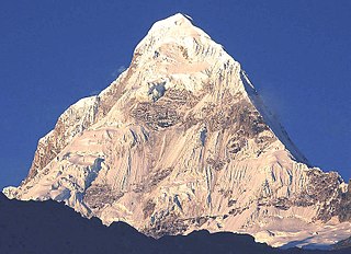
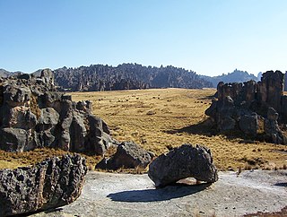
Santa Rosa District is one of five districts of the province El Collao in Puno Region, Peru.

Santa Cruz, Pucaraju,Pukaraju or Pico de Huaylas is a mountain in the Cordillera Blanca in the Andes of Peru; within Santa Cruz District, Huaylas Province, Ancash. It has a height of 6,259 metres (20,535 ft), although other maps cite a height of 6,241 metres (20,476 ft).

Cule,Kuli or Rumiwain is a mountain located on the boundary of the regions of Huanuco and Lima in Peru. It has an elevation of 5,580 metres (18,307 ft). It belongs to the Raura mountain range which is part of the Peruvian Andes.

Sirihuani or Sirijuani is a 5,359-metre-high (17,582 ft) mountain in the Urubamba mountain range in the Andes of Peru. It is located in the Cusco Region, Calca Province, in the districts of Calca and Lares. It is situated northwest of Sahuasiray and Canchacanchajasa, and northeast of Chicón.
Lake Tinquicocha is a lake in Peru located in the Huanuco Region, Lauricocha Province, Cauri District at a height of about 4,365 m. It is located in the Raura mountain range, southeast of Lake Patarcocha, west of Lake Carhuacocha and north of the smaller Lake Puyhuancocha. Lake Tinquicocha is 2 km long and 0.47 km at its widest point.

Caullaraju or Jeulla Rajo is a mountain in the Cordillera Blanca in the Andes of Peru, about 5,682 m (18,642 ft) high. It is located in the Ancash Region, Recuay Province. In the IGN-Peru map, the highest peak is reported to be named Jenhuaracra.
Lake Rajucocha is a lake in Peru located at a height of about 4,700 metres (15,420 ft) in the Ancash Region, Huaylas Province, Santa Cruz District. The lake is 1.1 km long, 0.58 km wide, and has an area of 0.54 km2. Lake Rajucocha lies in the Cordillera Blanca, west of Santa Cruz Norte.

Puyhuanccocha is a mountain in the Raura mountain range in the Andes of Peru. It is located in the boundary of the regions of Huánuco and Pasco. Its summit reaches about 5,200 m (17,060 ft) above sea level.

Raura is a mountain range located in the Andes of Peru, on the boundaries of the regions of Huánuco, Lima and Pasco. It extends between 10°21' and 10°31'S and 76°41' and 76°50'W for about 20 km. It lies a few kilometres southeast of Huayhuash mountain range.

Condorsenja or Condorshenga is a mountain in the Raura mountain range in the Andes of Peru with 5,379 metres (17,648 ft) of elevation. It is located in the Lima Region, Oyón Province, Oyón District. Condorsenja lies south of the lakes T'inkiqucha and Puywanqucha and west of mount Santa Rosa.

Santa Cruz, is a creek in Peru located in Santa Cruz District, Huaylas Province, Ancash. It is a right tributary of the Santa River.

Tantash is a 5,504-metre-high (18,058 ft) mountain in the Cordillera Blanca in the Andes of Peru. It is situated in the Ancash Region, Recuay Province, Catac District. Tantash lies southeast of Mururaju and east of Pukarahu.

Cushuropata is a mountain in the Rawra mountain range in the Andes of Peru whose summit reaches about 5,000 m (16,000 ft) above sea level. It is located in the boundary between the regions of Lima and Pasco. Cushuropata lies southeast of Chuspe.

Chuspe is a mountain in the Raura mountain range in the Andes of Peru whose summit reaches an elevation of approximately 5,000 m (16,000 ft). It is located in the boundary between the regions of Lima and Pasco. Chuspe lies north of Cushuropata.

Chacraccocha is a mountain in the Raura mountain range in the Andes of Peru, about 5,000 m (16,000 ft) high. It is located in the boundary between the regions of Huánuco and in Pasco.

Santa Cruz Norte is a mountain in the Cordillera Blanca in the Andes of Peru; within Santa Cruz District, Huaylas Province, Ancash. It has a height of 5,829 metres (19,124 ft).

Santa Cruz Chico, is a mountain in the Cordillera Blanca in the Andes of Peru; within Santa Cruz District, Huaylas Province, Ancash. It has a height of 5,800 metres (19,029 ft).

Yarupac or Caudalosa is a mountain located on the boundary of the regions of Huanuco and Lima in Peru. It has an elevation of 5,685 metres (18,652 ft). It belongs to the Raura mountain range which is part of the Peruvian Andes.

Siete Caballeros is a mountain in the Raura mountain range in the Andes of Peru with several peaks reaching approximately 5,000 m (16,000 ft) above sea level. It is located in the province of Lauricocha, in the region of Huánuco. Siete Caballeros lies north of Puyhuanccocha.

Flor de Luto,Flor de Loto or Torre de Cristal, is a mountain located in Lauricocha Province in the region of Huanuco in Peru. It has an elevation of 5,529 metres (18,140 ft). It belongs to the Raura mountain range which is part of the Peruvian Andes.


