The Pasig River is a water body in the Philippines that connects Laguna de Bay to Manila Bay. Stretching for 25.2 kilometers (15.7 mi), it bisects the Philippine capital of Manila and its surrounding urban area into northern and southern halves. Its major tributaries are the Marikina River and San Juan River. The total drainage basin of the Pasig River, including the basin of Laguna de Bay, covers 4,678 square kilometers (1,806 sq mi).

Tigbauan, officially the Municipality of Tigbauan, is a 2nd class municipality in the province of Iloilo, Philippines. According to the 2020 census, it has a population of 65,245 people.

Anda, officially the Municipality of Anda, is a 3rd class municipality in the province of Pangasinan, Philippines. Unique in this part of the province, The Sambalic language of Bolinao or Binubolinao is primarily spoken in the municipality and the adjacent town of Bolinao. According to the 2020 census, it has a population of 41,548 people.

Pangasinan, officially the Province of Pangasinan, is a coastal province in the Philippines located in the Ilocos Region of Luzon. Its capital is Lingayen while San Carlos City is the most populous. Pangasinan is in the western area of Luzon along Lingayen Gulf and the South China Sea. It has a total land area of 5,451.01 square kilometres (2,104.65 sq mi). According to the 2020 census, it has a population of 3,163,190. The official number of registered voters in Pangasinan is 1,651,814. The western portion of the province is part of the homeland of the Sambal people, while the central and eastern portions are the homeland of the Pangasinan people. Due to ethnic migration, the Ilocano people settled in the province.

Cordova, officially the Municipality of Cordova, is a 1st class municipality in the province of Cebu, Philippines. According to the 2020 census, it has a population of 70,595 people.

Alaminos, officially the City of Alaminos, is a 4th class component city in the province of Pangasinan, Philippines, and is known for being the home of the Hundred Islands National Park, which is composed of 124 islands and is located off the coast of Barangay Lucap. According to the 2020 census, it has a population of 99,397 people. The city is named after Juan Alaminos y de Vivar, a former governor-general of the Philippines.

Bani, officially the Municipality of Bani, is a 2nd class municipality in the province of Pangasinan, Philippines. According to the 2020 census, it has a population of 52,603 people.

Bayambang, officially the Municipality of Bayambang, is a 1st class municipality in the province of Pangasinan, Philippines. According to the 2020 census it has a population of 129,011.

Bolinao, officially the Municipality of Bolinao, is a 1st class municipality in the province of Pangasinan, Philippines. According to the 2020 census, it has a population of 83,979 people.

Calasiao, officially the Municipality of Calasiao, is a 1st class municipality in the province of Pangasinan, Philippines. According to the 2020 census, it has a population of 100,471 people.

Sual, officially the Municipality of Sual, is a 1st class municipality in the province of Pangasinan, Philippines. According to the 2020 census, it has a population of 39,091 people.

Tayug, officially the Municipality of Tayug, is a 3rd class municipality in the province of Pangasinan, Philippines. According to the 2020 census, it has a population of 45,241 people.

Alburquerque, officially the Municipality of Alburquerque, is a 5th class municipality in the province of Bohol, Philippines. It had a population of 11,246 people at the time of the 2020 census.

Magpet, officially the Municipality of Magpet, is a 1st class municipality in the province of Cotabato, Philippines. According to the 2020 census, it has a population of 52,800.

The Agno River, also known as the Pangasinan River, is a river on the island of Luzon in the Philippines. Traversing the provinces of Benguet, Pangasinan, and Tarlac, it is one of the largest river systems in the country, with a drainage area of 5,952 square kilometres (2,298 sq mi).

Apo Island is a volcanic island covering 74 hectares in land area, 7 kilometers off the southeastern tip of Negros Island and 30 kilometers south of the Negros Oriental capital of Dumaguete in the Philippines. The name "Apo" means "elder" or "respected ancestor" in the Visayan languages.

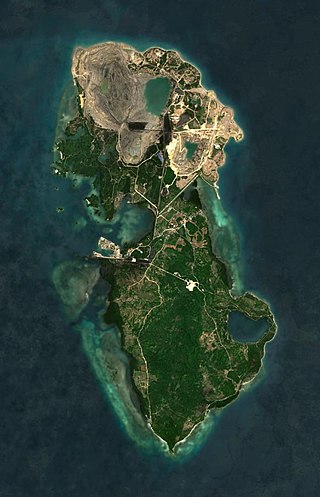
Semirara is an island in the Philippines located in the Caluya archipelago which is situated south of Mindoro Island. It is under the jurisdiction of the town of Caluya in the province of Antique. It is a major site of coal mining in the Philippines. Other economic activities in the island include fishing, seashell gathering, and farming.

Angel Chua Alcala was a Filipino biologist who was named a National Scientist of the Philippines in 2014. Alcala is known for his fieldwork to build sanctuaries and to promote biodiversity in the aquatic ecosystems of the Philippines. He was the Chairman of the Board of Advisers at the Angelo King Center for Research and Environmental Management located in Silliman University. Alcala published more than 200 peer-reviewed articles and books and his biological contributions to the environment and ecosystems have made him a renowned figure of natural sciences in the Philippines.

Poro Point, also known historically as San Fernando Point, is a headland and peninsula located in the city of San Fernando, La Union, on the island of Luzon in the Philippines. It projects northwesterly about 3.2 kilometres (2.0 mi) into the South China Sea. It was named after its location within barangay Poro and is the site of Poro Point Freeport Zone, a special economic zone established since 1993.

Silaki Island is a heart-shaped island located in Bolinao, Pangasinan, Philippines. This 10-hectare islet has 89 households with 376 population. It is tagged as the "Giant Clam Capital of the Philippines" because of the shallow reef surrounding the island that is home to giant clams locally known as "Taklobo" in an almost 16 hectares of the ocean. Silaki Island's reefs serve as a giant clam nursery and hatchery managed by the Bolinao Marine Laboratory (BML) of the University of the Philippines Marine Science Institute (UPMSI).


