
Heroica Ciudad de Huajuapan de León is a city with a surrounding municipality located in the northwestern part of the Mexican state of Oaxaca. It is part of the Huajuapan District in the north of the Mixteca Region. The municipality has a population of 78,318, the sixth-largest community in the state in population. It is located at the intersection of Federal Highways 125 and 190. The name of Huajuapan comes from the Nahuatl words huaxin = huaje, ohtli = road, and apan = river. Literally, River of the huajes. The town was elevated to an honorary Mexican status in June 1843 in remembrance of The siege of Huajuapan, a battle between the royal army and the insurgents led by José María Morelos. The battle was won by the insurgents. The city was named after Antonio de León, a hero of the Mexican War of Independence.

The Triqui or Trique are an Indigenous people of the western part of the Mexican state of Oaxaca, centered in the municipalities of Juxtlahuaca, Putla, and Tlaxiaco. They number around 23,000 according to Ethnologue surveys. The Triqui language is a Mixtecan language of Oto-Manguean genetic affiliation. Trique peoples are known for their distinctive woven huipiles, baskets, and morrales (handbags).
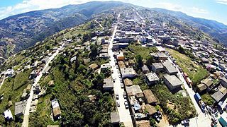
Asunción Cuyotepeji is a town and municipality in Oaxaca in south-western Mexico. The municipality covers an area of 547.33 km2. It is part of the Huajuapan District in the north of the Mixteca Region. As of 2005, the municipality had a total population of 14,438.Its specific location is in the northwest part of Oaxaca and forms part of a region denominated "La Mixteca" which is a region of Oaxaca in which Nahua civilizations used to be settled. It is 1760 meters above the sea level. Its territory is delimited by other small municipalities. At the north it is limited by Santiago Miltepec and San Juan Bautista Suchitepec municipalities; in south by Santa Maria Camotlan; at the east by Santa Catarina Zapoquila and Santiago Thuitlan Plumas; finally at the west it is delimited by Ciudad de Huajuapan de leon and Santiago Miltepec.

Coicoyan de Las Flores is a town and municipality in Oaxaca in south-western Mexico. The municipality covers an area of 105.89 km² and is part of the Juxtlahuaca district of the Mixteca Region. As of 2005, the municipality had a total population of 7,598.

San Juan Mixtepec is a town and municipality in Oaxaca in south-western Mexico. The municipality covers an area of 209.24 km², and is part of the Juxtlahuaca District of the Mixteca Region.
San Martín Peras is a town and municipality in Oaxaca about 157 mi south of Mexico City which is the country's capital city. The municipality covers an area of 237.31km2 and is part of the Juxtlahuaca district of the Mixteca Region.
San Miguel Achiutla is a town and municipality in Oaxaca in south-western Mexico. The municipality covers an area of 59.97 km2. It is part of the Tlaxiaco District in the south of the Mixteca Region.
San Miguel Tlacotepec is a town and municipality in Oaxaca in south-western Mexico. The municipality covers an area of 112.27 km² and is part of the Juxtlahuaca district of the Mixteca Region.
San Sebastián Tecomaxtlahuaca is a town and municipality in Oaxaca in south-western Mexico. The municipality covers an area of 369.99 km² and is part of the Juxtlahuaca District of the Mixteca Region.
Santiago Cacaloxtepec is a town and municipality in Oaxaca in south-western Mexico. The municipality covers an area of km2. It is part of the Huajuapan District in the north of the Mixteca Region.
Santiago Huajolotitlán is a town and municipality in Oaxaca in south-western Mexico. The municipality covers an area of km². It is part of the Huajuapan District in the north of the Mixteca Region.
Santiago Huauclilla is a town and municipality in Oaxaca in south-western Mexico. The municipality covers an area of km2. It is part of the Nochixtlán District in the southeast of the Mixteca Region.
Santiago Miltepec is a town and municipality in Oaxaca in south-western Mexico. The municipality covers an area of km². It is part of the Huajuapan District in the north of the Mixteca Region.
Santiago Nuyoó is a town and municipality in Oaxaca in south-western Mexico. The municipality covers an area of km². It is part of the Tlaxiaco District in the south of the Mixteca Region.
Santiago Tamazola is a town and municipality in Oaxaca in south-western Mexico. The municipality covers an area of km². It is part of the Silacayoapam District in the Mixteca Region.
Santiago Yucuyachi (monte-breve)is a town and municipality in Oaxaca in south-western Mexico. The municipality covers an area of 90.58 km². It is part of the Silacayoapam District in the Mixteca Region.
Santos Reyes Tepejillo is a town and municipality in Oaxaca in south-western Mexico. The municipality covers an area of km² and is part of the Juxtlahuaca District of the Mixteca Region.

Coixtlahuaca District is located in the northeast of the Mixteca Region of the State of Oaxaca, Mexico. As of 2005 the population was 9,018, down 2.8% from 2000.
Juxtlahuaca District is located in the southwest of the Mixteca Region of the State of Oaxaca, Mexico. The largest town is Santiago Juxtlahuaca. The district is at an average elevation of 1,690 meters above sea level, and has an area of 1,848 km2. It is divided into seven municipalities, and as of 2005 had 281 settlements with a total population of 72,176.

The Indigenous people of Oaxaca are descendants of the inhabitants of what is now the state of Oaxaca, Mexico, who were present before the Spanish invasion. Several cultures flourished in the ancient region of Oaxaca from as far back as 2000 BC, of whom the Zapotecs and Mixtecs were perhaps the most advanced, with complex social organization and sophisticated arts.


