Apure State is one of the 23 states of Venezuela. Its territory formed part of the provinces of Mérida, Maracaibo, and Barinas, in accordance with successive territorial ordinations pronounced by the colonial authorities. In 1824 the Department of Apure was created, under jurisdiction of Barinas, which laid the foundations for the current entity. In 1856 it separated from Barinas and for the first time Apure appeared as an independent province, which in 1864 acquired the status of state. In 1881, however, a new territorial division combined Apure and Guayana to form a single state named Bolívar. In 1899 it reestablished its autonomy and finally, by means of the Constitution of 1909, gained its current borders.

Cutervo National Park , established in 1961, is the oldest protected area in Peru. It is located in the northern Peruvian Andes, in the region of Cajamarca. The park was extended to 8,214 hectares (31.71 sq mi) and protects areas of Andean montane forests and paramo for headwater conservation. Moreover, those areas are the habitat of animal species like the spectacled bear, the mountain tapir, and the oilbird; and plant species like the Andean wax palms.

Capanaparo River is a river of Colombia and Venezuela. It is part of the Orinoco River basin in Venezuela. Together with the Cinaruco River, other smaller rivers and the area around them they form the Santos Luzardo National Park since 1988.

Cinaruco River is a river of Colombia and Venezuela. It is part of the Orinoco River basin. It has partially clear tanic waters. In Venezuela this river is part of the Santos Luzardo National Park since the year 1988. The Cinaruco River together with the Capanaparo River, other smaller rivers and the area around them form this national park. It houses a big biodiversity and many fishermen go each year looking for peacock bass. Three different species of peacock bass are found in this river: Cichla intermedia, Cichla orinocensis and Cichla temensis from smallest to biggest.
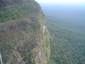
The Tamá National Natural Park is a national park located in the Tamá Massif of the Andean Region of Colombia, between the municipalities Toledo and Herrán, in the department of Norte de Santander, in the northeastern part of the Eastern Ranges of the Colombian Andes. One of the main attractions of the park is a 820-metre-high (2,690 ft) waterfall, one of the world's highest.

Los Quetzales National Park, located 97 kilometers from San Isidro de El General, in Costa Rica, was created in 2006 by decree 32981-MINAE. It is managed under the Central Conservation Area of the National System of Conservation Areas.

The Tapo-Caparo National Park, or National Park Tapo Caparo, is a protected area with national park status in Venezuela. The park covers 2,050 square kilometres (790 sq mi) in the western states of Barinas, Mérida, and Táchira.

The El Guache National Park Is a protected area with the status of national park in Venezuela, located at the beginning of the Andes mountain range, comprising mountainous parts of the Lara and Portuguesa states, and the birth of the Guache, Ospino, Toco, Morador and Are rivers. 2 In its adjacencies is the mighty waterfall San Miguel. It has an area of 12,200 ha traditionally measured and 15,960 Ha. Its temperature is between 19 °C. and 26 °C. Precipitation varies between 1800 and 2000 mm annually.

Tirgua National Park, also known as General Manuel Manrique National Park, is a national park in Venezuela. It protects the headwaters of several waterways, especially the river Tirgua, which gives its name to the park.
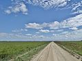
The Río Viejo San Camilo National Park, or Rio Viejo-San Camilo National Park, Is a protected area with the status of national park in the South American country of Venezuela. Specifically its territory is part of the state of Apure near the border with Colombia. It has an estimated area of 80,000 hectares, which constitute national park since 1 July 1993.

The Mariusa National Park is a protected area of Venezuela with national park status.

The Dinira National Park is a protected area with the national park status located between the states Lara, Portuguesa and Trujillo in the South American country of Venezuela. It was created on November 30, 1988.

The El Tamá National Park It is a protected area with the status of a national park that is located between the Andes and plains of Venezuela. It protects part of the Tamá Massif. It has an area of 139,000 hectares and is located in the states of Táchira and Apure, near the border with Colombia. Created as a National Park on December 12, 1978, by the then President Carlos Andrés Pérez.
The Yapacana National Park is a protected area with the status of national park in the South American country of Venezuela. It was formed on December 12, 1978 by executive decree of President Carlos Andres Perez. It is located southwest of the confluence of the Ventuari River on the Orinoco River, in the jurisdiction of the Atabapo municipality of Amazonas state.

The Aguaro-Guariquito National Park, also rendered as Aguaro Guariquito National Park, is a protected area with the status of national park in the South American country of Venezuela. Located in the region of the Llanos, it extends over the municipalities of Francisco de Miranda and Jose Rondon in Guárico state.

The Laguna de Tacarigua National Park, also known as Tacarigua Lagoon National Park, is a protected area with the status of a national park located east of Miranda State, close to the town of Laguna de Tacarigua in the South American country of Venezuela. It comprises a permanent coastal lagoon of 7800 ha and 1.2 m of average depth, separated from the sea by a restinga or coastal barrier of 28.8 km long and 300–1000 m wide that was formed by the action of the sea current which runs along the coast in an East-West direction.

The Macarao National Park Is a protected area with the status of a national park located in the Macarao, San Pedro and Jarillo rivers, in the north of the South American country of Venezuela. Its extension of 15,000 hectares covers part of the Capital District and Miranda State. The area was declared National Park in 1973.
The Yacambú National Park is a protected area with national park status in the South American country of Venezuela. It is located in the south of the Lara State, on the southern slope of the Portuguesa Mountain Range, which forms part of the mountain foothills of the Andes Mountains. It was created in 1962 with the purpose of protecting part of the Yacambú river basin, whose waters will feed the reservoir José María Ochoa Pilé, an ambitious project still under construction. The reservoir is of vital importance for water supply in the city of Barquisimeto and for economic development in the dry valleys of Quibor, where there is a protected area of sustainable use for agricultural purposes.

The Yurubí National Park is a protected area with the status of national park in the north of the South American country of Venezuela. It was founded on March 18, 1960 in Yaracuy State created to protect the Yurubí river basin, which is the source of fresh water for the city of San Felipe. The Yurubí National Park is located in the mountains of the Sierra de Aroa. The park includes cloud forests and low montane forests and is surrounded by cultivated areas. The park is crossed by small trails, which are used mainly by poachers or by a small number of visitors and researchers. The park is not inhabited; The former settlers of the area were relocated many years ago.

The Caura National Park is a protected area with the status of National Park in Venezuela. With an area of 7,534,000 ha. (75,340 km2) it is the largest park in the country and the most recently created (2017).