Kumaon is a revenue and administrative division in the Indian State of Uttarakhand. It spans over the eastern half of the state and is bounded on the north by Tibet, on the east by Nepal, on the south by the state of Uttar Pradesh, and on the west by Garhwal. Kumaon comprises six districts of the state: Almora, Bageshwar, Champawat, Nainital, Pithoragarh and Udham Singh Nagar.

Almora is a district in the Kumaon Division of Uttarakhand state, India. The headquarters is at Almora. It is 1,638 meters above sea level. The neighbouring regions are Pithoragarh district to the east, Chamoli district to the west, Bageshwar district to the north and Nainital district to the south.

Pauri is a town and a municipal board in Pauri Garhwal district in the Indian state of Uttarakhand. Pauri is the seat of the Divisional Commissioner of the Garhwal Division.
Gairsain is a town in Chamoli district of the Indian state of Uttarakhand near state's summer capital Bhararisain. A town and Nagar Panchayat, Gairsain is situated at the eastern edge of the vast Dudhatoli mountain range, and is located in Chamoli district almost at the centre of the state, at a distance of approximately 250 kilometres from Dehradun. It is easily accessible from both the Garhwal and the Kumaon divisions, and in a way, acts as the bridge between the two regions. It is being considered as the future Permanent capital of Uttarakhand.

Nainital district is a district in Kumaon division which is a part of Uttarakhand state in India. The headquarters is at Nainital.
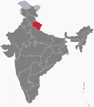
Pauri Garhwal is a district in the Indian state of Uttarakhand. Its headquarters is in the town of Pauri. It is sometimes referred to simply as Garhwal district, though it should not be confused with the larger Garhwal region of which it is only a part of.

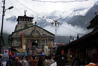
Rudraprayag is a district of the state of Uttarakhand of northern India. The district occupies an area of 1984 km2. The town of Rudraprayag is the administrative headquarters of the district. The district is bounded by Uttarkashi District on the north, Chamoli District on the east, Pauri Garhwal District on the south, and Tehri Garhwal District on the west.

Lansdowne is a cantonment town in Pauri Garhwal is a district in the Indian state of Uttarakhand.
Kotdwar is a city, municipal corporation in Pauri Garhwal district of Uttarakhand, India. It's just 101 km from Pauri town, the district headquarter. It is the eighth-largest city in Uttarakhand. Its old name was "Khohdwar", which means the gateway of the river Khoh since it is located on the bank of river Khoh. It is situated in the southwestern part of the state and is one of the main entrance points in the state of Uttarakhand.
Chandola is a Brahmin surname of Garhwali and Kumaoni origin mostly used in the Indian state of Uttarakhand.

Srinagar is a city and municipal corporation in Pauri Garhwal district in the Indian state of Uttarakhand. It is located about 33 km from Pauri town, the administrative headquarters of Pauri Garhwal district, Uttarakhand, India.

Satpuli is a town on the Meerut-Pauri highway, located approximately 50 kilometers from Kotdwar and 50 kilometers from Pauri, in Pauri Garhwal district of Uttarakhand.
Thalisain is a town and tehsil of Pauri Garhwal district in the North Indian state of Uttarakhand. At an elevation of 1690 metres from sea level, it is situated on a gentle slope above the right bank of Nayaar (East) river. It is in the southwestern foothills of Dudhatoli Range and at a distance of 83 kilometers from Pauri town and 95 kilometers from Gairsain, the future capital of Uttarakhand.
Kimsar is a village, in Yamkeshwar Block of Pauri Garhwal district, Uttarakhand, India.

Badol Gaon is a small village in Kotdwara tehsil, Pauri Garhwal district in Uttarakhand State of India. Village has barely 13 houses with a population of 45 (mostly belonging to Kala community. It is administered by a Sarpanch who is an elected head of the village.
The following outline is provided as an overview of and topical guide to Uttarakhand:

Isoti is a village in Pauri Garhwal district of Uttarakhand.
Gadkhark is a village in the Thalisain tehsil of Bironkhal block in Pauri Garhwal district, Uttarakhand, India.
Dhumakot is a tehsil, or administrative division, located in the Pauri Garhwal district of the Indian state of Uttarakhand. It is bordered by the tehsils of Lansdowne, Kotdwar, Thalisain and Bironkhal. It is also bordered by the districts Almora and Nainital of Kumaun.