Related Research Articles
The Cree are one of the largest groups of First Nations in North America.
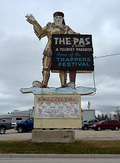
The Pas is a town in Manitoba, Canada, located at the confluence of the Pasquia River and the Saskatchewan River within Division No. 21 in the Northern Region. It is approximately 630 km (390 mi) northwest of the provincial capital, Winnipeg, and 40 km (25 mi) from the border of Saskatchewan. It is sometimes still called Paskoyac by locals after the first trading post, called Fort Paskoya and constructed during French colonial rule. The Pasquia River begins in the Pasquia Hills in east central Saskatchewan. The French in 1795 knew the river as Basquiau.
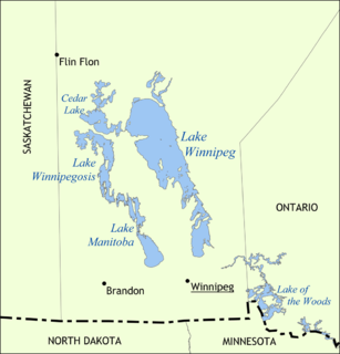
Lake Winnipeg is a very large, relatively shallow 24,514-square-kilometre (9,465 sq mi) lake in North America, in the province of Manitoba, Canada. Its southern end is about 55 kilometres (34 mi) north of the city of Winnipeg. Lake Winnipeg is Canada's sixth-largest freshwater lake and the third-largest freshwater lake contained entirely within Canada, but it is relatively shallow excluding a narrow 36 m (118 ft) deep channel between the northern and southern basins. It is the eleventh-largest freshwater lake on Earth. The lake's east side has pristine boreal forests and rivers that were recently inscribed as a UNESCO World Heritage Site. The lake is 416 km (258 mi) from north to south, with remote sandy beaches, large limestone cliffs, and many bat caves in some areas. Manitoba Hydro uses the lake as one of the largest reservoirs in the world. There are many islands, most of them undeveloped.

The Saulteaux are a First Nations band government in Ontario, Manitoba, Saskatchewan, Alberta and British Columbia, Canada. They are a branch of the Ojibwe who pushed west. They formed a mixed culture of woodlands and plains Indigenous customs and traditions.
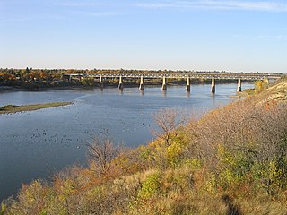
The Saskatchewan River is a major river in Canada, about 550 kilometres (340 mi) long, flowing roughly eastward across Saskatchewan and Manitoba to empty into Lake Winnipeg. Through its tributaries the North Saskatchewan and South Saskatchewan, its watershed encompasses much of the prairie regions of central Canada, stretching westward to the Rocky Mountains in Alberta and northwestern Montana in the United States. It reaches 1,939 kilometres (1,205 mi) to its farthest headwaters on the Bow River, a tributary of the South Saskatchewan in Alberta.
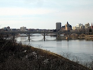
The South Saskatchewan River is a major river in Canada that flows through the provinces of Alberta and Saskatchewan.
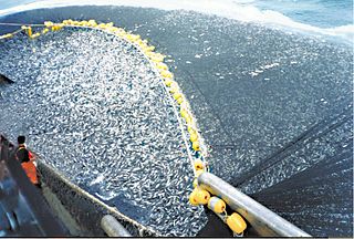
Overfishing is the removal of a species of fish from a body of water at a rate that the species cannot replenish, resulting in those species becoming underpopulated in that area. In a Food and Agriculture Organization of the United Nations 2018 report, the FAO estimates that one-third of world fish stocks were overfished by 2015. Over 30 billion euros in public subsidies are directed to fisheries annually.

The Qu'Appelle River is a Canadian river that flows 430 kilometres (270 mi) east from Lake Diefenbaker in southwestern Saskatchewan to join the Assiniboine River in Manitoba, just south of Lake of the Prairies, near the village of St. Lazare.

The Churchill River is a major river in Alberta, Saskatchewan and Manitoba, Canada. From the head of the Churchill Lake it is 1,609 kilometres (1,000 mi) long. It was named after John Churchill, 1st Duke of Marlborough and governor of the Hudson's Bay Company from 1685 to 1691.

The Chinook salmon is the largest species of Pacific salmon as well as the largest in the genus Oncorhynchus. Its common name is derived from the Chinookan peoples. Other vernacular names for the species include king salmon, Quinnat salmon, spring salmon, chrome hog, and Tyee salmon. The scientific species name is based on the Russian common name chavycha (чавыча).

Cumberland House is a community in Census Division No. 18 in northeast Saskatchewan, Canada on the Saskatchewan River. It is the oldest settler community in Saskatchewan and has a population of about 2,000 people. Cumberland House Provincial Park, which provides tours of an 1890s powder house built by the Hudson's Bay Company, is located nearby.
The Opaskwayak Cree Nation is a First Nations band government in Manitoba, Canada. Most of the on-reserve population lives near The Pas on the OCN 21E Reserve, but the band also has many other reserves stretching from Goose Lake, Manitoba in the north to Mountain Cabin, Saskatchewan in the south.
The lake sturgeon, also known as the rock sturgeon, is a North American temperate freshwater fish, one of about 25 species of sturgeon. Like other sturgeons, this species is an evolutionarily ancient bottom feeder with a partly cartilaginous skeleton, an overall streamlined shape and skin bearing rows of bony plates on its sides and back, resembling an armored torpedo. The fish uses its elongated, spade-like snout to stir up the substrate and sediments on the beds of rivers and lakes while feeding. The lake sturgeon has four purely sensory organs that dangle near its mouth. These organs, called barbels, help the sturgeon to locate bottom-dwelling prey. Lake sturgeons can grow to a relatively large size, topping 7.25 ft long and weighing over 240 lb (108 kg).
The Cumberland Sound belugas are a distinct population of belugas residing in the Cumberland Sound region of the Labrador Sea off the coast of Nunavut, Canada Individuals of this population reside in the sound year-round, congregating in its extreme north exclusively at Clearwater Fjord during the summer for calving. The Cumberland Sound beluga population is considered fairly isolated and genetically distinct from other beluga populations, with a notable number of haplotypes and microsatellite loci not found elsewhere.

The Atlantic sturgeon is a member of the family Acipenseridae and along with other sturgeon it is sometimes considered a living fossil. The Atlantic sturgeon is one of two subspecies of A. oxyrinchus, the other being the Gulf sturgeon. The main range of the Atlantic sturgeon is in eastern North America, extending from New Brunswick, Canada, to the eastern coast of Florida, United States. A disjunct population occurs in the Baltic region of Europe. The Atlantic sturgeon was in great abundance when the first European settlers came to North America, but has since declined due to overfishing and water pollution. It is considered threatened, endangered, and even locally extinct in many of its original habitats. The fish can reach 60 years of age, 15 ft (4.6 m) in length and over 800 lb (360 kg) in weight.
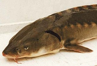
The shortnose sturgeon is a small and endangered species of North American sturgeon. The earliest remains of the species are from the Late Cretaceous Period, over 70 million years ago. Shortnose sturgeons are long-lived and slow to sexually mature. Most sturgeons are anadromous bottom-feeders, which means they migrate upstream to spawn but spend most of their lives feeding in rivers, deltas and estuaries. The shortnose sturgeon is often mistaken as a juvenile Atlantic sturgeon, because of their small size. Prior to 1973, U.S. commercial fishing records did not differentiate between the two species, both were reported as "common sturgeon", although it is believed based on sizes that the bulk of the catch was Atlantic sturgeon. The shortnose is distinguishable from the Atlantic sturgeon due to its shorter and rounder head.

The Alaska salmon fishery is a managed fishery that supports the sustainable annual harvest of five species of wild Pacific Salmon for commercial fishing, sport fishing, subsistence by Alaska Native communities, and personal use by local residents. The salmon harvest in Alaska is the largest in North America and represents about 80% of the total wild-caught catch, with harvests from Canada and the Pacific Northwest representing the remainder In 2017 over 200 million salmon were caught in Alaskan waters by commercial fishers, representing $750 million in exvessel value. Salmon fishing is a nearly ubiquitous activity across Alaska, however the most valuable salmon fisheries are in the Bristol Bay, Prince William Sound and Southeast regions.

The Saskatchewan River Delta (SRD) is a large alluvial delta that straddles the border between the provinces of Saskatchewan and Manitoba in south-central Canada. Currently terminating at Cedar Lake, Manitoba, the delta is composed mainly of various types of wetlands, shallow lakes, and active and abandoned river channels bordered by forested natural levees. Sixty-five percent of the delta is occupied by vegetated wetlands, over one third of which comprise peat-forming fens and bogs. Geographically, the SRD consists of two parts---western and eastern---separated by a prominent moraine that was deposited by the Laurentide Ice Sheet during late stages of the Wisconsinan glacial epoch. These two components, commonly termed the "upper delta" and "lower delta", together occupy an area of approximately 10,000 square kilometres (3,900 sq mi) making the SRD one of the largest active inland delta in North America. The broad wetland tracts of the upper delta in Saskatchewan are sometimes referred to as the Cumberland Marshes. Approximately 5% of the delta surface has been drained for agricultural use following feasibility studies by the Prairie Farm Rehabilitation Administration in the 1950s.

The Mathias Colomb First Nation, Mathias Colomb Cree Nation (MCCN), Mathias Colomb (Cree) First Nation, Pukatawagan/Mathias Colomb Cree Nation is a remote northern Manitoba First Nations, located 210 km (130 mi) north of The Pas and 819 km (509 mi) northwest of Winnipeg, Manitoba, which had two reserves under its jurisdiction, Indian Rreserve (IR) 198 and IR No. 199. They are part of the Treaty 6 and the main community is at Pukatawagan and consists of 1,536.6 ha on the shore of Pukatawagan Lake and lies about 210 km (130 mi) north of The Pas. Their second reserve was the Highrock reserve (CSD) located on Highrock Lake, 30 km (19 mi) downstream from Pukatawagan, which was dissolved by 2006.

Salmon population levels are of concern in the Atlantic and in some parts of the Pacific. Salmon fishery stocks are still abundant, and catches have been on the rise in recent decades, after the state initiated limitations in 1972. Some of the most important Alaskan salmon sustainable wild fisheries are located near the Kenai River, Copper River, and in Bristol Bay. Fish farming of Pacific salmon is outlawed in the United States Exclusive Economic Zone, however, there is a substantial network of publicly funded hatcheries, and the State of Alaska's fisheries management system is viewed as a leader in the management of wild fish stocks. In Canada, returning Skeena River wild salmon support commercial, subsistence and recreational fisheries, as well as the area's diverse wildlife on the coast and around communities hundreds of miles inland in the watershed. The status of wild salmon in Washington is mixed. Out of 435 wild stocks of salmon and steelhead, only 187 of them were classified as healthy; 113 had an unknown status, 1 was extinct, 12 were in critical condition and 122 were experiencing depressed populations.
References
- ↑ Saskatchewan River Sturgeon Management Board. "SRSMB Role".
- ↑ Saskatchewan River Sturgeon Management Board. "Why a Saskatchewan River Sturgeon Management Board?".
- ↑ Saskatchewan River Sturgeon Management Board. "Habitat Changes".
- ↑ Saskatchewan River Sturgeon Management Board. "Sturgeon Recovery".
- ↑ Saskatchewan River Sturgeon Management Board. "Who Makes up the Saskatchewan River Sturgeon Management Board?".