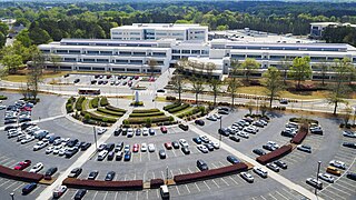
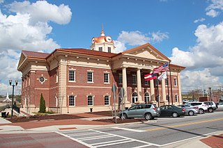
Gwinnett County is located in the north central portion of the U.S. state of Georgia. It forms part of the Atlanta metropolitan area. In 2020, the population was 957,062, making it the second-most populous county in Georgia. Its county seat is Lawrenceville. The county is named for Button Gwinnett, one of the signatories of the Declaration of Independence.

Chamblee is a city in northern DeKalb County, Georgia, United States, northeast of Atlanta. The population was 30,164 as of the 2020 census.

Buford is a city in Gwinnett and Hall counties in the U.S. state of Georgia. As of the 2020 census, the city had a population of 17,144. Most of the city is in Gwinnett County, which is part of the Atlanta-Sandy Springs-Marietta Metropolitan Statistical Area. The northern sliver of the city is in Hall County, which comprises the Gainesville, Georgia Metropolitan Statistical Area and is part of the larger Atlanta-Athens-Clarke-Sandy Springs Combined Statistical Area.

Duluth is a city in Gwinnett County, Georgia, United States. Located north of Interstate 85, it is approximately 22 miles (35 km) northeast of Atlanta.
Sugar Hill is a city in northern Gwinnett County in the U.S. state of Georgia, included within the Atlanta-Sandy Springs-Marietta Metropolitan Statistical Area. The population was 18,522 as of the 2010 census, making it the fourth-largest city in Gwinnett County. As of 2020, the estimated population was 23,994. It is in close proximity to Lake Lanier and the foothills of the North Georgia mountains.
CobbLinc is the bus public transit system in Cobb County, Georgia, one of metro Atlanta's three most populous suburban counties.
Ride Gwinnett is the bus public transit system in Gwinnett County, Georgia, United States, one of metro Atlanta's three most populous suburban counties.

Interstate 285 (I-285) is an auxiliary Interstate Highway encircling Atlanta, Georgia, for 63.98 miles (102.97 km). It connects the three major Interstate Highways to Atlanta: I-20, I-75, and I-85. Colloquially referred to as the Perimeter, it also carries unsigned State Route 407 (SR 407) and is signed as Atlanta Bypass on I-20, I-75, and I-85.

State Route 141 (SR 141) is a 34.1-mile-long (54.9 km) state highway that runs southwest-to-northeast in the northwest part of the U.S. state of Georgia. It connects the Buckhead area of Atlanta with Cumming. Its routing exists within portions of Fulton, DeKalb, Gwinnett, Forsyth counties.
Roosevelt Boulevard, officially named the Theodore Roosevelt Memorial Boulevard and often referred to, chiefly by local Philadelphians, simply as "the Boulevard," is a major traffic artery through North and Northeast Philadelphia. The road begins at Interstate 76 in Fairmount Park, running as a freeway also known as the Roosevelt Boulevard Extension or the Roosevelt Expressway through North Philadelphia, then transitioning into a twelve-lane divided highway that forms the spine of Northeast Philadelphia to its end at the city line.

State Highway 183 is a state highway in the Dallas–Fort Worth metroplex in Texas. Its most heavily used section is designated Airport Freeway where it serves the southern entrance of Dallas–Fort Worth International Airport.
U.S. Route 78 (US 78) is an east–west United States Numbered Highway that runs for 715 miles (1,151 km) from Memphis, Tennessee, to Charleston, South Carolina. From Byhalia, Mississippi to Birmingham, Alabama, US 78 runs concurrently with Interstate 22 (I-22). The highway's western terminus is at US 64/US 70/US 79 in Memphis, and its eastern terminus is on Line Street, in Charleston.

State Route 13 (SR 13) is a 49.5-mile-long (79.7 km) state highway in the north-central part of the U.S. state of Georgia, that travels through portions of Fulton, DeKalb, Gwinnett, and Hall counties.

Doraville is a train station in Doraville, Georgia, and the northern terminus on the Gold Line of the Metropolitan Atlanta Rapid Transit Authority (MARTA) rail system. Doraville serves as the ground for the Doraville rail yard for the Gold line, with a capacity of 30 rail cars.

State Route 140 (SR 140) is a 78.6-mile-long (126.5 km) state highway in the northwestern part of the U.S. state of Georgia. It connects the Armuchee and Peachtree Corners areas, within portions of Floyd, Bartow, Cherokee, Fulton, Gwinnett counties.

The Outer Perimeter is a freeway originally planned to encircle Atlanta, in the U.S. state of Georgia about 20 to 25 miles outside of Interstate 285, which is colloquially referred to as the Perimeter and is a point of reference for local travel outside Atlanta's city core.

State Route 324 (SR 324) is a 9.6-mile-long (15.4 km) west-to-east state highway located in portions of Gwinnett and Barrow counties in the northeastern part of the U.S. state of Georgia. It connects Buford and Auburn. It also has an interchange with Interstate 85 (I-85). Before it was renamed, Carl Bethlehem Road was once part of SR 324.
Sugarloaf Parkway is an at-grade and limited-access highway in Gwinnett County in the north-central part of the U.S. state of Georgia. The highway provides a cross-county route from Duluth to Dacula. In 2010, a freeway extension opened past the former eastern terminus at Georgia State Route 20 (SR 20), and the highway was extended to US 29/SR 316 in Dacula.

Several special routes of U.S. Route 70 exist. In order from west to east, these special routes are as follows.

The Western Gwinnett Bikeway is a multi-use trail under construction along Peachtree Industrial Boulevard in Gwinnett County. The trail will be 10 feet to 14 feet wide and traverse the cities of Norcross, Peachtree Corners, Berkeley Lake, Duluth, Suwanee, Sugar Hill and Buford. It is intended to be the spine of West Gwinnett’s trails and greenways, connecting parks, trails, businesses, schools and neighborhoods to the urban core.