
Domlur is a small township located in the eastern part of Bangalore city in India. Domlur was included in the erstwhile Bangalore Civil and Military Station under the British Madras Presidency till it was transferred to the Mysore State in 1949.
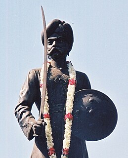
Nadaprabhu Hiriya Kempe Gowda, also known as Kempe Gowda was a chieftain under the Vijayanagara Empire. The city of Bengaluru, which is the capital of the Indian state of Karnataka, was fortified by Kempe Gowda in 1537. He erected many Kannada inscriptions in the region.

Basaveshwaranagara is a largely residential neighbourhood in the west of Bengaluru, Karnataka, India. It is located to the west of Rajajinagara and is sandwiched between the localities of Mahalakshmi Layout to the north and Vijayanagara to the south, spread across multiple sub-localities, three assembly constituencies and seven Bruhat Bengaluru Mahanagara Palike (BBMP) wards. The area of Basaveshwaranagara is often considered West of Chord Road as it lies to the west of Chord Road, an arterial road in the western part of Bengaluru.
Bengaluru is the capital and the largest city of the Indian state of Karnataka. It is India's third largest city and fifth largest metropolitan area. Modern Bengaluru was founded in 1537 CE by Kempe Gowda, a vassal of the Vijayanagara Empire. Kempe Gowda built a mud fort in the vicinity of modern Bengaluru. By 1831, the city was incorporated into the British Raj with the establishment of the Bangalore Cantonment. The British returned dominion of the city to the King of Mysore, choosing however, to retain jurisdiction over the cantonment. Therefore, Bengaluru essentially became a twin city, with civic and infrastructural developments of the cantonment conforming to European styles of planning. For most of the period after Indian independence in 1947, Bengaluru was a B-1 status city, and was not considered to be one of India's "4 major metropolitan cities". The growth of Information Technology in the city, which is the largest contributor to India's software exports, has led to a decadal growth that is second to only that of India's capital New Delhi. The city's roads, however, were not designed to accommodate the vehicular traffic, growing at an average of 8% annually, that prevails in Bengaluru. This leads to heavy slow traffic and traffic jams in Bengaluru Bangalore continues to fall behind in this area, and foreign visitors are often shocked to see the state of infrastructure, but now things are improving thanks to heavy investment of the Karnataka Government in infra projects. This is the main problem from migration of people from other states.
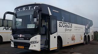
The KarnatakaState Road Transport Corporation (KSRTC) is a state-owned public road transport corporation in the Indian state of Karnataka. It is wholly owned by the Government of Karnataka. It serves routes to towns and cities in the Southern part of Karnataka and connects it to the rest of the state and the states of Tamil Nadu, karnataka, Telangana, Andhra Pradesh, Maharashtra, Goa and the Union territory of Puducherry. It offers online booking of ticket along with its subsidiaries.

Chintamani is a Taluk Headquarters in the Indian state of Karnataka. Located on the Deccan Plateau in the south-eastern part of Karnataka. Chintamani is one of the well planned and developed Towns in the District of Kolar and presently Chikkaballapur. Chintamani is known for its Silk and Tomato production and their largest markets in Karnataka.

Vijayanagar is a locality in southwest Bangalore, India. It derives its name from the Vijayanagara empire that flourished in South India during the 15th and 16th centuries. It is bound by Mysore Road and Magadi Road, with Chord Road cutting through. It is the northernmost area in South Bangalore.
Girinagar is a residential area in South West Bengaluru, very close to Mysore Road. This medium-sized locality is surrounded by Nayandahalli in the west, Byatarayanapura and Deepanjali Nagar in the north, Srinagar and Banashankari in the east and Hosakerehalli in the south.
Marathahalli is an eastern suburb of Bangalore city in Karnataka state of India. The locality is named after the Marut fighter aircraft developed at a HAL facility nearby.

Nagarabhavi is a residential area of Bangalore, Karnataka, India. Located in West Bangalore, Nagarabhavi is located between Mysore Road and Magadi road.
Banashankari, abbreviated as BSK, is a locality in South Bangalore. It gets its name from the Banashankari Temple on Kanakapura Road, one of Bangalore's oldest and well known temples constructed by Subramanya Shetty in 1915.
Lavelle Road is an upmarket residential and commercial street in the city of Bangalore, Karnataka in India. It is an important connection between Mahatma Gandhi Square and Richmond Circle. The road starts from the Queens Road end of the M. Chinnaswamy Stadium and after curving in a serpentine manner meets the junction of Bangalore Club with Richmond Circle. Lavelle Road was named after Michael F Lavelle, an Irish soldier who later made his money in the Kolar Gold Fields.

Siddhartha Nagar is an eastern suburb of Mysore city in Karnataka, a south Indian state.

Ashokapuram is a suburb of Mysore coming on the southern side of the city. It is part of Mysore district in Karnataka state of India.
Raja Rajeshwari Nagar is a residential suburb of Mysore city in the state of Karnataka of the nation of India and is located in the Greater Bhogadi area of the city.
Hale Kesare is a small village in Mysore district of Karnataka state in India.
Akshaya Bhandar is a suburb of Mysore in Karnataka, India.

Hootagalli or Hutagalli is a city and a Suburb of Mysore, situated in Mysuru metropolitan area ಮೈಸೂರು ಜಿಲ್ಲೆ of Karnataka, India. Hootagalli is located in the outskirts of the city of Mysuru and forms a continuous urban area. Hootagalli city municipal council consists of previous census towns of Hinkal, Hootagalli and Gram Panchyats of Koorgalli and Belavadi totally covering an area of 28.48 square km. In November 2020, the government of Karnataka approved the formation of Hootagalli City Municipal Council by merging four gram panchayats. The initial plan was to include it with MCC to form Greater Mysuru City Corporation (BMMP) however, due to MCC disputing the proposal, a separate body was created. According to 2011 census, the city municipal council has combined population of 56,876. On November 26, 2020, a gazetted notification was passed making the CMC official.
Hanumanthanagar is a locality in Bannimantap, a suburb of Mysore coming on the Northern side of the city. It is part of Mysore district in Karnataka state of India. Hanumanth Nagar is famous for the World famous Jumbo Savari with the golden Howdah a part of Mysore Dasara which marks an end of the procession in Bannimantap via Highway Circle of Hanumanth Nagar. Hanumanth Nagar is famous for high-end multicuisine restaurants like Eats of Arabs, Blue Inn, Hotel Rio Meridian and the star rated Hotel Grand Mercure built and owned by the Brigade Group.

Vijayanagar and Hebbal are two areas of Mysore city in India. the growth of technology-related industry in the first decade of the 21st century has resulted in the city emerging as the second largest software exporter in the state of Karnataka, next to Bangalore.

