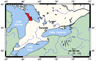
The Bruce Peninsula is a peninsula in Ontario, Canada, that lies between Georgian Bay and the main basin of Lake Huron. The peninsula extends roughly northwestwards from the rest of Southwestern Ontario, pointing towards Manitoulin Island, with which it forms the widest strait joining Georgian Bay to the rest of Lake Huron. The Bruce Peninsula contains part of the geological formation known as the Niagara Escarpment.

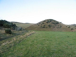
A kame is a glacial landform, an irregularly shaped hill or mound composed of sand, gravel and till that accumulates in a depression on a retreating glacier, and is then deposited on the land surface with further melting of the glacier. Kames are often associated with kettles, and this is referred to as kame and kettle topography. The word kame is a variant of comb, which has the meaning "crest" among others. The geological term was introduced by Thomas Jamieson in 1874.

In geology, a terrace is a step-like landform. A terrace consists of a flat or gently sloping geomorphic surface, called a tread, that is typically bounded one side by a steeper ascending slope, which is called a "riser" or "scarp." The tread and the steeper descending slope together constitute the terrace. Terraces can also consist of a tread bounded on all sides by a descending riser or scarp. A narrow terrace is often called a bench.

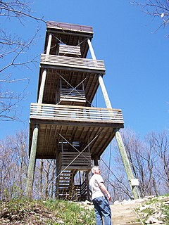
The Kettle Moraine State Forest is a state forest in southeastern Wisconsin. The chief feature of the reserve is the Kettle Moraine, a highly glaciated area. The area contains very hilly terrain and glacial landforms, such as kettles, kames and eskers. The 56,000-acre (23,000 ha) forest is divided into two large and three small units, which are spread across a hundred miles.
Mollidgewock Brook is a 12.6-mile (20.3 km) long stream in northern New Hampshire and western Maine in the United States. It is a tributary of the Androscoggin River, which flows south and east into Maine, joining the Kennebec River near the Atlantic Ocean.
Sidney is an unincorporated community located in Comanche County in the U.S. state of Texas.

Chantry Island is a small island in Lake Huron, south of the mouth of the Saugeen River and approximately a kilometre off the shores of the town of Southampton, Ontario and south of the mouth of the Saugeen River on Lake Huron. It is approximately 19 hectares in size and is a migratory bird sanctuary. Since the sanctuary territory extends 183 metres into the water surrounding the island, the total official area is listed as 63 hectares.

The Christmas Mountains are a series of rounded peaks in northern New Brunswick, Canada, at the headwaters of North Pole Stream and the Little Southwest Miramichi River, west of Big Bald Mountain, and south of Mount Carleton. The mountains, in part, separate the Miramichi River watershed from the watersheds of the Serpentine River and the Nepisiguit River.
The Spider Islands are a small archipelago in the north basin of Lake Winnipeg in Manitoba, Canada. The archipelago is situated near the eastern shoreline of the lake, north of the mouth of the Belanger River.
The Glenville Hills Kames is a 345 hectare provincially significant Earth Science Area of Natural and Scientific Interest in Ontario, Canada.
The Uxbridge Forest Kames is a 644-hectare (1,591-acre) provincially significant Earth Science Area of Natural and Scientific Interest in Ontario, Canada. The land is owned and managed by the Toronto and Region Conservation Authority.

Minnitaki Kames Provincial Park is a 4,422-hectare (10,930-acre) nature reserve in Ontario, Canada, designated to protect several distinguishing features, including east-west kame ridges and numerous terraces. It abuts the shores of Minnitaki Lake, with the nearest settlement at Sioux Lookout, about 20 km to the north.
The Fleetwood Kames is a 939 hectare provincially significant Earth Science Area of Natural and Scientific Interest in Ontario, Canada. The topographical feature is located on the north slope of the Oak Ridges Moraine, in the city of Kawartha Lakes. Part of the parcel, known as Fleetwood Creek, is owned by the Ontario Heritage Foundation.
The Bennet Lake Esker Kame Complex Conservation Reserve is a Canadian conservation reserve in the townships of Boyle and Guilfoyle, in Cochrane District, Ontario. The 3,481 hectare reserve is approximately 40 km northeast of Kapuskasing.

Boulder Park National Natural Landmark, along with the nearby McNeil Canyon Haystack Rocks and Sims Corner Eskers and Kames natural landmarks, illustrate well-preserved examples of classic Pleistocene ice stagnation landforms that are found in Washington. These landforms include numerous glacial erratics and haystack rocks that occur near and on the Withrow Moraine, which is the terminal moraine of the Okanogan ice lobe.
Whites Lake, could mean the following :
Saugeen may refer to the following in Ontario, Canada:
The Saugeen Golf Club is located between the tourist towns of Southampton and Port Elgin in Bruce County, Ontario, Canada, situated on Lake Huron. The club was founded in 1925 and consists of 27 holes, split into three separate nine-hole courses known as Legacy, Sunrise and Sunset.

Wareham is a community in Grey County, Ontario. It is about 80 km northwest of Brampton, Ontario and about 60 km west of Barrie, Ontario. It is south of The Blue Mountains, Ontario and of the Grey Highlands.

Kayak Point is a census-designated place (CDP) located in Snohomish County, Washington, United States. The CDP was newly defined by the United States Census Bureau in 2013. The population was 1,737 as of 2013 estimates.


