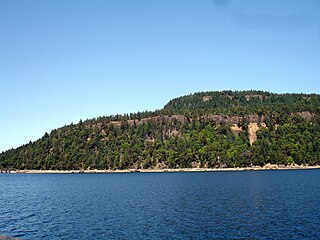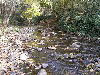
Mount Mitchell is the highest peak of the Appalachian Mountains and the highest peak in mainland eastern North America. It is located near Burnsville in Yancey County, North Carolina; in the Black Mountain subrange of the Appalachians, about 19 miles (31 km) northeast of Asheville. It is protected by Mount Mitchell State Park and surrounded by the Pisgah National Forest. Mount Mitchell's elevation is 6,684 feet (2,037 m) above sea level.

The Pacific temperate rainforests ecoregion of North America is the largest temperate rain forest ecoregion on the planet as defined by the World Wildlife Fund. The Pacific temperate rain forests lie along the western side of the Pacific Coast Ranges along the Pacific Northwest Coast of North America from the Prince William Sound in Alaska through the British Columbia Coast to Northern California, and are part of the Nearctic ecozone, as also defined by the World Wildlife Fund. The Pacific temperate rain forests are characterized by a high amount of rainfall, in some areas more than 300 cm (10 ft) per year and moderate temperatures in both the summer and winter months.

Quadra Island is an island off the eastern coast of Vancouver Island, British Columbia, Canada, part of the Discovery Islands located within the Strathcona Regional District. Quadra Island is about 35 kilometres from its northernmost point to its southernmost point. The island at its narrowest point, on its southern peninsula, is less than 2 km (1.24 mi) wide, and at its widest point, about 15 km (9 mi) wide. Quadra island is about 310 square kilometres in area. The population of island and surrounding mainland inlets, as of the 2006 federal census, was 2,472, down from the 2001 federal census count of 2,548. In 1903 it was named after the Spanish navigator Juan Francisco de la Bodega y Quadra, who explored and settled the Vancouver Island area in the late 18th century. It is separated from Vancouver Island by Discovery Passage, and from Cortes Island, and is linked to that island by a ferry from Heriot Bay on its eastern shore. The island has many beaches, trails, lakes, and parks. Main Lake Provincial Park is located on the northern part of the island, and Rebecca Spit Marine Provincial Park is on the eastern shore, near Heriot Bay.

Hornby Island of British Columbia, Canada, is a Salish Sea island located near Vancouver Island's Comox Valley.
Uplands, Victoria is a 465-acre neighbourhood located in the north east part of the District of Oak Bay, a suburb adjacent to Victoria, British Columbia, Canada, and situated between the neighbourhoods of Cadboro Bay and North Oak Bay. Uplands is a prominent example of a garden suburb designed in the early part of the 20th century.

Denman Island, or Sla-dai-aich (Taystayic), its indigenous name, is one of the Northern Gulf Islands and part of the Comox Valley Regional District of British Columbia, Canada, and is home to a small community of 1,022 year-round residents.
Soil texture is a classification instrument used both in the field and laboratory to determine soil classes based on their physical texture. Soil texture can be determined using qualitative methods such as texture by feel, and quantitative methods such as the hydrometer method. Soil texture has agricultural applications such as determining crop suitability and to predict the response of the soil to environmental and management conditions such as drought or calcium (lime) requirements. Soil texture focuses on the particles that are less than two millimeters in diameter which include sand, silt, and clay. The USDA soil taxonomy and WRB soil classification systems use 12 textural classes whereas the UK-ADAS system uses 11. These classifications are based on the percentages of sand, silt, and clay in the soil..
John Dean Provincial Park is a provincial park in British Columbia, Canada. The park is located on and around Mount Newton, a small mountain in the middle of the Saanich Peninsula, north of Victoria. The park is named after John Dean, who was a pioneer of the area and erected a cabin close to what is now the center of the park. Dean donated the original land which became the park in 1921, which was later expanded. Dean's cabin was razed in 1957, but the foundation and much of the building material remains, and the site is marked with a signpost.

Koksilah Ridge (Hwsalu'utsum)is an elevated area located south of the Cowichan Valley on Vancouver Island, British Columbia. It is centered at 48°42′N, 123°47′W. Its summit lies about 892 meters above sea level. It is visible in most of the Cowichan Valley and on the Saanich Peninsula north of Brentwood Bay. As seen from North Saanich or Sidney, it is plough-shaped, with long gentle slopes.

Eagle Heights is an elevated area located south of Koksilah Ridge on Vancouver Island, British Columbia, Canada. It is centered at 48°40′N, 123°46′W. Its summit lies about 836 meters above sea level. Populated areas where it is visible include North Saanich, Sidney, and Shawnigan Lake.

Santa Rosa Creek is a 22-mile-long (35 km) stream in Sonoma County, California, which rises on Hood Mountain and discharges to the Laguna de Santa Rosa by way of the Santa Rosa Flood Control Channel. This article covers both the creek and the channel.

San Joaquin is an officially designated state insignia, the state soil of the U.S. state of California.

The Coast Range ecoregion is a Level III ecoregion designated by the Environmental Protection Agency (EPA) in the U.S. states of Washington, Oregon, and California. It stretches along the Pacific Coast from the tip of the Olympic Peninsula in the north to the San Francisco Bay in the south, including Grays Harbor, Willapa Bay, and the Long Beach Peninsula in Washington, the entire length of the Oregon Coast, and the Northern California Coast. Named for the Coast Range mountains, it encompasses the lower elevations of the Olympic Mountains, the Oregon Coast Range, the Californian North Coast Ranges, and surrounding lowlands.

The Willamette Valley ecoregion is a Level III ecoregion designated by the United States Environmental Protection Agency in the U.S. states of Oregon and Washington. Slightly larger than the Willamette Valley for which it is named, the ecoregion contains fluvial terraces and floodplains of the Willamette River system, scattered hills, buttes, and adjacent foothills. It is distinguished from the neighboring Coast Range, Cascades, and Klamath Mountains ecoregions by lower precipitation, lower elevation, less relief, and a different mosaic of vegetation. Mean annual rainfall is 37 to 60 inches, and summers are generally dry. Historically, the region was covered by rolling prairies, oak savanna, coniferous forests, extensive wetlands, and deciduous riparian forests. Today, it contains the bulk of Oregon's population, industry, commerce, and agriculture. Productive soils and a temperate climate make it one of the most important agricultural areas in Oregon.

Laminated root rot also known as yellow ring rot is caused by the fungal pathogen Phellinus weirii. Laminated root rot is one of the most damaging root disease amongst conifers in northwestern America and true firs, Douglas-fir, Mountain hemlock, and Western hemlock are highly susceptible to infection with P. weirii. A few species of plants such as Western white pine and Lodgepole pine are tolerant to the pathogen while Ponderosa pine is resistant to it. Only hardwoods are known to be immune to the pathogen.
Yamaska National Park is a provincial park centered on the man-made Choiniere Reservoir. It is located in the municipalities of Roxton Pond and Saint-Joachim-de-Shefford in La Haute-Yamaska Regional County Municipality, just northeast of Granby, Quebec. Its undulating hilly landscape is supported by slate and sandstone bedrock. The main soil is a stony sandy loam podzol which has been mapped as the Racine series—one of the most acidic soils in the area.
Little River Nature Park is a protected area on the eastern shore of Vancouver Island in the Comox Valley Regional District. It is home to beaches, man-made ponds, an estuarine marsh, and well-drained forests dominated by Douglas-fir. The park is underlain by sand and gravel which was locally extracted in open pits; these have since become the ponds.
Lazo Wildlife Park is a protected area on eastern Vancouver Island in the Comox Valley Regional District(CVRD). It lies at the north end of Lazo Marsh and its entrance is at the end of Sand Pines Drive in Comox. Part of the park lies on the Comox Sandhills in which the forest contains a large proportion of Shore Pine. Douglas-Fir, Western White Pine and Western Red Cedar are prominent among the other tree species present. Bird life is dominated by nesting populations of ducks and geese. Soils in the area were mapped in 1959 as Arrowsmith peat and Kye-Custer complex of rapidly to imperfectly drained sandy podzols.
Comox Sandhills represents an ancient sand dune system in the Comox Valley near Cape Lazo, British Columbia. The dunes have been overgrown by a forest of Douglas-Fir and Shore Pine, which are joined by Western Hemlock, Western White Pine, Sitka Spruce, Western Red Cedar and Red Alder in moist areas. Classic podzol soil profile development was the rule, mapped as Kye-Custer complex ("Ky-Cu") in a 1959 survey; however, housing developments have since disturbed the area and disrupted soil profiles so that many of the soils no longer resemble podzols. As a result, a 1985 report mapped the Sandhills in a brunisolic (Kuhushan) soil association.
Clayoquot Sound Biosphere Reserve is a UNESCO Biosphere Reserve situated in Vancouver Island on the west coast of British Columbia. A diverse range of ecosystems exist within the biosphere reserve boundaries, including temperate coastal rainforest, ocean and rocky coastal shores.
Day, J.H., L. Farstad, and D.G. Laird, 1959. Soil Survey of Southeast Vancouver Island and Gulf Islands, British Columbia. B.C. Soil Survey, Rept. No. 6, Can. Dept. Agric.


