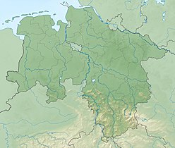
The Weser is a river in Northwestern Germany. Formed at Hannoversch Münden by the confluence of the rivers Fulda and Werra, it flows through Lower Saxony, then reaching the Hanseatic city of Bremen, before emptying 50 km (31 mi) further north at Bremerhaven into the North Sea. On the opposite (west) bank is the town of Nordenham at the foot of the Butjadingen Peninsula; thus, the mouth of the river is in Lower Saxony. The Weser has an overall length of 452 km (281 mi). Together with its Werra tributary, which originates in Thuringia, its length is 744 km (462 mi).

The Harz is a Mittelgebirge that has the highest elevations in Northern Germany and its rugged terrain extends across parts of Lower Saxony, Saxony-Anhalt, and Thuringia. The name Harz derives from the Middle High German word Hardt or Hart, Latinized as Hercynia. The Brocken is the highest summit in the Harz with an elevation of 1,141.1 metres (3,744 ft) above sea level. The Wurmberg is the highest peak located entirely within the state of Lower Saxony.

Harz National Park is a nature reserve in the German federal states of Lower Saxony and Saxony-Anhalt. It comprises portions of the western Harz mountain range, extending from Herzberg and Bad Lauterberg at the southern edge to Bad Harzburg and Ilsenburg on the northern slopes. 95 % of the area is covered with forests, mainly with spruce and beech woods, including several bogs, granite rocks and creeks. The park is part of the Natura 2000 network of the European Union.

Wulften am Harz is a municipality in Lower Saxony, Germany, near the towns of Northeim and Osterode am Harz.

The Großer Knollen is a 687.4-metre-high (2,255 ft) mountain in the southwestern part of the Harz in Lower Saxony, Germany.

Romkerhall is a popular tourist destination on the River Oker in the Harz Mountains of Germany. There is a public car park here as well as a hotel and restaurant opposite the Romkerhall Waterfall. Romkerhall lies within the unincorporated area of Harz in the Lower Saxon county of Goslar in the Harz Mountains. The hotel and waterfall form a small tourist attraction which is marketed as the "Kingdom of Romkerhall - the smallest kingdom in the world!"

The Upper Harz Water Regale is a system of dams, reservoirs, ditches and other structures, much of which was built from the 16th to 19th centuries to divert and store the water that drove the water wheels of the mines in the Upper Harz region of Germany. The term regale, here, refers to the granting of royal privileges or rights in this case to permit the use of water for mining operations in the Harz mountains of Germany.
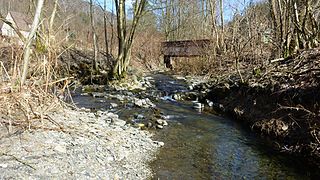
The Krumme Lutter is one of the two headstreams of the Lutter in the South Harz in central Germany, north of Bad Lauterberg in the district of Göttingen in Lower Saxony. It rises below 620 m on the Aschentalshalbe and flows towards the south past the Wolkenhügel and Hoher Trost pits, before it unites with the Grade Lutter in Kupferhütte to become the Lutter.
The Lutter is a small river that flows near Bad Lauterberg in the district of Göttingen in the north German state of Lower Saxony. It begins at the confluence of the Grade Lutter and Krumme Lutter in Kupferhütte and is 2.2 km long. It discharges into the Oder.
The Grade Lutter is one of the two headstreams of the River Lutter in the South Harz. It rises at over 660 metres on the Aschentalshalbe. It then flows mainly in a southerly direction in order to merge with the Krumme Lutter near Kupferhütte to form the Lutter.

The Übelsberg is a 651.3 metre high mountain in the South Harz, which lies southwest of Sieber in the district of Göttingen in Lower Saxony. It sits astride the watershed between the Grade Lutter and the Krumme Lutter rivers. The mountain is linked via a ridge to the Aschentalshalbe in the north and the Mittelberg in the south.
The Kleiner Knollen is a 631 metre high mountain in the southwestern part of the Harz in the German state of Lower Saxony.
The Braakberg is a 645.5 metre high mountain in the Harz in central Germany that lies in the unincorporated area of Harz in the district of Göttingen in the state of Lower Saxony.

The Northern Harz Boundary Fault is a geological fault where the Harz Block, which consists of rocks formed during the Palaeozoic Era and folded in the course of Hercynian mountain building, borders on the Subhercynian Basin or Harz Foreland. The fault is also known in English as the Harz North Rim Fault or Harznordrand Thrust (Fault).

Within the Lower Harz region are still many traces of the historical water management facilities used by the mining industry. In addition to water-carrying ditches and ponds, there are also long-abandoned ditches and dry pond beds. The Lower Harz Pond and Ditch System, which forms the major part of these old water management facilities, lies in the central Lower Harz, almost entirely within the borough of the present-day town of Harzgerode.

The Göttingen Forest is a ridge in Germany's Central Uplands that is up to 427.5 metres high. It forms part of the Lower Saxon Hills in South Lower Saxony.
The Höxterberg is a hill in the Harz Mountains of central Germany, that lies south of Sieber in the district of Göttingen in Lower Saxony. It is 584 metres high and lie 0.9 kilometres west of the Pagelsburg, 1.5 kilometres south of the Fissenkenkopf, 1.8 km west of the Großer Knollen and 1 kilometre north of the Mittelecke. The hill is mostly covered by beech woods. Towards the northwest the Höxterberg transitions into the Steile Wand.
The Heibeeksköpfe in the Harz Mountains of central Germany are a double summit with a maximum height of 465.2 m above sea level (NN), near Bad Lauterberg in the unincorporated area of Harz in the district of Göttingen in Lower Saxony.

The Royal Palace of Werla is located near Werlaburgdorf in Lower Saxony. The grounds of the royal palace cover about 20 hectares rising atop Kreuzberg hill, a 17 m high natural plateau overlooking the Oker river. In the Early Middle Ages the palace was an important place in the Holy Roman Empire, serving as an important base for the Ottonians in the 10th century in particular. Although it subsequently lost its political significance to the newly established Imperial Palace of Goslar at Rammelsberg, it developed into an independent settlement with a busy industrial quarter. In the 14th century it fell into ruin and was completely unknown until its rediscovery in the 18th century. The core fortress in particular was thoroughly excavated in the 20th century. Excavations carried out since 2007 have brought new understanding to the hitherto largely unexplored outworks. Since 2010 the palace complex with foundation and enceinte, as well as earthworks, has been partially reconstructed and is now open to the public as the Archäologie- und Landschaftspark Kaiserpfalz Werla.