Schneeberg (Thuringian Forest)

Last updated
Schneeberg
Thuringia relief location map.jpg
Red triangle with thick white border.svg
Schneeberg
Highest point
Elevation 692.4 m above  sea level (NN) (2,272 ft)
Listing Höchster Berg im Kl. Thür. Wald, südlichster Punkt der Stadt Suhl
Coordinates 50°33′41″N10°39′31″E / 50.5613°N 10.6585°E / 50.5613; 10.6585 Coordinates: 50°33′41″N10°39′31″E / 50.5613°N 10.6585°E / 50.5613; 10.6585
Geography
Location Thuringia, Germany
Parent range Thuringian Forest

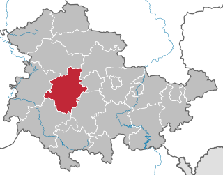
The Schneeberg is a mountain, 692.4 metres high, that marks the southernmost boundary point of the borough of Suhl in the German state of Thuringia. [1]

Suhl Place in Thuringia, Germany

Suhl is a city in Thuringia, Germany, located 50 kilometres SW of Erfurt, 110 kilometres NE of Würzburg and 130 kilometres N of Nuremberg. With its 35,000 inhabitants, it is the smallest of the six urban districts within Thuringia. Together with its northern neighbour-town Zella-Mehlis, Suhl forms the largest urban area in the Thuringian Forest with a population of 46,000. The region around Suhl is marked by up to 1,000-meter high mountains, including Thuringia's highest peak, the Großer Beerberg, approximately 5 kilometres NE of the city centre.

Thuringia State in Germany

Thuringia, officially the Free State of Thuringia, is a state of Germany.

The mountain is forested down to the valley in the south. Its southern mountainside belongs to the parish of Grub and Eichenberg, both small forest villages near Themar in the county of Hildburghausen. The Schneeberg is the highest point of the Little Thuringian Forest. A hiking trail runs over the wooded Schneeberg linking Dolmar to the Rennsteig trail.

Themar Place in Thuringia, Germany

Themar is a town in the district of Hildburghausen, in Thuringia, Germany. It is situated on the river Werra, 11 km northwest of Hildburghausen, and 14 km southwest of Suhl.

The Little Thuringian Forest is a region of mountains and hills that lies southwest of Suhl and northwest of Schleusingen, and extends as far as an imaginary line from Schmeheim via Bischofrod and Gethles to Rappelsdorf. Its length is about 11 km (6.8 mi), its width varies between 1 km (0.62 mi) and 2 km (1.2 mi). Its name is not to be understood in an orographic or geographic sense, but is due to the marked similarity of its bedrock to that of the Thuringian Forest to the north of it.

Dolmar company

Makita Engineering Germany GmbH (Dolmar) is one of the oldest manufacturers of portable gasoline chainsaws and is headquartered in Hamburg, Germany. The company founder, Emil Lerp, developed in 1927 the "type A" saw, which weighed 125 lb and required two men to operate. It was tested on Mount Dolmar in the Thüringer forest and the company took its name from the test site.

Related Research Articles

Thuringian Forest mountain range in the German state of Thuringia

The Thuringian Forest, is a mountain range in the southern parts of the German state of Thuringia, running northwest to southeast between the valley of the river Werra near Eisenach and the Thuringian-Vogtlandian Slate Mountains. The geographical boundary with the latter range follows approximately a line from Gehren via Großbreitenbach to Schönbrunn near Schleusingen, defined by the rivers Schleuse and Neubrunn on the southwestern slope, and Talwasser, Wohlrose and Möhre on the northeastern slope.

Gotha (district) District in Thuringia, Germany

Gotha is a Kreis (district) in western central Thuringia, Germany. Neighboring districts are Unstrut-Hainich, Sömmerda, the Kreis-free city Erfurt, Ilm-Kreis, Schmalkalden-Meiningen and the Wartburgkreis.

Haßberge (district) District in Bavaria, Germany

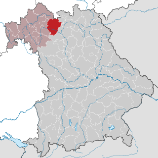
Haßberge is a Landkreis (district) in Bavaria, Germany. It is bounded by the districts of Coburg, Bamberg, Schweinfurt and Rhön-Grabfeld, and by the state of Thuringia.

Hildburghausen (district) District in Thuringia, Germany

Hildburghausen is a district in Thuringia, Germany. It is bounded by the district of Schmalkalden-Meiningen, the city of Suhl, the districts of Ilm-Kreis, Saalfeld-Rudolstadt and Sonneberg, and the state of Bavaria. Located roughly halfway between the mountain chains of the Rhön and the Thuringian Forest, the district is densely forested and covered by hilly countryside. Its territory is similar to that of the former Ernestine duchy, Saxe-Hildburghausen.

Ilm-Kreis District in Thuringia, Germany

Ilm-Kreis is a district in Thuringia, Germany. It is bounded by the city of Erfurt, the districts of Weimarer Land, Saalfeld-Rudolstadt and Hildburghausen, the city of Suhl, and the districts of Schmalkalden-Meiningen and Gotha. It is named after the river Ilm, flowing through the district.

Schmalkalden-Meiningen District in Thuringia, Germany

Schmalkalden-Meiningen is a Landkreis in the southwest of Thuringia, Germany. Its neighboring districts are the districts Wartburgkreis, Gotha, Ilm-Kreis, the district-free city Suhl, the district Hildburghausen, the Bavarian district Rhön-Grabfeld, and the district Fulda in Hesse.

Hildburghausen Place in Thuringia, Germany

Hildburghausen is a town in Thuringia in central Germany, capital of the district Hildburghausen.

Saxe-Hildburghausen

Saxe-Hildburghausen was an Ernestine duchy in the southern side of the present State of Thuringia in Germany. It existed from 1680 to 1826 but its name and borders are currently used by the District of Hildburghausen.

House of Henneberg noble family

Henneberg was a medieval German comital family (Grafen) which from the 11th century onwards held large territories in the Duchy of Franconia. Their county was raised to a princely county in 1310.

Main-Franconian is group of Upper German dialects being part of the East Franconian group. The name is derived from the river Main which meets the river Rhine near Frankfurt after having crossed the former West Germany from East to West. The dialect is estimated by Ethnologue as 40% intelligible with Standard German.

Großer Beerberg mountain

The Großer Beerberg is a mountain located in the Thuringian Forest, Germany, and the highest point in the state of Thuringia. The nearest town is Suhl.

Freies Wort is the largest regional newspaper in southern Thuringia. Including Meininger Tageblatt, Freies Wort has a circulation of 80,000.

Thuringian Highland mountain range

The Thuringian HighlandThuringian Highlands or Thuringian-Vogtlandian Slate Mountains is a low range of mountains in the German state of Thuringia.

Rennsteig hiking trail in Germany

The Rennsteig is a ridge walk as well as an historical boundary path in the Thuringian Forest, Thuringian Highland and Franconian Forest in Central Germany. The long-distance trail runs for about 170 km from Eisenach and the Werra valley in the northwest to Blankenstein and the Selbitz river in the southeast.

Bezirk Suhl District in 8 Kreise and 1 Stadtkreis, German Democratic Republic

The Bezirk Suhl was a district (Bezirk) of East Germany. The administrative seat and the main town was Suhl.

Simmersberg mountain in Germany

The Simmersberg is a mountain, 780.8 m above sea level (NHN), near Schnett in the municipality of Masserberg) in the county of Hildburghausen in Germany. It is the main summit of a forked mountain chain, which runs along the boundary between the Thuringian Forest and the Thuringian Highland from Masserberg towards the southwest and is bounded by the valleys of the Schleuse and its tributary, the Biber.

References

  1. Thüringer Landesvermessungsamt, ed. (1999), "Official topographical map of Thuringia 1:10,000 scale. LK Schmalkalden-Meiningen, LK Hildburghausen, LK Sonneberg, Kreisfreie Stadt Suhl", CD-ROM Reihe Top10 (in German), Erfurt, CD 6