Karlsruhe is a Landkreis (district) in the northwest of Baden-Württemberg, Germany. Neighboring districts are Rhein-Neckar, Heilbronn, Enz, Calw, Rastatt, Germersheim, Rhein-Pfalz-Kreis and the district-free city Speyer. The urban district Karlsruhe, which contains the City of Karlsruhe, is located in the middle of the district, and partially cuts it into a northern and a southern part.

Döbeln is a town in Saxony, Germany, part of the Mittelsachsen district, on both banks of the river Freiberger Mulde.

Mittweida is a town in Saxony, Germany, in the Mittelsachsen district.

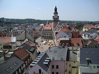
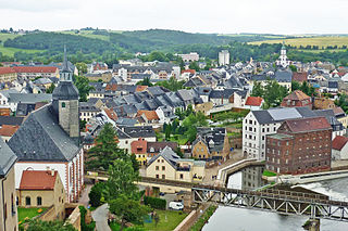
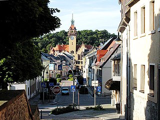
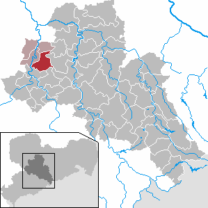
Rochlitz is a major district town in the district of Mittelsachsen, in Saxony, Germany. Rochlitz is the head of the "municipal partnership Rochlitz" with its other members being the municipalities of Königsfeld, Seelitz and Zettlitz.

Geringswalde is a town in the district of Mittelsachsen, in Saxony, Germany. It is situated 12 km northwest of Mittweida, and 27 km north of Chemnitz.

Thum is a small town in the district of Erzgebirgskreis in Saxony, Germany. It has a population of about 5,000.

Waldheim is a town in Mittelsachsen district, in Saxony, Germany.

Narsdorf is a former municipality in the Leipzig district, in Saxony, Germany. As of 1 July 2017 Narsdorf has been incorporated into Geithain. The villages of Ossa, and Rathendorf had been incorporated administratively into Narsdorf in 1996, while nearby Seifersdorf had already been incorporated in 1934 and Dölitzsch in 1973.

Seelitz is a municipality in the district of Mittelsachsen, in Saxony, Germany. It is part of the administrative partnership Verwaltungsgemeinschaft Rochlitz based in the eponymous town.
Mittelsachsen is a district (Kreis) in the Free State of Saxony, Germany.

The Chemnitz–Riesa railway is a two-track and electrified mainline railway in the German state of Saxony, originally built and operated by the Chemnitz-Riesa Railway Company. The line was opened between 1847 and 1852 and is one of the oldest railways in Germany. The line runs from Riesa via Döbeln to Chemnitz and is part of the Berlin–Chemnitz route.

Döbeln Hauptbahnhof is the largest station in Döbeln in the German state of Saxony. Now an unstaffed halt, it was built as a Keilbahnhof. The station is listed by the rail authorities with the abbreviation of DDE.
The Borsdorf–Coswig railway is a mainline railway in the German state of Saxony, originally built and operated by the Leipzig-Dresden Railway Company. It runs mostly along the Freiberger Mulde from Borsdorf via Döbeln and Meissen to Coswig near Dresden. It is part of a long-distance connection from Leipzig to Dresden, but is now used for local traffic only.

The Waldheim–Rochlitz railway was a single-track branchline of about 21 km length in Saxony, connecting the towns of Waldheim and Rochlitz via Hartha and Geringswalde. It was opened in 1893, closed in 1998 and served mainly the purposes of the local industry and population.

The Rochlitz–Penig railway was a 21 km long branchline in Saxony from Rochlitz via Narsdorf to Penig which opened in 1872 and connected the railway lines Neukieritzsch–Chemnitz and Glauchau–Wurzen. Its Narsdorf–Penig section was decommissioned in 1998 and has been lifted, the remainder was decommissioned in 2000.

Mildenstein Castle, in German Burg Mildenstein, also called Schloss Leisnig, is located in Leisnig in Landkreis Mittelsachsen, Saxony, Germany. It is a property of the Free State of Saxony and is administrated by the company State Palaces, Castles and Gardens of Saxony.

Siebenlehn is a district of the town Großschirma in Landkreis Mittelsachsen. Until 2003 it was a separate town. Upon fusion with the neighbouring rural municipality Großschirma on 1 September 2003, the town privileges were transferred to the joint municipality.

Benndorf is a district of the town Frohburg in the Landkreis Leipzig district of Saxony, Germany. The former independent municipality became a district of Frohburg on 1 January 1997. Since 1948, the former independent municipality Bubendorf became part of Benndorf.
Döhlen is a village in Landkreis Mittelsachsen in the Free State of Saxony, Germany. It is part of the municipality of Seelitz.


