
Queens County is located in central New Brunswick, Canada. The county shire town is the village of Gagetown. The county was named as an expression of loyalty to the Crown and to commemorate a group of earlier settlers originally from Queens County, New York.
The Hammond River is a tributary of the Kennebecasis River in New Brunswick, Canada. It runs approximately 40 kilometres (25 mi) in southern Kings County along the border of Saint John County. It rises in the Caledonia Highlands near the rural community of Hammondvale and runs in a westerly direction to its junction with the Kennebecasis River. Near the mouth of the river, at the rural community of Nauwigewauk, the river is joined by a short tributary draining Darlings Lake.

Shuswap Lake Provincial Park is a provincial park in British Columbia, Canada.
Geary is a Canadian rural community in Sunbury County, New Brunswick. It is often considered to be in four small parts: Haneytown, Waterville-Sunbury, Geary, and French Lake.

Mactaquac Provincial Park is a Canadian provincial park with an area of 5.25 square kilometres (2.03 sq mi). It is located on the Saint John River 15 kilometres west of Fredericton, New Brunswick in the community of Mactaquac.

Mount Carleton Provincial Park, established in 1970, is the largest provincial park in the Province of New Brunswick, Canada. It encompasses 174 square kilometres (67 sq mi) in the remote highlands of north-central New Brunswick. The park is a lesser-known gem of the Atlantic Canadian wilderness. Some outdoor enthusiasts refer to it as the "Algonquin of New Brunswick."

Queensbury is a geographic parish in York County, New Brunswick, Canada.
Mactaquac is a community in the Canadian province of New Brunswick in York County around the intersection of Route 105 and Route 615.

New Maryland is a geographic parish in York County, New Brunswick, Canada.
Route 640 is a 35.9-kilometre (22.3 mi) long mostly north–south secondary highway in the southwestern portion of New Brunswick, Canada. Most of the route is in Prince William Parish.
Route 690 is a 45.6-kilometre (28.3 mi) long mostly north–south secondary highway in the southwestern portion of New Brunswick, Canada. Most of the route is in Canning Parish.
Route 735 is a 19.4-kilometre (12.1 mi) long mostly north–south secondary highway in the southwestern portion of New Brunswick, Canada. Most of the route is in Charlotte County.
Route 760 is a 37.4-kilometre (23.2 mi) long mostly west–east secondary highway in the southwestern portion of New Brunswick, situated in Canada.
Route 770 is a 58.1-kilometre (36.1 mi) long mostly west–east secondary highway in the southwestern portion of New Brunswick, Canada.
Route 780 is a 29-kilometre (18 mi) long mostly west–east secondary highway in the southwestern portion of New Brunswick, Canada.
Route 785 is a 68.8-kilometre (42.8 mi) long mostly north–south secondary highway in the southwestern portion of New Brunswick, Canada. Locally, this road may be known as either the "Shin Crick Road" or the "Mine Road". In the early 1980s, a mine was established off Route 785, at Mount Pleasant. Today, Adex Mining holds a mineral claim on the mine however the mine is currently in an idle state. As a result of mine development at Mount Pleasant, Route 785 was heavily developed and rerouted from the original stage coach trail. Another name for the road is the "Sheldon Lee Highway", a satirical reference to former New Brunswick Minister of Transportation, Hon. Sheldon Lee, who continued developed the road during his terms in office, especially on the portion of road north of Mount Pleasant. Mr. Lee lived in the community of Bonny River, which is located near the southern end of Route 785, and like many people today, frequently used Route 785 for travel to Fredericton from the St. George area, roughly shaving off 40km per trip when compared to highway travel. Today, the road is heavily used by forest operations.
Route 790 is a 31.1-kilometre (19.3 mi) long mostly east–west secondary highway in the southwestern portion of New Brunswick, Canada.

Saint George is a geographic parish in Charlotte County, New Brunswick, Canada, located between St. Stephen and Saint John.
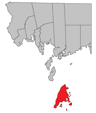
Grand Manan is a geographic parish in Charlotte County, New Brunswick, Canada, comprising one village and part of a rural district; the rural district portion was formerly a local service district (LSD); both of which are members of the Southwest New Brunswick Service Commission (SNBSC). The parish includes Grand Manan Island and numerous lesser islands, only one of which has permanent year-round inhabitants.
Musquash is a Canadian rural community in Saint John County, New Brunswick. It is located 5 km (3.1 mi) west southwest of the community of Prince of Wales in Musquash Parish.
