Charleswood is a residential community and neighbourhood in Winnipeg, Manitoba, Canada. It is located in the South-West of the city and is bordered by the neighbourhoods Tuxedo to the East, Fort Whyte to the South, and the Rural Municipality of Headingley on the West. Its boundaries are Roblin and the Assiniboine River to the north, Shaftesbury Boulevard on the East, Wilkes Avenue to the South and the Perimeter Highway to the West.
The Winnipeg City Council is the governing body of the city of Winnipeg, Manitoba, Canada. The Council is seated in the Council Building of Winnipeg City Hall.

Tuxedo is a residential suburb of Winnipeg, Manitoba. It is located about 7 kilometres southwest of downtown Winnipeg and borders the Assiniboine River and Assiniboine Park on the north, Shaftesbury Boulevard on the west, Route 90 to the East and McGillvary Boulevard to the South. Prior to 1972, the community was incorporated as the Town of Tuxedo.
Provincial Trunk Highway 1 is Manitoba's section of the Trans-Canada Highway. It is a heavily used, 4-lane divided highway, with the exception of a short 18 km section in the southeastern corner of the province. It is the main link between southern Manitoba's largest cities, and also serves as the province's main transportation link to the neighbouring provinces of Saskatchewan and Ontario. The highway is the only major east-west divided highway in Manitoba, and carries a large majority of east-west traffic within and through the province. It has full freeway status sections at Portage la Prairie and Winnipeg. The total distance of the Trans-Canada Highway in Manitoba is approximately 490 km (300 mi).
Old Kildonan is the northernmost city ward of Winnipeg, Manitoba. Before the City of Winnipeg Act of 1972, it was an independent unincorporated municipality called the Municipality of Old Kildonan; prior to that, from 1914, it was a subdivision of the Rural Municipality of Kildonan.

The amalgamation of Winnipeg, Manitoba was the municipal incorporation of the old City of Winnipeg, eleven surrounding municipalities, and the Metropolitan Corporation of Greater Winnipeg (Metro) into one.
North Kildonan is a city ward in northern Winnipeg, and a former municipality in Manitoba, Canada. Its population as of 2016 was 44,664.

St. James-Assiniboia is a major community area in Winnipeg, Manitoba, Canada. As it encapsulates most of the city ward of St. James, which includes the major St. James Street, the area itself is often simply referred to "St. James."

Carberry is a town in southwestern Manitoba, Canada. It is situated 3 kilometres (1.9 mi) south of the Trans-Canada Highway on Highway 5 in the Municipality of North Cypress – Langford, and has a population of 1,818 people.

Whiteshell Provincial Park is a provincial park in southeast Manitoba, approximately 120 kilometres (75 mi) east of the city of Winnipeg. The park is considered to be a Class II protected area under the IUCN protected area management categories. It is 275,210 hectares in size.

Turtle Mountain, or the Turtle Mountains, is an area in central North America, in the north-central portion of the U.S. state of North Dakota and southwestern portion of the Canadian province of Manitoba, approximately 62 miles (100 km) south of the city of Brandon on Manitoba Highway 10 / U.S. Route 281. It is a plateau 2,000 ft above sea level, 300 ft to 400 ft above the surrounding countryside, extending 20 mi (32 km) from north to south and 40 mi (64 km) from east to west. Rising 1,031 feet (314 m), North Dakota's most prominent peak, Boundary Butte, is located at the western edge of the plateau.

The West End is a mostly residential area of Downtown Winnipeg, Manitoba, Canada. It includes the neighbourhoods of Armstrong's Point, Colony, Daniel McIntyre, Minto, Sargent Park, Spence, St. Matthews, West Broadway, and Wolseley.
Scouting and Guiding in Ontario has a long history. Although there is some dispute about the founding of the first Scouting Group, both 1st Merrickville and 1st St. Catharines Scout Group have a documented existence from 1908. In 1955, the 8th World Scout Jamboree was held at Niagara-on-the-Lake, Ontario. Scouting continues in Ontario to the present day, serving thousands of youths in programs that suit the environment in which they live.

Scouting in Saskatchewan goes back to the early days of Scouting in Canada in 1908.
Scouting in Nova Scotia has a long history, from 1908 to the present day. There is early record of Boys' Brigade scouts, Canadian Boy Scouts and Salvation Army's Life-Saving Scouts in Nova Scotia. Scouting in Nova Scotia is currently conducted by local Scout groups and various associations including Scouts Canada, L'Association des Scouts du Canada and Canadian Federation of Independent Scouts affiliates such as BPSA - Nova Scotia.
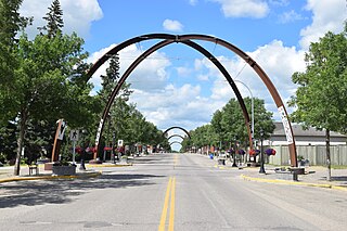
Russell is an unincorporated urban community in the Municipality of Russell-Binscarth in Manitoba, Canada.
Manitoba Justice, or the Department of Justice, is the provincial government department responsible for administering the Crown Law justice systems in the province of Manitoba.
The D Division is the division of the Royal Canadian Mounted Police responsible for federal policing in Manitoba and, at times, northwestern Ontario. Headquartered in Winnipeg, the division is commanded by Assistant Commissioner Scott McMurchy and consists of 1089 police officers and 438 support staff.