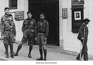
Scouting in Yukon dates back to 1913, serving thousands of young men and women.

Scouting in Yukon dates back to 1913, serving thousands of young men and women.
Yukon is administratively connected to British Columbia in the Cascadia Council [1] (formally the BC/Yukon Council) of Scouts Canada.
Among Yukon's varied Scouting groups are Scouts and Venturers.

Girls from age 5 through 17 are served by the Yukon District of Girl Guides of Canada-Guides du Canada. [2] Yukon District is part of the Aurora Adventures Area Council and Alberta Council. [3] Through financial support from YRAC, Yukon District can provide administrative support to Guiders and girls through the Guide Office (102-302 Steele Street, Whitehorse, Y1A 2C5, 667–2455). [4]

British Columbia is the westernmost province of Canada. Situated in the Pacific Northwest between the Pacific Ocean and the Rocky Mountains, the province has a diverse geography, with rugged landscapes that include rocky coastlines, sandy beaches, forests, lakes, mountains, inland deserts and grassy plains. British Columbia borders the province of Alberta to the east; the territories of Yukon and Northwest Territories to the north; the U.S. states of Washington, Idaho and Montana to the south, and Alaska to the northwest. With an estimated population of over 5.6 million as of 2024, it is Canada's third-most populous province. The capital of British Columbia is Victoria, while the province's largest city is Vancouver. Vancouver and its suburbs together make up the third-largest metropolitan area in Canada, with the 2021 census recording 2.6 million people in Metro Vancouver. British Columbia is Canada's third-largest province in terms of total area, after Quebec and Ontario.

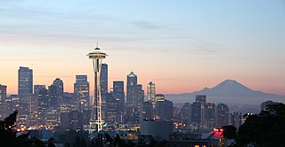
The Pacific Northwest (PNW), sometimes referred to as Cascadia, is a geographic region in western North America bounded by its coastal waters of the Pacific Ocean to the west and, loosely, by the Rocky Mountains to the east. Though no official boundary exists, the most common conception includes the U.S. states of Oregon, Washington, northern Idaho, and the Canadian province of British Columbia. Some broader conceptions reach north into Alaska and Yukon, south into northern California, and east into western Montana. Other conceptions may be limited to the coastal areas west of the Cascade and Coast mountains.

Scouting in the US state of Washington officially began in the 1910s.
The Alaska Highway was constructed during World War II to connect the contiguous United States to Alaska across Canada. It begins at the junction with several Canadian highways in Dawson Creek, British Columbia, and runs to Delta Junction, Alaska, via Whitehorse, Yukon. When it was completed in 1942, it was about 2,700 kilometres (1,700 mi) long, but in 2012, it was only 2,232 km (1,387 mi). This is due to the realignments of the highway over the years, which has rerouted and straightened many sections. The highway opened to the public in 1948. Once legendary for being a rough, challenging drive, the highway is now paved over its entire length. Its component highways are British Columbia Highway 97, Yukon Highway 1, and Alaska Route 2.

Scouting in Washington, D.C. has a long history, from the 1910s to the present day, serving thousands of youth in programs that suit the environment in which they live.

Tatshenshini-Alsek Park or Tatshenshini-Alsek Provincial Wilderness Park is a provincial park in British Columbia, Canada. The park is 9,580 km2 (3,700 sq mi) in size. It was established in 1993 after an intensive campaign by Canadian and American conservation organizations to halt mining exploration and development in the area, and protect the area for its strong natural heritage and biodiversity values.

Atlin is a community in northwestern British Columbia, Canada, located on the eastern shore of Atlin Lake. In addition to continued gold-mining activity, Atlin is a tourist destination for fishing, hiking and heliskiing. As of 2016, there are 477 permanent residents.
Scouting in British Columbia has a long history, from the 1900s to the present day, serving thousands of youth in programs that suit the environment in which they live.

Scouting and Guiding in Alberta has a long history, from the 1900s to the present day, serving thousands of youth in programs that suit the environment in which they live.

The Cascadia movement is a bioregional independence movement based in the Cascadia bioregion of western North America. Potential boundaries differ, with some drawn along existing political state and provincial lines, and others drawn along larger ecological, cultural, political, and economic boundaries. The Cascadia Movement is largely associated with leftist political circles.
The concept of Cascadian bioregionalism is closely identified with the environmental movement. In the early 1970s, the contemporary vision of bioregionalism began to be formed through collaboration between natural scientists, social and environmental activists, artists and writers, community leaders, and back-to-the-landers who worked directly with natural resources. A bioregion is defined in terms of the unique overall pattern of natural characteristics that are found in a specific place. The main features are generally obvious throughout a continuous geographic terrain and include a particular climate, local aspects of seasons, landforms, watersheds, soils, and native plants and animals. People are also counted as an integral aspect of a locale's life, as can be seen in the ecologically adaptive cultures of early inhabitants, and in the activities of present-day reinhabitants who attempt to harmonize in a sustainable way with the place where they live.
The First Peoples' Cultural Council (FPCC) is a First Nations governed Crown Corporation of the province of British Columbia, Canada. It is based in Brentwood Bay, British Columbia on Tsartlip First Nation. The organization was formerly known as the First Peoples' Heritage, Language and Culture Council, but shortened its name in 2012.
Thomas Sigurdson is a former Canadian provincial level politician. He served as a member of the Legislative Assembly of Alberta from 1986 to 1993. He is a labour activist and organizer for the New Democratic Party in British Columbia. He is currently the executive director for the British Columbia and Yukon Territory Building and Construction Trades Council.

The following outline is provided as an overview of and topical guide to British Columbia:
HealthLinkBC is a government-funded telehealth service launched in 2001, which provides non-emergency health information to the residents of British Columbia, Canada through combined telephone, internet, mobile app, and print resources. HealthLink BC has two dedicated phone numbers 8-1-1 and 7-1-1 for deaf and hard of hearing callers.

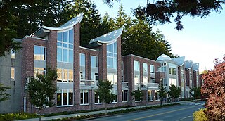
The C. K. Choi Building is an educational building on the campus of the University of British Columbia (UBC) known for its sustainable design features.Named for businessman and philanthropist Dr. Cheung-Kok Choi, the building houses UBC's Institute of Asian Research. The architecture of the building implements Asian motifs.

The Stikine Region is an unincorporated area in northwestern British Columbia, Canada. It is the only area in the province that is not part of a regional district. The Stikine Region was left unincorporated following legislation that established the province's regional districts in 1968 and is not classified as a regional district. It contains no municipal governments which normally constitute the majority of seats on the boards of regional districts. There is only one local planning area, the Atlin Community Planning Area, which was combined in 2009 with the Atlin Community Improvement District to provide fire, landfill, water, streetlighting, sidewalks and advisory land use services. All other services not provided privately are administered directly by various provincial government ministries. The area around Dease Lake, formerly in the Stikine Region, is now within the boundaries of the Regional District of Kitimat–Stikine following a boundary amendment in 2008.
The Cassiar Land District is a cadastral survey subdivision of the province of British Columbia, Canada, created with rest of those on Mainland British Columbia via the Lands Act of the Colony of British Columbia in 1860. The British Columbia government's BC Names system, a subdivision of GeoBC, defines a land district as "a territorial division with legally defined boundaries for administrative purposes". All land titles and surveys use the Land District system as the primary point of reference, and entries in BC Names for placenames and geographical objects are so listed.

The Yukon Telegraph Trail, also known simply as the Telegraph Trail, is a historic pathway in the Canadian province of British Columbia that extends from the village of Ashcroft in the south to the community of Atlin in the north. It was used for servicing the Yukon Telegraph Line which ran from Ashcroft in the south to Dawson City, Yukon in the north. The telegraph line was constructed by the Dominion Government Telegraph Service from 1898 to 1901. It was abandoned in 1936 with the advent of radio communication. Along the length of the trail are remains of telegraph cabins, telegraph cable and other artifacts that were used during the construction of the telegraph line.