SeaWiFS was a satellite-borne sensor designed to collect global ocean biological data. Active from September 1997 to December 2010, its primary mission was to quantify chlorophyll produced by marine phytoplankton.

The coastal zone color scanner (CZCS) was a multi-channel scanning radiometer aboard the Nimbus 7 satellite, predominately designed for water remote sensing. Nimbus 7 was launched 24 October 1978, and CZCS became operational on 2 November 1978. It was only designed to operate for one year (as a proof-of-concept), but in fact remained in service until 22 June 1986. Its operation on board the Nimbus 7 was limited to alternate days as it shared its power with the passive microwave scanning multichannel microwave radiometer.

Colored dissolved organic matter (CDOM) is the optically measurable component of dissolved organic matter in water. Also known as chromophoric dissolved organic matter, yellow substance, and gelbstoff, CDOM occurs naturally in aquatic environments and is a complex mixture of many hundreds to thousands of individual, unique organic matter molecules, which are primarily leached from decaying detritus and organic matter. CDOM most strongly absorbs short wavelength light ranging from blue to ultraviolet, whereas pure water absorbs longer wavelength red light. Therefore, water with little or no CDOM, such as the open ocean, appears blue. Waters containing high amounts of CDOM can range from brown, as in many rivers, to yellow and yellow-brown in coastal waters. In general, CDOM concentrations are much higher in fresh waters and estuaries than in the open ocean, though concentrations are highly variable, as is the estimated contribution of CDOM to the total dissolved organic matter pool.

Ocean color is the branch of ocean optics that specifically studies the color of the water and information that can be gained from looking at variations in color. The color of the ocean, while mainly blue, actually varies from blue to green or even yellow, brown or red in some cases. This field of study developed alongside water remote sensing, so it is focused mainly on how color is measured by instruments.
The deep chlorophyll maximum (DCM), also called the subsurface chlorophyll maximum, is the region below the surface of water with the maximum concentration of chlorophyll. The DCM generally exists at the same depth as the nutricline, the region of the ocean where the greatest change in the nutrient concentration occurs with depth.
The marine optical buoy (MOBY) measures light at and very near the sea surface in a specific location over a long period of time, serving as part of an ocean color observation system. Satellites are another component of the system, providing global coverage through remote sensing; however, satellites measure light above the Earth's atmosphere, becoming subject to interference from the atmosphere itself and other light sources. The Marine Optical Buoy helps alleviate that interference and thus improve the quality of the overall ocean color observation system.
Gene Carl Feldman has been an oceanographer at NASA Goddard Space Flight Center (GSFC) since 1985. His primary interest has been to try to make the data that NASA gathers from its spaceborne fleet of Earth observing instruments, especially those monitoring the subtle changes in ocean color, as scientifically credible, readily understandable and as easily available to the broadest group of people possible. He has been involved in a number of past and present NASA missions including the Coastal Zone Color Scanner (CZCS), the Sea-Viewing Wide Field Sensor (SeaWiFS) and the Moderate-Resolution Imaging Spectroradiometer (MODIS) and along with the NASA Ocean Biology Processing group which he co-leads, been given the responsibility for designing, implementing and operating the data processing and mission operations component of ocean salinity mission called Aquarius, a space mission developed by NASA and the Space Agency of Argentina - Comisión Nacional de Actividades Espaciales (CONAE) that was successfully launched in June 2011 and began routine operations on December 1, 2011 and completed its prime mission in June 2015.
Geostationary Ocean Color Imager, is the world's first geostationary orbit satellite image sensor in order to observe or monitor an ocean-color around the Korean Peninsula [1][2]. The spatial resolution of GOCI is about 500m and the range of target area is about 2,500 km×2,500 km centered on Korean Peninsula. GOCI was loaded on Communication, Ocean, and Meteorological Satellite (COMS) of South Korea which was launched in June, 2010. It will be operated by Korea Ocean Satellite Center (KOSC) at Korea Institute of Ocean Science & Technology (KIOST), and capture the images of ocean-color around the Korean Peninsula 8 times a day for 7.7 years.

The North Atlantic Aerosols and Marine Ecosystems Study (NAAMES) was a five-year scientific research program that investigated aspects of phytoplankton dynamics in ocean ecosystems, and how such dynamics influence atmospheric aerosols, clouds, and climate. The study focused on the sub-arctic region of the North Atlantic Ocean, which is the site of one of Earth's largest recurring phytoplankton blooms. The long history of research in this location, as well as relative ease of accessibility, made the North Atlantic an ideal location to test prevailing scientific hypotheses in an effort to better understand the role of phytoplankton aerosol emissions on Earth's energy budget.
Collin Roesler is an American oceanographer. She is known for her work on optical oceanography, including research on harmful algal blooms in the Gulf of Maine and green icebergs.
Paula Susan Bontempi is an oceanographer who has led the use of satellites in marine science during her positions in NASA and as the dean of the Graduate School of Oceanography at the University of Rhode Island.
Remote sensing in oceanography is a widely used observational technique which enables researchers to acquire data of a location without physically measuring at that location. Remote sensing in oceanography mostly refers to measuring properties of the ocean surface with sensors on satellites or planes, which compose an image of captured electromagnetic radiation. A remote sensing instrument can either receive radiation from the earth’s surface (passive), whether reflected from the sun or emitted, or send out radiation to the surface and catch the reflection (active). All remote sensing instruments carry a sensor to capture the intensity of the radiation at specific wavelength windows, to retrieve a spectral signature for every location. The physical and chemical state of the surface determines the emissivity and reflectance for all bands in the electromagnetic spectrum, linking the measurements to physical properties of the surface. Unlike passive instruments, active remote sensing instruments also measure the two-way travel time of the signal; which is used to calculate the distance between the sensor and the imaged surface. Remote sensing satellites often carry other instruments which keep track of their location and measure atmospheric conditions.
Mary Jane Perry is an American oceanographer known for the use of optics to study marine phytoplankton.

Ocean optics is the study of how light interacts with water and the materials in water. Although research often focuses on the sea, the field broadly includes rivers, lakes, inland waters, coastal waters, and large ocean basins. How light acts in water is critical to how ecosystems function underwater. Knowledge of ocean optics is needed in aquatic remote sensing research in order to understand what information can be extracted from the color of the water as it appears from satellite sensors in space. The color of the water as seen by satellites is known as ocean color. While ocean color is a key theme of ocean optics, optics is a broader term that also includes the development of underwater sensors using optical methods to study much more than just color, including ocean chemistry, particle size, imaging of microscopic plants and animals, and more.
Low-nutrient, low-chlorophyll (LNLC)regions are aquatic zones that are low in nutrients and consequently have low rate of primary production, as indicated by low chlorophyll concentrations. These regions can be described as oligotrophic, and about 75% of the world's oceans encompass LNLC regions. A majority of LNLC regions are associated with subtropical gyres but are also present in areas of the Mediterranean Sea, and some inland lakes. Physical processes limit nutrient availability in LNLC regions, which favors nutrient recycling in the photic zone and selects for smaller phytoplankton species. LNLC regions are generally not found near coasts, owing to the fact that coastal areas receive more nutrients from terrestrial sources and upwelling. In marine systems, seasonal and decadal variability of primary productivity in LNLC regions is driven in part by large-scale climatic regimes leading to important effects on the global carbon cycle and the oceanic carbon cycle.
Colleen Beckmann Mouw is an associate professor at the University of Rhode Island known for her work on phytoplankton ecology and increasing retention of women in oceanography.
The sea surface skin temperature (SSTskin), or ocean skin temperature, is the temperature of the sea surface as determined through its infrared spectrum (3.7–12 μm) and represents the temperature of the sublayer of water at a depth of 10–20 μm. High-resolution data of skin temperature gained by satellites in passive infrared measurements is a crucial constituent in determining the sea surface temperature (SST).
Patricia Ana Matrai is a marine scientist known for her work on the cycling of sulfur. She is a senior research scientist at Bigelow Laboratory for Ocean Sciences.

Water clarity is a descriptive term for how deeply visible light penetrates through water. In addition to light penetration, the term water clarity is also often used to describe underwater visibility. Water clarity is one way that humans measure water quality, along with oxygen concentration and the presence or absence of pollutants and algal blooms.
Shubha Platt, known professionally as Shubha Sathyendranath, is a marine scientist known for her work on marine optics and remote sensing of ocean colour. She is the 2021 recipient of the A.G. Huntsman Award for Excellence in the Marine Sciences.
 Schematic of the types of oceanography measurements that may be uploaded to the SeaBASS data repository.
 Light absorption spectra of phytoplankton show the amount of light in different colors of the visible light spectrum absorbed by ocean phytoplankton. Spectral light absorption is one type of data stored in the SeaBASS data repository.
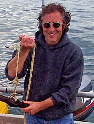
 Researchers prepare instruments to deploy from a research vessel (in situ). Data collected using instruments like these ones get uploaded to SeaBASS to help scientists derive products (like chlorophyll-a concentration) from satellite data.


