Seahorse Islands

Last updated
Seahorse Islands
Geography
Coordinates 70°53′18″N158°42′27″W / 70.88833°N 158.70750°W / 70.88833; -158.70750
Length5 km (3.1 mi)
Highest elevation2 m (7 ft)
Administration
United States
State Alaska

The Seahorse Islands is a chain of long and narrow sandy islands in western North Slope Borough, Alaska, United States. They are located between Peard Bay and the Chukchi Sea, 1.7 km (1.1 mi) east of Point Franklin. The longest island is about 5 km (3.1 mi) in length and the highest point of the islands is 2 m (6.6 ft). The shape of these coastal islands has changed over the years.

North Slope Borough, Alaska borough in the U.S. state of Alaska

North Slope Borough, established in 1972, is an Alaskan borough bounded on the south by the Brooks Range and located largely in the North Slope region of the U.S. state of Alaska. It is the northernmost formal community on the North American continent. As of the 2010 census, the population was 9,430. The borough seat is Utqiagvik. The mayor is Harry K. Brower, Jr., first elected in a special election in July 2016 after recall of the previous mayor by an April 2016 election.

Alaska State of the United States of America

Alaska is a U.S. state in the northwest extremity of North America, just across the Bering Strait from Asia. The Canadian province of British Columbia and territory of Yukon border the state to the east, its most extreme western part is Attu Island, and it has a maritime border with Russia to the west across the Bering Strait. To the north are the Chukchi and Beaufort seas—southern parts of the Arctic Ocean. The Pacific Ocean lies to the south and southwest. It is the largest state in the United States by area and the seventh largest subnational division in the world. In addition, it is the 3rd least populous and the most sparsely populated of the 50 United States; nevertheless, it is by far the most populous territory located mostly north of the 60th parallel in North America: its population—estimated at 738,432 by the United States Census Bureau in 2015— is more than quadruple the combined populations of Northern Canada and Greenland. Approximately half of Alaska's residents live within the Anchorage metropolitan area. Alaska's economy is dominated by the fishing, natural gas, and oil industries, resources which it has in abundance. Military bases and tourism are also a significant part of the economy.

United States federal republic in North America

The United States of America (USA), commonly known as the United States or America, is a country composed of 50 states, a federal district, five major self-governing territories, and various possessions. At 3.8 million square miles, the United States is the world's third or fourth largest country by total area and is slightly smaller than the entire continent of Europe's 3.9 million square miles. With a population of over 327 million people, the U.S. is the third most populous country. The capital is Washington, D.C., and the largest city by population is New York City. Forty-eight states and the capital's federal district are contiguous in North America between Canada and Mexico. The State of Alaska is in the northwest corner of North America, bordered by Canada to the east and across the Bering Strait from Russia to the west. The State of Hawaii is an archipelago in the mid-Pacific Ocean. The U.S. territories are scattered about the Pacific Ocean and the Caribbean Sea, stretching across nine official time zones. The extremely diverse geography, climate, and wildlife of the United States make it one of the world's 17 megadiverse countries.

Contents

The Seahorse Islands were named by Captain Frederick William Beechey in 1826. Beechey had sent out his barge to explore the coastline further north. It reached the islands on August 21, 1826. Beechey, writing later, said: "On the 21st they arrived off a chain of sandy islands... which I have distinguished by the name of the Sea Horse Islands." [1] "Sea Horse" is an antiquated term for the walrus.

Frederick William Beechey Royal Navy officer and geographer

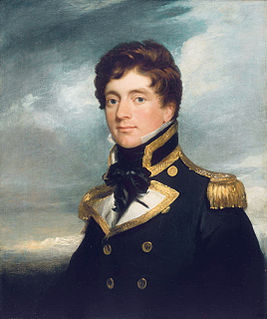
Frederick William Beechey was an English naval officer and geographer.

Walrus Species of mammal

The walrus is a large flippered marine mammal with a discontinuous distribution about the North Pole in the Arctic Ocean and subarctic seas of the Northern Hemisphere. The walrus is the only living species in the family Odobenidae and genus Odobenus. This species is subdivided into three subspecies: the Atlantic walrus which lives in the Atlantic Ocean, the Pacific walrus which lives in the Pacific Ocean, and O. r. laptevi, which lives in the Laptev Sea of the Arctic Ocean.

Coordinates: 70°53′18″N158°42′27″W / 70.88833°N 158.70750°W / 70.88833; -158.70750

Geographic coordinate system Coordinate system

A geographic coordinate system is a coordinate system that enables every location on Earth to be specified by a set of numbers, letters or symbols. The coordinates are often chosen such that one of the numbers represents a vertical position and two or three of the numbers represent a horizontal position; alternatively, a geographic position may be expressed in a combined three-dimensional Cartesian vector. A common choice of coordinates is latitude, longitude and elevation. To specify a location on a plane requires a map projection.

See also

Related Research Articles

Dillingham Census Area, Alaska census area in Alaska, United States

Dillingham Census Area is a census area located in the state of Alaska, United States. At the 2010 census, the population was 4,847. It is part of the unorganized borough and therefore has no borough seat. Its largest community by far is the city of Dillingham, on a small arm of Bristol Bay on the Bering Sea.

Kruzof Island is an island in the Alexander Archipelago in southeastern Alaska at 57°10′14″N135°40′29″W. It is about 16 km (10 mi) west of Sitka, and is part of the City and Borough of Sitka. It was named in 1805 by Captain U.T. Lisianski as Crooze Island, after a Russian Admiral. In January 1813 the Russian exploration ship Neva wrecked just off the island. The survivors made it to shore and established a camp where they subsisted until rescued about a month later. The site of the wreck, and also the survival camp has since been found.

Hotham Inlet

Hotham Inlet, also known as Kobuk Lake, is an arm of Kotzebue Sound on the northwestern coast of the U.S. state of Alaska. It is 50 miles (80 km) long and 5–20 miles (8–32 km) wide. The inlet is the outlet of the Kobuk and Selawik Rivers and it is bounded on the southwest by the Baldwin Peninsula.

Point Barrow Northernmost point of the United States in Alaska

Point Barrow or Nuvuk is a headland on the Arctic coast in the U.S. state of Alaska, 9 miles (14 km) northeast of Utqiagvik. It is the northernmost point of all the territory of the United States, at 71°23′20″N156°28′45″W. The distance to the North Pole is 1,122 nautical miles. The northernmost point on the Canadian mainland, Murchison Promontory, is 40 miles (64 km) farther north.

Amaknak Island island in the United States of America

Amaknak Island or Umaknak Island is the most populated island in the Aleutian Islands.

Fairway Rock island in the United States of America

Fairway Rock is a small islet in the Bering Strait, located southeast of the Diomede Islands and west of Alaska's Cape Prince of Wales. It has an area of 0.3 km2 (0.12 mi2). Known to Eskimo natives of the Bering Strait region in prehistory, Fairway was documented by James Cook in 1778 and named by Frederick Beechey in 1826. Although uninhabited, the island is a nesting site for seabirds — most notably the least and crested auklet — which prompt egg-collecting visits from local indigenous peoples. The United States Navy placed radioisotope thermoelectric generator-powered environmental monitoring equipment on the island from the 1960s through the 1990s.

Hagemeister Island island in the United States of America

Hagemeister Island is an island in the U.S. state of Alaska, located on the north shore of Bristol Bay at the entrance to Togiak Bay.

Peard Bay is a bay in the Chukchi Sea, in Alaska's North Slope. It is located at 70°50′43″N158°48′39″W. This bay lies just a few miles northeast of Wainwright. It was named by Frederick William Beechey in 1826, after one of his officers.

Point Franklin is a piece of land located on the Chukchi Sea side of North Slope, Alaska.

Puffin Island (Alaska) island in the United States of America

Puffin Island is a rocky islet in the Kotzebue Sound, Alaska. It is located off Spafarief Bay at the mouth of Eschscholtz Bay, just south of the Choris Peninsula, in the Northwest Arctic Borough at 66°13′40″N161°51′31″W.

Sledge Island island in the United States of America

Sledge Island, or Ayak Island, is a small island in the Bering Sea. It is located 5.3 mi (8.5 km) from the southwestern shore of the Seward Peninsula, off the shores of Alaska.

Cape Thompson is a headland on the Chukchi Sea coast of Alaska. It is located 26 miles to the southeast of Point Hope, Arctic Slope. It is part of the Chukchi Sea unit of Alaska Maritime National Wildlife Refuge.

Cape Blossom

Cape Blossom is a cape located on the Baldwin Peninsula in Alaska which occupies a point that extends southwestwards into Kotzebue Sound, 18 km south of Kotzebue.

Elephant Point is a headland in Kotzebue Sound, Chukchi Sea in Northwest Arctic Borough, Alaska, United States.

Point Hope (cape) cape in Alaska, United States

Point Hope is a headland in the U.S. state of Alaska, located at the western tip of the Lisburne Peninsula. It lies on the Chukchi Sea coast, 40 miles southwest of Cape Lisburne, Arctic Slope at 68°20′27″N166°50′00″W. The city of Point Hope is located on the foreland.

HMS <i>Blossom</i> (1806)

HMS Blossom was an 18-gun Cormorant-class sloop-of-war. She was built in 1806 and is best known for the 1825–1828 expedition under Captain Beechey to the Pacific Ocean. She explored as far north as Point Barrow, Alaska, the furthest point into the Arctic any non-Inuit had been at the time. She was finally broken up in 1848.

Aleutian Islands chain of islands in the Northern Pacific

The Aleutian Islands are a chain of 14 large volcanic islands and 55 smaller ones belonging to both the U.S. state of Alaska and the Russian federal subject of Kamchatka Krai. They form part of the Aleutian Arc in the Northern Pacific Ocean, occupying an area of 6,821 sq mi (17,666 km2) and extending about 1,200 mi (1,900 km) westward from the Alaska Peninsula toward the Kamchatka Peninsula in Russia, and mark a dividing line between the Bering Sea to the north and the Pacific Ocean to the south. Crossing longitude 180°, at which point east and west longitude end, the archipelago contains both the westernmost part of the United States by longitude and the easternmost by longitude. The westernmost U.S. island in real terms, however, is Attu Island, west of which runs the International Date Line. While nearly all the archipelago is part of Alaska and is usually considered as being in the "Alaskan Bush", at the extreme western end, the small, geologically related Commander Islands belong to Russia.

Cape Smyth is the southern extremity of Sturge Island in the Balleny Islands. In 1841, Captain James C. Ross, viewing Sturge Island from a considerable distance, thought it a group of three islands. He named the southernmost "Smyth Island" for his friend Captain William Henry Smyth, Royal Navy, President of the Royal Astronomical Society. Ross' error was discovered in 1904 by Captain Robert F. Scott, who applied the name to the southernmost point on Sturge Island.

References

  1. Beechey, Frederick William (1832). Narrative of a voyage to the Pacific and Beering's Strait: to co-operate with the Polar expeditions : performed in His Majesty's Ship Blossom, under the command of Captain F.W. Beechey, R.N. ... in the years 1825,26,27,28. Philadelphia: Carey & Lea.