
U.S. Route 66 or U.S. Highway 66 was one of the original highways in the United States Numbered Highway System. It was established on November 11, 1926, with road signs erected the following year. The highway, which became one of the most famous roads in the United States, ran from Chicago, Illinois, through Missouri, Kansas, Oklahoma, Texas, New Mexico, and Arizona before terminating in Santa Monica in Los Angeles County, California, covering a total of 2,448 miles (3,940 km).

U.S. Route 9 (US 9) is a north–south United States Numbered Highway in the states of Delaware, New Jersey, and New York in the Northeastern United States. It is one of only two U.S. Highways with a ferry connection ; the other is US 10. US 9 is signed east–west in Delaware and north–south on the rest of its route. The southern terminus of the route is in Laurel, Delaware, at an intersection with US 13, while the highway's northern terminus is at a junction with Interstate 87 (I-87) in Champlain, New York, where the old roadway continues north as the unsigned New York State Route 971B (NY 971B), which ends in a cul-de-sac just short of the Canadian border.

Interstate 80 (I-80) is an east–west transcontinental freeway that crosses the United States from downtown San Francisco, California, to Teaneck, New Jersey, in the New York metropolitan area. The highway was designated in 1956 as one of the original routes of the Interstate Highway System; its final segment was opened in 1986. The second-longest Interstate Highway in the United States after I-90, it runs through many major cities, including Oakland, Sacramento, Reno, Salt Lake City, Omaha, Des Moines, and Toledo and passes within 10 miles (16 km) of Chicago, Cleveland, and New York City.
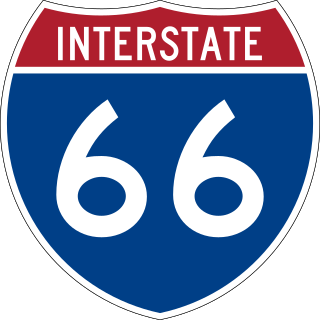
Interstate 66 (I-66) is a 76.32 mile east–west Interstate Highway in the eastern United States. The highway runs from an interchange with I-81 near Middletown, Virginia, on its western end to an interchange with U.S. Route 29 (US 29) in Washington, D.C., at the eastern terminus. Much of the route parallels US 29 or State Route 55 (SR 55) in Virginia. I-66 has no physical or historical connection to US 66, which was located in a different region of the United States.

U.S. Route 202 (US 202) is a spur route of US 2. It follows a northeasterly and southwesterly direction stretching from Delaware in the south to Maine in the north and traveling through the states of Pennsylvania, New Jersey, New York, Connecticut, Massachusetts, and New Hampshire. The highway has borne the number 202 since at least 1936. Before this, sections of the highway were designated U.S. Route 122, as it intersected US 22 in New Jersey. Its current designation is based on its intersection with I-395 and SR 15 near US 2 in Maine, but it does not have a direct connection with US 2.

U.S. Route 7 (US 7) is a north–south United States Numbered Highway in western New England that runs for 308 miles (496 km) through the states of Connecticut, Massachusetts, and Vermont. The highway's southern terminus is at Interstate 95 (I-95) exit 15 in Norwalk, Connecticut. Its northern terminus is at I-89 exit 22 near the village of Highgate Springs, Vermont, immediately south of the Canada–United States border.
King's Highway 50, commonly referred to as Highway 50, was a provincially maintained highway in the Canadian province of Ontario. The highway, which was decommissioned in 1998, is still referred to as Highway 50, though it is now made up of several county and regional roads: Peel Regional Road 50, York Regional Road 24 and Simcoe County Road 50. The route began in the north end corner of the former Etobicoke at Highway 27 as Albion Road, and travelled northwest to Highway 89 west of the town of Alliston. En route, it passed through the villages of Bolton, Palgrave and Loretto. The road south of Bolton has become more suburban as development has encroached from the east and west; but despite this increased urbanization, the removal of highway status, and the fact that it runs through the former Albion Township, the Albion Road name has not been extended to follow it outside Toronto.

Pennsylvania Route 100 is a 59.4-mile (95.6 km) long state highway in the U.S. state of Pennsylvania that runs from U.S. Route 202 near West Chester north to PA 309 in Pleasant Corners. The route runs between the western suburbs of Philadelphia and the Lehigh Valley region of the state, serving Chester, Montgomery, Berks, and Lehigh counties. PA 100 intersects several important highways, including US 30 in Exton, the Pennsylvania Turnpike (Interstate 76, near Lionville, US 422 near Pottstown, US 222 in Trexlertown, and I-78/US 22 in Fogelsville. Several sections of PA 100 are multi-lane divided highway with some interchanges, including between US 202 and the Pennsylvania Turnpike in Chester County between south of Pottstown and New Berlinville, and between Trexlertown and Fogelsville.

Marsa Alam is a tourist town in south-eastern Egypt, located on the western shore of the Red Sea. It is currently seeing fast increasing popularity as a tourist destination and development following the opening of Marsa Alam International Airport in 2003. Marsa Alam is considered one of the newly established towns, as its development began in 1995 through the investments of Kuwaiti Al-Kharafi Group, which Established the town with all its facilities, resorts and infrastructure, to make Marsa Alam one of the most attractive places in Egypt for tourism. The town is located on an area of 38,433 km2, 274 km south of Hurghada, and 134 km south of Qusayr, and its 60 meters above sea level. It is inhabited by about 11,497 residents.
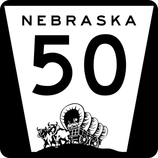
Nebraska Highway 50 (N-50) is a north–south highway in the state of Nebraska. The southern terminus is at the Nebraska-Kansas border near Du Bois. The northern terminus is in the Millard neighborhood of Omaha at an intersection with U.S. Highway 275 (US 275) and N-92. It is a two lane highway except for the section from Springfield north to the southern edge of the Millard neighborhood in Omaha, which is a divided highway.

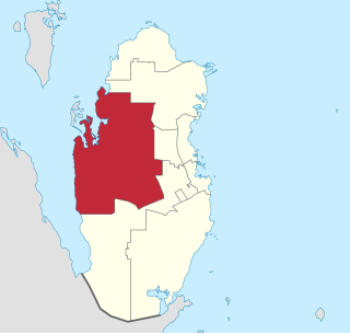
Al Rayyan is the third-largest municipality in the state of Qatar. Its primary settlement is the city of the same name, which occupies the entire eastern section and is a part of the Doha Metropolitan Area. The vast expanse of mostly undeveloped lands in the south-west also falls under the municipality's administration.

Karak is one of the governorates of Jordan, located south-west of Amman, Jordan's capital. Its capital is Al-Karak. It s bordered by Madaba and the Capital governorates to the north, Ma'an Governorate to the east, Tafilah Governorate to the south, and the Dead Sea to the west.
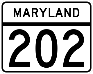
Maryland Route 202 is a state highway in the U.S. state of Maryland. The highway runs 13.92 miles (22.40 km) from MD 725 in Upper Marlboro north to MD 450 in Bladensburg. MD 202 connects the central Prince George's County communities of Bladensburg, Cheverly, Landover, and Largo with the county seat of Upper Marlboro. The state highway was constructed from Bladensburg to Largo in the mid- to late 1920s and from Largo to Upper Marlboro in the early 1930s. MD 202 was relocated through Landover in the early 1940s. The highway was expanded to a divided highway with several interchanges from Bladensburg through Landover and Largo from the early 1960s to the mid-1970s. In the 1990s, MD 202's divided highway segment was extended halfway to Upper Marlboro and expanded again through Largo, including the construction of several auxiliary routes to connect the highway with FedExField.
Al Shahaniya is a municipality (3299 km2) in Qatar, with its municipal seat being a city of the same name (39 km2). Formerly in the municipality of Al Rayyan, but now an independent municipality, the municipal seat was delimited in 1988 by Law No. 22. In 2014, the cabinet ratified a draft amending provisions to the 1988 law that formalized Al Shahaniya as Qatar's eighth municipality.
Highway 33 is a highway in the southern portion of the Canadian province of Saskatchewan connecting Regina to Stoughton; the highway is divided near Regina. Highway 33 is about 139 kilometres (86 mi) long.
U.S. Route 202 is a US Highway running from New Castle, Delaware, northeast to Bangor, Maine. In the U.S. state of Pennsylvania, the route runs for 59 miles (95 km), from the Delaware state line in Bethel Township, Delaware County, to the New Hope–Lambertville Toll Bridge over the Delaware River in Solebury Township, where the route crosses into New Jersey. The highway runs through the western and northern suburbs of Philadelphia in the Delaware Valley metropolitan area, and serves as a toll-free bypass around the city, avoiding the busy traffic and congestion on Interstate 95 (I-95). It is signed north–south and follows a general southwest–northeast direction through the state.
Muqsha is a village in Bahrain and is situated west of the capital Manama. It is also located in Budaiya Highway, where it is located in the northern part of the highway which separates it from the village of Qadam, south of Muqsha. Muqsha also borders the villages of Al-Hilla, Karbabad, Al-Qalaa to the north, Karranah to the west, and Jidhafs to the east.
Al Musalla is a village situated in the northern region of the Kingdom of Bahrain, on the western outskirts of the capital city Manama. The villages lies under the Northern Governorate administrative region. The villages lies west of the village of Tashan and Khamis and north of Sehla.
Abu Baham is a small village situated in the northern region of the Kingdom of Bahrain, on the western outskirts of the capital city Manama. The village lies under the Northern Governorate administrative region. The village lies directly south of Al Musalla, west of the village of Khamis and east of Sehla.
