Bahadurganj is a town nestled in the Tarai of Himalaya and a notified area in Kishanganj district in the state of Bihar, India.
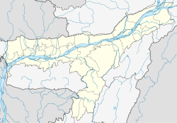
Bahbari Gaon is a census town in Tinsukia district in the state of Assam, India.
Chitbara Gaon is a town and a nagar panchayat of Ballia district, Uttar Pradesh, India.
Dergaon is a town and a municipality in the Golaghat district of Assam, India. It is 282 km from the state capital Guwahati.
Kokkothamangalam is a census town in Alappuzha district in the Indian state of Kerala.
Kumar Kaibarta Gaon is a census town in Jorhat district in the Indian state of Assam.
Mehragaon is a Village in Narmadapuram district in the Indian state of Madhya Pradesh.
Mhowgaon is a Nagar Panchayat under Sub Division Dr. Ambedkar Nagar (Mhow) in Indore district in the Indian state of Madhya Pradesh. The total geographical area of Mhowgaon nagar panchayat is 13.5 km2 and it is the smallest city by area in the sub district. The population density of the city is 2309 persons per km2. Mhowgaon is divided into 15 wards for which elections are held every 5 years. Among them, Mhowgaon Ward No. 2 is the most populous ward with a population of 3440 and Mhowgaon Ward No. 15 is the least populous ward with a population of 957. Mhowgaon Nagar Panchayat has total administration over 6,373 houses to which it supplies basic amenities like water and sewerage. It is also authorized to build roads within Nagar Panchayat limits and impose taxes on properties coming under its jurisdiction.
Naubaisa Gaon is a census town in Jorhat district in the Indian state of Assam.
Navalpattu is a census town in Tiruchirappalli district in the Indian state of Tamil Nadu. Navalpattu is a part of Tiruchirappalli urban agglomeration. The city's only IT park is based here.
Neyyoor is a panchayat town in Kanniyakumari district in the Indian state of Tamil Nadu.
Paduvilayi is a census town in Kannur district in the Indian state of Kerala. Paduvilayi is situated In Anjarakandi. More than 20000 people live in this census town
Pappakurichi is a census town in Tiruchirappalli district in the Indian state of Tamil Nadu. It was merged with the Tiruchirappalli Corporation in 2011.
Peerkankaranai is a neighborhood in the city of Tambaram, situated within the Chennai Metropolitan Area, Tamil Nadu, India.
Phulpur is a town area in Prayagraj district in the Indian state of Uttar Pradesh. It is known for being the Lok Sabha seat from which Jawaharlal Nehru got elected to the Indian Parliament. Phulpur also hosts a Vidhan Sabha seat.
Pudukadai is a panchayat town in Kanniyakumari district in the Indian state of Tamil Nadu.
Ratangarh is a town and a nagar parishad in Neemuch district in the Indian state of Madhya Pradesh.
Bidhuna is a town and a nagar panchayat in Auraiya district in the state of Uttar Pradesh, India.
Kerur is a town in Bagalkot district in Karnataka, which located on NH 218. It has an average elevation of 617 meters (2024 feet). It's the birthplace of Jagadish Shettar, a former Chief Minister of Karnataka. Kerur is a Town Panchayat city in the district of Bagalkot, Karnataka. The Kerur city is divided into 16 wards for which elections are held every five years. The Kerur Town Panchayat has a population of 19,731 of which 9,929 are males while 9,802 are females as per report released by Census India 2011.
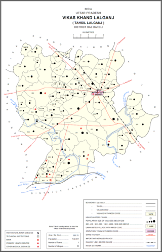
Taudhakpur, also known as Mirzapur Urf Taudhakpur, is a village located in Raebareli district, in the state of Uttar Pradesh, India. The village is 31 km from Raebareli and 87 km from Lucknow. As of 2011, the village had the population of 833 with 70.43% literacy rate. With the introduction of a digitized information center and modern-age communication facilities in 2018, Taudhakpur became the first smart village of India.



 India
India 