Sendling

Last updated
Borough 6 - Sendling: location in Munich Munchen - Stadtbezirk 06 (Karte) - Sendling.png
Borough 6 - Sendling: location in Munich
Borough 7 - Sendling-Westpark: location in Munich Munchen - Stadtbezirk 07 (Karte) - Sendling - Westpark.png
Borough 7 - Sendling-Westpark: location in Munich
The spires of Old and New St. Margaret's Church are important landmarks of Sendling. Munich Sendling Alte St-Margaret & Margaretenkirche Chimney.jpg
The spires of Old and New St. Margaret's Church are important landmarks of Sendling.
Aerial view of the Market Hall area (view to the east). A legend is available on the picture's page. Munich Sendling Grossmarkthalle aerial numbered.jpg
Aerial view of the Market Hall area (view to the east). A legend is available on the picture's page.

Sendling is a borough of Munich. It is located south-west of the city centre and spans the city boroughs Sendling and Sendling-Westpark. Sendling is subdivided into Obersendling, Mittersendling and Untersendling. Untersendling and Mittersendling are located in the borough of Sendling, and Obersendling is located in the borough of Thalkirchen-Obersendling-Forstenried-Fürstenried-Solln.

Contents

Overview

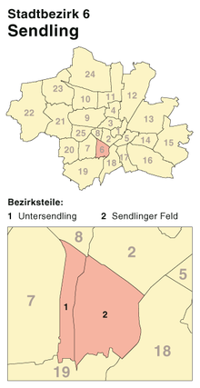
Sendling is mainly a residential quarter, with shops and businesses straddling the Plinganserstraße around the historical core of Sendling. It is a multicultural quarter, with one of the largest rates of foreigners among the population. The proposed site for the new mosque in Sendling is located at Gotzinger Platz, opposite St. Korbinian Church. Supposedly, this neighborhood boasts the best falafels in town, located in the Valleystrasse.

Harras, an urban square near the historical centre of Sendling, is the busiest square of the borough. A number of shops and businesses line the square; Plinganserstraße, an important traffic artery running from north to south, skirts Harras in the east. A railway station, Harras Station, is located nearby, serviced by U-Bahn metro and S-Bahn suburban trains. Harras is the business point in Munich-South. There are many shops, working places and two of the biggest schools in Munich: Dante-Gymnasium and Klenze-Gymnasium.

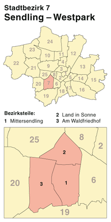
The Westpark is a large recreational park located in the west of the borough. It was laid out for the International Gardening Exhibition that took place in Munich in 1983. Munich's main traffic artery, the Mittlerer Ring, cuts right through the park and divides it into an eastern and a western park. [1]

Sendling is served by the U-Bahn metro lines 3 and 6 as well as the S-Bahn suburban trains 7, 20 and 27. Harras Station is served by some regional train services, as well.

The Wholesale Market Munich, in the eastern part of the borough, is Europe's third-largest grocery market as well as the borough's largest single employer.

In the very northeast of Sendling the Alte Utting is located, a nightlife spot and attraction that became known far beyond Munich's city borders.

Sendling's Night of Murder

Historically, Sendling is known for the Sendlinger Mordweihnacht ("Sendling's Night of Murder"), a massacre of rebelling peasants which took place there in 1705.

Education

Secondary campus of the Lycee Jean Renoir Lycee Jean Renoir.JPG
Secondary campus of the Lycée Jean Renoir
Japanische Internationale Schule Munchen Japanische Internationale Schule Munchen 01.JPG
Japanische Internationale Schule München

The Lycée Jean Renoir , a French international school, maintains its secondary school campus in Sendling. [2]

The Japanische Internationale Schule München, a Japanese international school, is located in Sendling. [3]

Related Research Articles

<span class="mw-page-title-main">Wilmersdorf</span> Quarter of Berlin in Germany

Wilmersdorf, an inner-city locality of Berlin, lies south-west of the central city. Formerly a borough by itself, Wilmersdorf became part of the new borough of Charlottenburg-Wilmersdorf in Berlin's 2001 administrative reform.

The Munich U-Bahn is an electric rail rapid transit network in Munich, Germany. The system began operation in 1971, and is operated by the municipally owned Münchner Verkehrsgesellschaft. The network is integrated into the Münchner Verkehrs- und Tarifverbund and interconnected with the Munich S-Bahn. The U-Bahn currently comprises eight lines, serving 96 stations, and encompassing 103.1 kilometres (64.1 mi) of routes.

<span class="mw-page-title-main">Obergiesing</span> Borough of Munich, Germany

Obergiesing is a borough of Munich, about 5km south-east of the city center. The larger part is residential or a mix of business and residential, but there are also a number of recreational facilities.

<span class="mw-page-title-main">Pasing</span>

Pasing is a district in the city of Munich, Germany, and part of the borough Pasing-Obermenzing.

<span class="mw-page-title-main">Sendling-Westpark</span> Borough of Munich, Germany

Sendling-Westpark is the 7th borough of Munich.

<span class="mw-page-title-main">Wholesale Market Munich</span>

The Großmarkthalle München is a German-international wholesale market located in the Munich borough of Sendling. In an area of 310,000 m2, 270 importing companies and wholesalers offer 140 different product classes from 83 countries with a sales volume of more than 750 million Euro. Additionally there are 65 horticultural producers, 45 florists and 15 wholesalers of miscellaneous lines. The market's geographical sales area is virtually "boundless“: day after day it supplies a region with approximately 5 million people and delivers goods to almost every European country.

<span class="mw-page-title-main">Bogenhausen</span> Borough of Munich, Germany

Bogenhausen is the 13th borough of Munich, Germany. It is the geographically largest borough of Munich and comprises the city's north-eastern quarter, reaching from the Isar on the eastern side of the Englischer Garten to the city limits, bordering on Unterföhring to the north, Aschheim to the east and the Haidhausen borough to the south.

<span class="mw-page-title-main">Thalkirchen-Obersendling-Forstenried-Fürstenried-Solln</span> Borough of Munich, Germany

Thalkirchen-Obersendling-Forstenried-Fürstenried-Solln is the 19th borough of Munich, Germany, comprising the extreme southern part of the city on the west bank of the river Isar. After the administrative reform, the boroughs Thalkirchen-Obersendling-Forstenried and Solln were incorporated, thus forming the new borough. It comprises 17.7631 square kilometres and has a population of 96,714 residents.

<span class="mw-page-title-main">Münchner Freiheit</span> Square in Munich

The Münchner Freiheit is a square in Munich's Schwabing, near the English Garden. It is a popular tourist attraction, especially during winter when one of Munich's largest Christmas markets takes place.

<span class="mw-page-title-main">Trams in Munich</span> Tram system in the city of Munich, Germany

The Munich tramway is the tramway network for the city of Munich in Germany. Today it is operated by the municipally owned Münchner Verkehrsgesellschaft and is known officially and colloquially as the Tram. Previous operators have included Société Anonyme des Tramways de Munich, the Münchner Trambahn-Aktiengesellschaft, the Städtische Straßenbahnen and the Straßenbahn München.

<span class="mw-page-title-main">Moosach (Munich)</span> Borough of Munich, Germany

Moosach is the 10th northwestern district of Munich, Bavaria, Germany. It is sectioned in the urban districts Hartmannshofen, Pressestadt and Borstei.

The Munich–Holzkirchen railway is a continuously-electrified, double-track, railway in the German state of Bavaria. It runs from Munich to Holzkirchen via Deisenhofen.

<span class="mw-page-title-main">Japanische Internationale Schule München</span> Primary & middle school in Munich, Germany

Japanische Internationale Schule München e.V. is a Japanese international school in Sendling, Munich, Germany. It serves both elementary and junior high school levels.

<span class="mw-page-title-main">Lycée Jean Renoir (Munich)</span>

Lycée Jean Renoir is a French international school in Munich, Germany, operated directly by the Agency for French Teaching Abroad. About 1,415 students attend the school. It serves levels maternelle (preschool) through lycée.

<span class="mw-page-title-main">Einkaufs-Center Neuperlach – pep</span> Shopping mall in Munich, Germany

The Einkaufs-Center Neuperlach – pep is a shopping mall in Munich's Neuperlach borough operated by ECE. With a floor space of 60,000 square meters and about 135 specialty shops, it was according to a survey for the year 2002, the most profitable shopping center in Germany, the average revenue per square meter was twice as high as the national average. In designing the state capital, it is recognized as an integrated site with the function of a district center, and through its size has an important role for the entire southeast of the metropolitan Munich.

<span class="mw-page-title-main">Ramersdorf-Perlach</span> Borough of Munich, Germany

Ramersdorf-Perlach is a borough of Munich. It is located south-east of the city center and is the most populous of Munich's boroughs with a population of about 116,000. It consists of the five districts Ramersdorf, Balanstraße West, Altperlach, Neuperlach and Waldperlach.

<span class="mw-page-title-main">Großhadern</span> District in Munich, Bavaria

Großhadern is a district in the south-west of the Bavarian state capital Munich. Großhadern is primarily a bourgeois residential area. Exceptions are the so-called "village core" with numerous small shops as well as the university district around the Klinikum Großhadern. This includes several student halls and three football fields. The number of restaurants and beer gardens is also remarkably high. In the south-west of Großhadern, between the subway station "Klinikum Großhadern" and the adjacent forest, a new settlement is being built on a former field with owned and rented apartments as well as some shops. Many of the houses are already finished and lived in. The old church of St. Peter is located in the village center, not far from it, the parish church of St. Canisius, built in 1925, with the Stations of the Cross by Kaspar Schleibner. The Protestant church has its home in the Reformation Memorial Church. A large part of the Großhadern area is in the south-west of the Waldfriedhof.

<span class="mw-page-title-main">Outline of Munich</span> Overview of and topical guide to Munich

The following outline is provided as an overview of and topical guide to Munich:

<span class="mw-page-title-main">Stammstrecke 1 (Munich U-Bahn)</span> Principal line of the Munich subway system

The Stammstrecke 1 of the Munich U-Bahn is the first, of a total of three realized main routes, in the subway network of the Bavarian capital Munich. It runs mainly in north–south direction and is currently used by the two subway lines, the U3 and U6. Also, since 15 December 2013, the additional amplifier line, the U8, runs on Saturdays on the section Olympiazentrum-Scheidplatz. Between the subway stations Münchner Freiheit and Implerstraße, the lines U3 and U6 run on the same route, before, or after which they branch off and the two lines are then run each on a separate route. The mainline 1 has a total length of 41 kilometers and passes 42 subway stations. It does not run exclusively in Munich urban areas, but for a distance of about eight kilometers in the northern area of Garching. A large part of the northern section of the U6 runs above ground, the remaining part completely in tunnels.

Bonner Platz, 1906 named after the city of Bonn, is a square in the Schwabing district of Munich, in the Schwabing-West quarter. The underground station of the same name Bonner Platz of the line U3 is located here.

References

  1. "Brenner Park". terrafinanz.de. Retrieved 23 October 2013.
  2. "Accès - Transports." Lycée Jean Renoir . Retrieved on 22 January 2015. "Plan d’accès au site de l’administration et du secondaire (Collège et Lycée), Berlepschstraße 3 (Quartier de Sendling) 81373 München: Métro U3 ou U6, arrêt "Poccistraße", puis trajet de 10 minutes à pieds ou BUS 62, arrêt "Herzog-Ernst-Platz"."
  3. Behr, Sabine. "Erster Spatenstich für japanische Schule" (Archive). Die Welt . 7 November 2001. Retrieved on 6 January 2014.

48°07′17″N11°32′29″E / 48.12139°N 11.54139°E / 48.12139; 11.54139