
Altstadt (Central Bavarian: Oidstod) and Lehel (Central Bavarian: Lechl) are districts of the German city of Munich. Together they form the first borough of the city: Altstadt-Lehel.
Altstadt (Central Bavarian: Oidstod) and Lehel (Central Bavarian: Lechl) are districts of the German city of Munich. Together they form the first borough of the city: Altstadt-Lehel.
The borough covers the historical area of Altstadt (as defined by the Altstadtring) and the Lehel area, which is attached to Altstadt via the north east. It also covers the Isar in the east and the Englischer Garten as well as Prinzregentenstraße, bordering it in the north.


Since the town extension via Ludwig the Bavarian lasting from 1285 until 1347, Altstadt consisted of four quarters and an open locale:


"(The) Lehel" (with locals, the article will never be missing) is regarded "the oldest suburb of Munich"; it was, however, officially incorporated into the city as of 1724 only.
Lehel has become another area for the arts next to the Kunstareal: The State Museum of Ethnology in Maximilianstraße is the second largest collection in Germany of artifacts and objects from outside Europe, while the Bavarian National Museum and the adjoining State Archeological Collections in Prinzregentenstrasse rank among Europe's major art and cultural history museums. The nearby Schackgalerie is an important gallery of German 19th-century paintings.
The quarter, having been one of Munich's surrounding poor houses in times of old, began to turn into today's much sought-after and very expensive residential area beginning with the construction of the first Wilhelminian style apartment houses at the turn of the 20th century and latest after the start of heavy gentrification during the 1980s.
There are many theories for the origin of the name of this area.
The more commonly represented indicates to a connection with the name "Lohe", Central and Upper German for a more or less dwindling alluvial forest and/or a light grove intermingled with shrubbing/coppice. Growing predominantly on a ground made up of gravel with heath upon it, it used to be found all around historic Munich from the west to the river Isar in the north-east on the Munich gravel plain. It meets with many locations and its remainders can still be found in the spot from Aubing to Eching. Many places' names in the area still refer to these forests, for example Auginger Lohe. Angerlohe, Allacher Lohe, Lohhof or Keferloh. Here is the consideration, that the pharyngeally pronounced word Lohe, thus perhaps Loche, adjusted and led Orthography in the course of time for other own place names, for example Lochham or Lochhausen. Hereafter, the Bavarian diminutive Löhel, modernly, if even somewhat crudely spelled "Lehel", refers to a small bit of said alluvial forest. In fact, Lehel used to be an "island" in a geographical sense, as it was surrounded by the river Isar at one side and brooks running alongside and towards the river at the others.
This is congruent with the fact that old inhabitants of the district used to pronounce their district as Lächl, with a long vocal. Only in recent times, firstly in a failed attempt to adapt an Old Bavarian dialect word to Standard German by order of town officials and decision of the local public transport compound and secondly by the many non-native inhabitants having adapted to this and native youngsters no longer commanding the dialect, has the pronunciation shifted towards Lehel as it is written, with a lightly accented e on the first syllable in the first aspirate, and shortly pronounced e in the second syllable.
Another, rarer theory holds the view that Lehel is possibly in regards to an earlier feud ("Lehen) that took place; thus Lehen becoming Lehel through the Bavarian diminutive. The author György Dalos mentions in his book "Hungary in a nutshell" the execution of the Hungarian army commander Lehel in the year 955 at Regensburg and thus this district of Munich was named after this hapless warrior.
(as of 31 December, inhabitants with principal residence)
| Year | Inhabitants | of which Foreigners | Area (ha.) | Inhabitants/ha. | Source |
|---|---|---|---|---|---|
| 2000 | 18,374 | 4,219 (23.0%) | 316.36 | 58 | Statistisches Taschenbuch München 2001. pdf-Download |
| 2001 | 18,462 | 4,227 (22.9%) | 316.36 | 58 | Statistisches Taschenbuch München 2002. pdf-Download |
| 2002 | 18,193 | 4,079 (22.4%) | 316.36 | 58 | Statistisches Taschenbuch München 2003. pdf-Download |
| 2003 | 18,159 | 4,178 (23.0%) | 316.35 | 57 | Statistisches Taschenbuch München 2004. pdf-Download |
| 2004 | 18,210 | 4,108 (22.6%) | 316.39 | 58 | Statistisches Taschenbuch München 2005. pdf-Download |
| 2005 | 18,631 | 4,261 (22.9%) | 315.87 | 59 | Statistisches Taschenbuch München 2006. pdf-Download |
In 2004, with an area of 316.39 hectares there yields 58 inhabitants per hectare.
(Statistical Pocket Book of Munich)
Houses of Altstadt in a backyard of Widenmayer Street in Lehel, later demolished prior to the construction of and substituted by an insurance trust's giant office building, served as the backdrop of the joiner's workshop in Meister Eder und sein Pumuckl .
The Munich U-Bahn is an electric rail rapid transit network in Munich, Germany. The system began operation in 1971, and is operated by the municipally owned Münchner Verkehrsgesellschaft. The network is integrated into the Münchner Verkehrs- und Tarifverbund and interconnected with the Munich S-Bahn. The U-Bahn currently comprises eight lines, serving 96 stations, and encompassing 103.1 kilometres (64.1 mi) of routes.

The Innviertel is a traditional Austrian region southeast of the Inn river. It forms the western part of the state of Upper Austria and borders the German state of Bavaria. The Innviertel is one of the four traditional "quarters" of Upper Austria, the others being Hausruckviertel, Mühlviertel, and Traunviertel.

Bogenhausen is the 13th borough of Munich, Germany. It is the geographically largest borough of Munich and comprises the city's north-eastern quarter, reaching from the Isar on the eastern side of the Englischer Garten to the city limits, bordering on Unterföhring to the north, Aschheim to the east and the Haidhausen borough to the south.

Au-Haidhausen is the 5th borough of the German city of Munich, Bavaria. It is formed by the Au and Haidhausen districts.

Au is a district in the south eastern plain tract of the German city of Munich in Bavaria. Au extends from the Deutsches Museum in the north and along the Isar up to Wittelsbacherbrücke in the south.

This article gives an overview about the architecture of Munich, Germany.
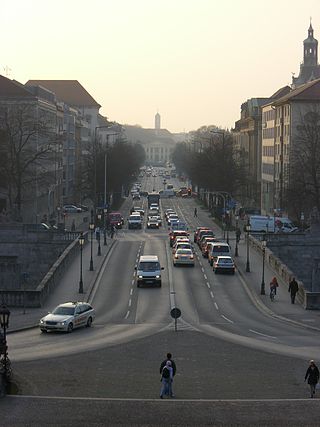
The Prinzregentenstraße in Munich is one of four royal avenues and runs parallel to Maximilianstraße and begins at Prinz-Carl-Palais, in the northeastern part of the Old Town. The avenue was constructed from 1891 onwards as a prime address for the middle-class during the reign of Luitpold, Prince Regent of Bavaria and is named in his honour. The square in the eastern part of the street is named Prinzregentenplatz.

The neoclassical Brienner Straße in Munich is one of four royal avenues next to the Ludwigstraße, the Maximilianstraße and the Prinzregentenstraße. The boulevard was constructed from 1812 onwards, during the reigns of Maximilian I Joseph of Bavaria and his successor Ludwig I, in accordance with a plan by Karl von Fischer and Friedrich Ludwig von Sckell. The avenue is named after the Battle of Brienne.

The Maximilianstraße in Munich is one of the city's four royal avenues next to the Brienner Straße, the Ludwigstraße and the Prinzregentenstraße. It starts at Max-Joseph-Platz, where the Residenz and the National Theatre are situated, and runs east-west. Planned and begun in 1850 by King Maximilian II of Bavaria, the street takes his name. The lead architect was Friedrich Bürklein. Today, Maximilianstraße has the distinction of the highest retail rents in Germany.

Thalkirchen-Obersendling-Forstenried-Fürstenried-Solln is the 19th borough of Munich, Germany, comprising the extreme southern part of the city on the west bank of the river Isar. After the administrative reform, the boroughs Thalkirchen-Obersendling-Forstenried and Solln were incorporated, thus forming the new borough. It comprises 17.7631 square kilometres and has a population of 96,714 residents.

The Odeonsplatz is a large square in central Munich which was developed in the early 19th century by Leo von Klenze and is at the southern end of the Ludwigstraße, developed at the same time. The square is named for the former concert hall, the Odeon, on its northwestern side. The name Odeonsplatz has come to be extended to the parvis (forecourt) of the Residenz, in front of the Theatine Church and terminated by the Feldherrnhalle, which lies to the south of it. The square was the scene of a fatal gun battle which ended the march on the Feldherrnhalle during the 1923 Beer Hall Putsch.

Ludwigsvorstadt-Isarvorstadt is one of the boroughs of Munich, Germany.

Haidhausen is a quarter of Munich, Germany. It is now part of the borough—or stadtbezirk—number 5 Au-Haidhausen.
The Sonnenstraße is a street in the city center of Munich. It forms the border between the city districts Altstadt and Ludwigsvorstadt.

The following outline is provided as an overview of and topical guide to Munich:

Neuhauser Straße is part of the first and largest pedestrian zone in Munich's Old Town. Here, many retail shops and restaurants are to be found.

The Lindwurmstraße is a 2.4-kilometer poplar alley in the Munich districts Ludwigsvorstadt-Isarvorstadt and Sendling.

The Munich Old Town is part of the Bavarian capital Munich and has belonged to the city the longest, even if some places which are meanwhile districts of Munich, were mentioned long before Munich's documents spoke of the Old Town. The Old Town forms together with the district Lehel, the municipality No. 1 Altstadt-Lehel. The entire area of the Old Town is listed as both a historical ensemble as well as a historical monument listed in the Bavarian historical monument list.

Englschalking is a quarter of the Bavarian capital Munich and belongs to the district 13 Bogenhausen.