
Måsøy is a municipality in Finnmark county, Norway. The administrative centre of the municipality is the village of Havøysund. Other villages include Ingøy, Måsøy, Slåtten, and Gunnarnes. The municipality is located on the mainland as well as several islands.

Gamvik (help·info) is a municipality in Finnmark county, Norway. The administrative centre of the municipality is the village of Mehamn. The other main villages in Gamvik include Gamvik and Skjånes. Gamvik is known as one of the poorest and most undeveloped municipalities in Norway. The number of inhabitants rose at one moment in 2012, but in 2014, after the fish factory closed, the population declined dramatically with the departure of the eastern European fishermen.
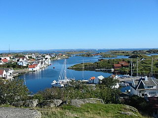
Kvitsøy is an island municipality in Rogaland county, Norway. At only 6.29-square-kilometre (2.43 sq mi), it is the smallest municipality in Norway by area and one of the smallest by population. Kvitsøy is located in the traditional district of Ryfylke. The administrative centre of the municipality is the village of Ydstebøhamn on the island of Kvitsøy. The municipality is an archipelago located at the entrance to the large Boknafjorden. It sits about 2 nautical miles northwest of the mainland Stavanger peninsula. There are plans for the Rogfast tunnel to eventually connect Kvitsøy to the mainland road network.

Øygarden is a municipality in Hordaland county, Norway. It is an island municipality located in the traditional district of Midhordland. Since 2009, the administrative centre of Øygarden has been the village of Rong. Other villages in the municipality include Alveim, Blomvåg, and Vikavågen.

Torsken is a municipality on the western coast of the large island of Senja in Troms county, Norway. The administrative centre of the municipality is the village of Gryllefjord. Other larger villages in Torsken municipality include the villages of Torsken, Medby, and Flakstadvåg.

Senja (Norwegian) or Sážžá (Northern Sami) is an island and future municipality in Troms county, Norway. At 1,586.3-square-kilometre (612.5 sq mi), it is the second largest island in Norway. It has a wild, mountainous outer (western) side facing the Atlantic, and a mild and lush inner (eastern) side. The island is governed by four municipalities: Torsken, Tranøy, Lenvik, and Berg, however in on 1 January 2020, the four municipalities are scheduled to be merged into one large Senja Municipality. The island of Senja had 7,864 inhabitants as of 1 January 2017. Most of the residents live along the eastern coast of the island, with Silsand being the largest urban area on the island. The fishing village of Gryllefjord on the west coast has a summer-only ferry connection to the nearby island of Andøya: the Andenes–Gryllefjord Ferry.

Vangsvik or Vangsvika is a village in Tranøy Municipality in Troms county, Norway. The village, which is the administrative centre of the municipality, has a population of about 350. The village has a school, Vangsvik Chapel, store, and medical office. There is also a large fish farming facility nearby. The Senja Rutebil has its headquarters in Vangsvik.

Breivikbotn is the administrative centre of Hasvik Municipality in Finnmark county, Norway. It is an old trading post and fishing village that is located on the western end of the island of Sørøya, looking out across the Lopphavet Sea. The village lies along Norwegian County Road 822 in the central part of the municipality. The village of Hasvik lies about 15 kilometres (9.3 mi) to the south, the former village of Dønnesfjord lies about 13 kilometres (8.1 mi) to the northeast, and the village of Sørvær lies about 20 kilometres (12 mi) to the west.

Rykene or Rygene is a village located along the river Nidelva in Aust-Agder county, Norway. The village is primarily located in Arendal municipality, but a small portion of the village lies across the river in the neighboring municipality of Grimstad. Rykene is located about 10 kilometres (6.2 mi) north of the town of Grimstad and about the same distance south of the city of Arendal. Historically, the village grew up due to its close proximity to forests as the timber was floated down river to the sawmills in Rykene. The village of Lindtveit lies about 2 kilometres (1.2 mi) to the northwest, the village of Løddesøl lies about 4 kilometres (2.5 mi) to the north, the village of Gjennestad lies about 3 kilometres (1.9 mi) to the northeast. The village sits at the junction of Norwegian County Road 407 and Norwegian County Road 408.

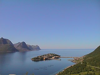
Gryllefjord is a fishing village and also the administrative centre of Torsken Municipality in Troms county, Norway. It is located on the island of Senja, along the Gryllefjorden in the northern part of the municipality. The 0.25-square-kilometre (62-acre) village has a population (2017) of 383 which gives the village a population density of 1,532 inhabitants per square kilometre (3,970/sq mi).
Husøy is a village in Lenvik Municipality in Troms county, Norway. The village covers the entire island of Husøy which is located in the Øyfjorden off the northwest coast of the large island of Senja. The village/island is located about 53 kilometres (33 mi) southwest of the city of Tromsø. The village of Fjordgård sits about 4 kilometres (2.5 mi) across the fjord on the island of Senja.

Olderdalen (Norwegian) or Dálošvággi (Northern Sami) is the administrative centre of the municipality of Gáivuotna-Kåfjord-Kaivuono in Troms county, Norway. Olderdalen is located in the Olderdalen valley along the Kåfjorden with a view of the Lyngen Alps. The village has a ferry connection to Lyngseidet, the administrative centre of Lyngen Municipality, across the fjord. The European route E6 highway passes through this village also.

Storslett is the administrative centre of Nordreisa Municipality in Troms county, Norway. The village is located at the southern end of the Reisafjorden along the mouth of the river Reisaelva. The 1.63-square-kilometre (400-acre) village has a population (2017) of 1,837 which gives the village a population density of 1,127 inhabitants per square kilometre (2,920/sq mi).

Byrknes is a fishing village in the municipality of Gulen in Sogn og Fjordane county, Norway. It is located on the western shore of the island of Byrknesøyna. It is about 16 kilometres (9.9 mi) southwest of the municipal center of Eivindvik, about 17 kilometres (11 mi) west of the village of Dalsøyra, and about 14 kilometres (8.7 mi) northwest of the Mongstad industrial area in neighboring Lindås and Austrheim municipalities to the south. The Sognesjøen strait is located to the northwest of the village.

Skrova is a small island group and village area in Vågan Municipality in Nordland county, Norway. The 2.5-square-kilometre (0.97 sq mi) Skrova island group in the Lofoten archipelago, about 9 kilometres (5.6 mi) southeast of the town of Svolvær. It is located in the Vestfjorden, south of the islands of Austvågøya, Litlmolla, and Stormolla. The largest island in the group is Storskrova and the island of Heimskrova is where most of the population is located. The six main inhabited islands in the group are all interconnected by a small bridge and several man-made causeways.
Breidtinden (Norwegian) or Reaiddaidčohkka (Northern Sami) is the highest mountain on the island of Senja in Troms county, Norway. It is located in the northeastern part of the municipality of Berg, southeast of the Mefjorden and southwest of the village of Mefjordbotn. The village of Senjahopen lies about 10 kilometres (6.2 mi) northwest of the mountain. The lake Svartholvatnet is located along the southwestern base of the mountain.

Mefjordvær is a fishing village in Berg Municipality in Troms county, Norway. The village is located about 3.5 kilometres (2.2 mi) northwest of the village of Senjahopen, along the Mefjorden on the northwest coast of the large island of Senja. In 2001, there were 179 residents of the village. Mefjordvær Chapel is located in this village.

Skjervøy is the administrative centre in Skjervøy Municipality in Troms county, Norway. The village is located on the island of Skjervøya along the Kvænangen, near the mouth of the Reisafjorden. The 1.29-square-kilometre (320-acre) village has a population (2017) of 2,460 which gives the village a population density of 1,907 inhabitants per square kilometre (4,940/sq mi).


