Related Research Articles

Ceresco is a farming village in Saunders County, Nebraska, United States. The population was 889 at the 2010 census. It is located near U.S. Highway 77, just north of Lincoln, just south of Wahoo, and a short distance southwest of Omaha.

Changlang district (Pron:/tʃæŋˈlæŋ/) is located in the Indian state of Arunachal Pradesh, located south of Lohit district and north of Tirap district. As of 2011 it is the second most populous district of Arunachal Pradesh, after Papum Pare. It has become one of the major districts in the area owing to the presence of crude oil, coal and mineral resources other than tourism and hydropower.
Tirap district (Pron:/tɪˈɹæp/) is a district located in the southeastern part of the state of Arunachal Pradesh in India. It shares a state border with Assam, an international border with Myanmar and a district border with Changlang and Longding.
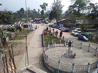
Khonsa is the headquarters of Tirap district in the Indian state of Arunachal Pradesh. It also houses Ramakrishna Sarada Mission School, Christ The King ICSE School. The Noctes, a Wancho tribe, are the indigenous population, although the town is cosmopolitan in nature, people from every Indian state can be found here.

Ambala district is one of the 22 districts of Haryana state in the country of India with Ambala town serving as the administrative headquarters of the district. District Ambala lies on the North-Eastern edge of Haryana and borders Punjab and Himachal Pradesh. Ambala District is a part of Ambala Division.

Deomali is a census town in Tirap district in the state of Arunachal Pradesh, India. The small sub-divisional town has scenic beauty and is surrounded by hills, tea gardens, forests and rivers.
Chifra (Sifra) is a woreda in Afar Region, Ethiopia. Part of the Administrative Zone 1, Chifra is located near the base of the eastern escarpment of the Ethiopian highlands and bordered on the south by Mille, on the west by the Amhara Region, on the north by the Administrative Zone 4, and on the east by Dubti; the Logiya River defines part of the boundary with Zone 4. The administrative center of Chifra is Chifra.
Shinile is a woreda in Somali Region, Ethiopia. Part of the Sitti Zone, Shinile is bordered on the south by Dire Dawa, on the west by Erer, on the north by the Afar Region, on the east by Ayesha, and on the southeast by Dembel and Jijiga Zone. Towns in Shinile include Adigale, Harewa, Milo, and Shinile; villages include Jaldessa, Marmaarsa, Toome

Bugna is a woreda in Amhara Region, Ethiopia. It is named after the former district. Located in the northwest corner of the Semien Wollo Zone, Bugna is bordered on the south by Meket, on the west by the Debub Gondar Zone, on the north by the Wag Hemra Zone, and on the east by the Lasta woreda. The main town is Ayne. The Lasta woreda, where Lalibela is, was split off from Bugna.
Badalgacchi is a Upazila of Naogaon District in Bangladesh. It consists of 36,614 households and has a total area of 213.98 square kilometres (82.62 sq mi).
Jablanica is a village in the municipality of Bujanovac, Serbia. According to the 2002 census, the town has a population of 109 people.
Skradnik is a village in the municipality of Sjenica, Serbia. According to the 2002 census, the village has a population of 2 people.
Wancho is a Konyak language of north-eastern India. Wancho is spoken in 36 villages of southeastern Longding district, Tirap district, Arunachal Pradesh, as well as in Assam and Nagaland (Ethnologue). Alternate names include Banpara Naga, Joboka, Jokoba.
Longding district (Pron:/lɒŋˈdɪŋ/) is one of the 20 administrative districts of Arunachal Pradesh in northeastern India. It was carved out of the south-western portion of the Tirap District. The district shares its boundary to the south and south-east with the country of Myanmar. Its boundary to the west and the north are shared with the Indian states of Nagaland and Assam, respectively. Towards the north-east is the Tirap District from which the district was carved out in 2012. The district has a population of around 60000 and an area of roughly 1200 square kilometers. Longding has a pleasant climate throughout the year. Due to its hilly terrain, the temperature ranges from 15C to 30C in summers).

Pullong is a village in Khonsa Tehsil of Tirap district in Arunachal Pradesh, India. According to Census 2011 information, the location code or village code of Pullong village is 264478. Khonsa is the nearest town to Pullong village.
Lazu is a village in Khonsa Taluka of Tirap district of Arunachal Pradesh of India.
Nianu is a village located in Longding district ( earlier Tirap district of Arunachal Pradesh in India.

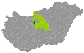
Érd is a district in south-western part of Pest County. Érd is also the name of the town where the district seat is found. The district is located in the Central Hungary Statistical Region.
Korhalli is a large village located in Sindagi Taluk in Bijapur District of Karnataka State, India.
Niausa is a village located in Longding district ( earlier Tirap district of Arunachal Pradesh in India.
References
- ↑ "Tirap District Handbook, Census 2011" (PDF). Retrieved 14 March 2021.