Sept-Rivières—Caniapiscau | |
---|---|
Census division | |
Coordinates: 51°53′30″N68°09′55″W / 51.89167°N 68.16528°W Coordinates: 51°53′30″N68°09′55″W / 51.89167°N 68.16528°W [1] | |
Country | |
Province | |
Region | Côte-Nord |
Area [2] | |
• Land | 100,858.53 km2 (38,941.70 sq mi) |
Population (2011) [2] | |
• Total | 39,500 |
• Density | 0.4/km2 (1/sq mi) |
• Pop (2006–11) | |
• Dwellings | 18,018 |
Time zone | EST (UTC−5) |
• Summer (DST) | EDT (UTC−4) |
Area code(s) | 418 and 581 |
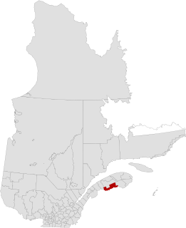
Sept-Rivières—Caniapiscau is a census division (CD) of Quebec, with geographical code 97. It consists of the regional county municipalities of Sept-Rivières and Caniapiscau.
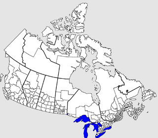
The census geographic units of Canada are the administrative divisions defined and used by Canada's federal government statistics bureau Statistics Canada to conduct the country's five-yearly census. They exist on four levels: the top-level (first-level) divisions are Canada's provinces and territories; these are divided into second-level census divisions, which in turn are divided into third-level census subdivisions and fourth-level dissemination areas.
Quebec is one of the thirteen provinces and territories of Canada. It is bordered to the west by the province of Ontario and the bodies of water James Bay and Hudson Bay; to the north by Hudson Strait and Ungava Bay; to the east by the Gulf of Saint Lawrence and the province of Newfoundland and Labrador; and to the south by the province of New Brunswick and the U.S. states of Maine, New Hampshire, Vermont, and New York. It also shares maritime borders with Nunavut, Prince Edward Island, and Nova Scotia. Quebec is Canada's largest province by area and its second-largest administrative division; only the territory of Nunavut is larger. It is historically and politically considered to be part of Central Canada.
The term regional county municipality or RCM is used in Quebec to refer to one of 87 county-like political entities. In some older English translations they were called county regional municipality.
The division had a population of 39,500 in the Canada 2011 Census. [2] Of that total, 25,686 people, 65 per cent of the division's entire population, reside in the city of Sept-Îles. [3]
Sept-Îles is a city in the Côte-Nord region of eastern Quebec, Canada. It is among the northernmost locales with a paved connection to the rest of Quebec's road network. The population was 25,686 as of the Canada 2011 Census. The town is called Uashau, meaning "bay," in the Innu language.
Census Code | S or C? | Name | Type | Population 2011 | Population 2006 | Total dwellings | Dwellings usual res. | Land Area |
---|---|---|---|---|---|---|---|---|
2497908 | C | Caniapiscau | NO | 0 | 0 | 0 | 0 | 34057.11 |
2497035 | C | Fermont | V | 2874 | 2633 | 1389 | 1221 | 470.67 |
2497806 | c | Kawawachikamach | TK | 586 | 569 | 169 | 149 | 30.83 |
2497810 | c | Lac-John | IRI | 21 | 16 | 12 | 10 | 0.62 |
2497912 | C | Lac-Juillet | NO | 26 | 0 | 5 | 5 | 3030.78 |
2497914 | C | Lac-Vacher | NO | 0 | 0 | 0 | 0 | 475.85 |
2497904 | S | Lac-Walker | NO | 102 | 128 | 59 | 44 | 17683.30 |
2497804 | s | Maliotenam | IRI | 1316 | 1123 | 445 | 431 | 5.17 |
2497808 | c | Matimekosh | IRI | 540 | 528 | 200 | 169 | 0.74 |
2497022 | S | Port-Cartier | V | 6651 | 6758 | 3093 | 2879 | 1101.31 |
2497906 | C | Rivière-Mouchalagane | NO | 0 | 0 | 0 | 0 | 32297.67 |
2497902 | S | Rivière-Nipissis | NO | 0 | 0 | 1 | 0 | 9914.04 |
2497040 | C | Schefferville | V | 213 | 202 | 178 | 110 | 25.11 |
2497007 | S | Sept-Îles | V | 25686 | 25514 | 12029 | 11221 | 1764.13 |
2497802 | s | Uashat | IRI | 1485 | 1190 | 438 | 421 | 1.22 |
Sept-Rivières—Caniapiscau | CD | 39500 | 38661 | 18018 | 16660 | 100858.53 | ||
S/s | Sept-Rivières | MRC | 35240 | 34713 | 16065 | 14996 | 30469.17 | |
C/c | Caniapiscau | MRC | 4260 | 3948 | 1953 | 1664 | 70389.38 |
In the second column:
In the rightmost column, summed up area adds up to 100858.55 rather than the correct 100858.53 due to rounding error.
Antoine-Labelle is a regional county municipality located in the Laurentides region of Quebec, Canada. Its seat is Mont-Laurier. It is named for Antoine Labelle.
Avignon is a regional county municipality located in the Gaspésie–Îles-de-la-Madeleine region of Quebec, Canada. The seat is Nouvelle. Its largest city is Carleton-sur-Mer.
Bonaventure is a regional county municipality in the Gaspésie–Îles-de-la-Madeleine region of eastern Quebec, Canada, on the Gaspé Peninsula. Its seat is New Carlisle.
Deux-Montagnes is a regional county municipality in the Laurentides region of Quebec, Canada. It is located immediately north of Laval on the north shore of the Rivière des Mille-Îles and on the north shore of the Lake of Two Mountains. Its seat is Saint-Eustache.
Les Basques(the Basques) is a regional county municipality in the Bas-Saint-Laurent region in eastern Quebec, Canada. It is located on the south bank of the Saint Lawrence River halfway between Rimouski and Rivière-du-Loup.
Les Moulins is a regional county municipality in the Lanaudière region of Quebec, Canada.
L'Île-d'Orléans is a regional county municipality in central Quebec, Canada, in the Capitale-Nationale region. Its seat is Sainte-Famille. The population in the 2011 census was 6,711 persons.
Maskinongé is a regional county municipality in the Mauricie region of Quebec, Canada. The seat is Louiseville. It is located adjacent on the west of Trois-Rivières on the Saint Lawrence River.
Minganie is a regional county municipality in the Côte-Nord region of Quebec, Canada. It includes Anticosti Island. Its seat is Havre-Saint-Pierre.
Rivière-du-Loup is a regional county municipality in the Bas-Saint-Laurent region of Quebec, Canada. Its most important city is Rivière-du-Loup, which contains more than half of the population.
Sept-Rivières is a regional county municipality of Quebec, Canada, in the Côte-Nord region. Its county seat is Sept-Îles.
Témiscouata is a regional county municipality in the Bas-Saint-Laurent region of Quebec, Canada. It is located southeast of Rivière-du-Loup, bordering New Brunswick, and is centred on Lake Témiscouata. Its seat is Témiscouata-sur-le-Lac.
Thérèse-De Blainville is a regional county municipality in the Laurentides region of Quebec, Canada. It is located immediately north of Laval on the north shore of the Rivière des Mille-Îles.
Caniapiscau is a regional county municipality in the Côte-Nord region of Quebec, Canada. The seat is Fermont.
Les Chenaux is a regional county municipality in central Quebec, Canada, in the Mauricie region. The seat is in Saint-Luc-de-Vincennes. It is located adjacent on the east of Trois-Rivières on the Saint Lawrence River. It has a land area of 872.04 square kilometres (336.70 sq mi) and a population of 17,865 inhabitants in the Canada 2011 Census. Its largest community is the parish of Notre-Dame-du-Mont-Carmel.
Saint-Prosper-de-Champlain is a municipality of 516 people in the Les Chenaux Regional County Municipality, in Quebec, Canada. It is the smallest municipality in terms of population in the regional county.
Minganie—Le Golfe-du-Saint-Laurent is a census division of Quebec, with geographical code 98. It consists of the regional county municipalities of Minganie and Le Golfe-du-Saint-Laurent.
Cacouna is a Maliseet First Nations reserve in Quebec, physically located within the Rivière-du-Loup Regional County Municipality. It is surrounded by the city of the same name.
This Quebec-related article is a stub. You can help Wikipedia by expanding it. |