Related Research Articles

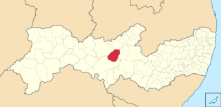
Serra Talhada is a city in the state of Pernambuco, Brazil. It is located at 07º59'31" South and 38º17'54" West, at an altitude of 429 metres. As of 2020, its estimated population by IBGE was 86,915 people. Its area is approximately 2980 km sq.

Belo Monte is a municipality located in the western of the Brazilian state of Alagoas. Its population is 6,710 (2020) and its area is 334 km².

Floresta is a city in the Brazilian state of Pernambuco. It is situated at latitude 08º36'04" south and at longitude 38º34'07" west, at an altitude of 316 metres. Its population was estimated in 2020 to be 33,184 inhabitants, according to the Brazilian Institute of Geography and Statistics. It has an area of 3644.17 km².

Serra Negra Biological Reserve is a Biological reserve in the state of Pernambuco, Brazil.
Seridó Ecological Station is a hot, semi-arid ecological station in the state of Rio Grande do Norte, Brazil.
Tacaratu is a municipality in the state of Pernambuco, Brazil. The population in 2020, according with IBGE is 26,106 and the area is 1264.5 km2.
Betânia (Bethany) is a city in the state of Pernambuco, Brazil. The population in 2020, according to IBGE was 12,765 and the area is 1244.07 km².
Mirandiba is a city in the state of Pernambuco, Brazil. The population in 2020, according with IBGE was 15,470 inhabitants and the total area is 821.68 km².

Inajá is a city in the state of Pernambuco, Brazil. The population in 2020, according with IBGE was 23,645 inhabitants and the total area is 1168.16 km².
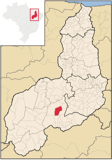
Alvorada do Gurguéia is a municipality in the state of Piauí in the Northeast region of Brazil.
Bom Jesus is a municipality in the state of Piauí in the Northeast region of Brazil.

Brejo do Piauí is a municipality in the state of Piauí in the Northeast region of Brazil.

Canto do Buriti is a municipality in the state of Piauí in the Northeast region of Brazil.

Caracol is a municipality in the state of Piauí in the Northeast region of Brazil.

Guaribas is a municipality in the state of Piauí in the Northeast region of Brazil.

Jurema, Piauí is a municipality in the state of Piauí in the Northeast region of Brazil.
Tamboril do Piauí is a municipality in the state of Piauí in the Northeast region of Brazil.

The Serra das Confusões National Park is a national park in the state of Piauí, Brazil.
The Caatinga Ecological Corridor is an ecological corridor in the caatinga biome of northeast Brazil.

The Raso da Catarina is an ecoregion in the caatinga biome of Bahia and Pernambuco, Brazil. It is a sandstone plateau, much eroded, that is extremely dry for most of the year. Vegetation includes low bushes, often thorny, cacti and bromeliads.
References
- ↑ Serra Negra at Peakbagger.com
- ↑ Mattos, Marluza (2006), Ministério cria Corredor Ecológico da Caatinga (in Portuguese), Ministério do Meio Ambiente, retrieved 2016-11-01CS1 maint: discouraged parameter (link)
| Authority control |
|
|---|
Coordinates: 9°59′S37°52′W / 9.983°S 37.867°W
| | This Sergipe, Brazil location article is a stub. You can help Wikipedia by expanding it. |