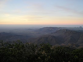
Ceará is one of the 26 states of Brazil, located in the northeastern part of the country, on the Atlantic coast. It is the eighth-largest Brazilian State by population and the 17th by area. It is also one of the main tourist destinations in Brazil. The state capital is the city of Fortaleza, the country's fourth most populous city. The state has 4.3% of the Brazilian population and produces 2.1% of the Brazilian GDP.

Ceará Sporting Club, or Ceará, as they are usually called, is a Brazilian football team from the city of Fortaleza, capital city of the Brazilian state of Ceará, founded on June 2, 1914, by Luís Esteves and Pedro Freire. Ceará is one of the most traditionally successful clubs in the Northeast region of Brazil alongside Bahia, Santa Cruz, Sport, Náutico, Vitória and their city rivals Fortaleza.

The Trans-Amazonian Highway, was introduced on September 27, 1972. It is 4,000 km long, making it the third longest highway in Brazil. It runs through the Amazon forest and the Brazilian states of Paraíba, Ceará, Piauí, Maranhão, Tocantins, Pará and Amazonas, from the proximities of Saboeiro up until the town of Lábrea.
Paulo César Lopes de Gusmão, known as Paulo César Gusmão or PC Gusmão, is a football coach and former player who played as a goalkeeper.

Associação Desportiva Recreativa e Cultural Icasa, or simply Icasa, is a Brazilian professional football club based in Juazeiro do Norte, Ceará. It competes in the Campeonato Cearense Série B, the second division of the Ceará state football league.
Alto Santo is a municipality in the state of Ceará in the Northeast region of Brazil.

Pacatuba, Ceará is a municipality in the state of Ceará in the Northeast region of Brazil.
Pacajus is a municipality in Ceará, Northeast Region, Brazil.
Viçosa do Ceará is a municipality in the state of Ceará in the Northeast region of Brazil.
Morrinhos, Ceará is a municipality in the state of Ceará in the Northeast region of Brazil.
Hidrolândia, Ceará is a municipality in the state of Ceará in the Northeast region of Brazil.
São Gonçalo do Amarante, Ceará is a municipality in the state of Ceará in the Northeast region of Brazil.
Capistrano, Ceará is a municipality in the state of Ceará in the Northeast region of Brazil.
Tamboril, Ceará is a municipality in the state of Ceará in the Northeast region of Brazil. It has an area of about 2046.6 km², and is located at a latitude of 04º49'56" South and longitude 40º19'14" West, at an altitude of 322 meters. The estimated population of Tamboril in 2020 was 26,225.

Parambu, Ceará is a municipality in the state of Ceará in the Northeast region of Brazil.

Boa Viagem, Ceará is a municipality in the state of Ceará in the Northeast region of Brazil.

Aurora, Ceará is a municipality in the state of Ceará in the Northeast region of Brazil.
Barro, Ceará is a municipality in the state of Ceará in the Northeast region of Brazil.

Jardim, Ceará is a municipality in the state of Ceará in the Northeast region of Brazil.
Tarairiú is an extinct and very poorly known language of eastern Brazil. The Tarairiu nation was divided into several tribes: the Janduí, Kanindé, Paiaku, Jenipapo, Jenipabuçu, Javó, Kamaçu, Tukuriju, Ariu, and "Xukuru" / Xacó.