| Mountain | Metres | Feet | Range | Notes |
|---|---|---|---|---|
| Pico da Neblina | 2,995 | 9,826 | Serra do Imeri | Highest in Brazil; 2015 measurement, previous measurements of 3014 m (1966) and 2994 m (2004) |
| Pico 31 de Março | 2,974 | 9,757 | Serra do Imeri | Shared with Venezuela; 2015 measurement, previous measurements of 2992 m (1966) and 2973 m (2004) |
| Pico da Bandeira | 2,891 | 9,485 | Highest in the states of Minas Gerais and Espírito Santo, Highest in the Brazilian Highlands | |
| Pico do Cruzeiro | 2,861 | 9,386 | Unconfirmed elevation [1] | |
| Pico do Calçado | 2,849 | 9,347 | ||
| Pedra da Mina | 2,798 | 9,180 | Mantiqueira Mountains | Highest in São Paulo state |
| Pico das Agulhas Negras | 2,791 | 9,157 | Mantiqueira Mountains | Highest in Rio de Janeiro State |
| Pico do Cristal | 2,770 | 9,088 | ||
| Mount Roraima | 2,734 | 8,970 | Guiana Shield | Shared with Venezuela and Guyana – Border tripoint elevation [2] |
| Pico dos Marins | 2,420 | 7,940 | Mantiqueira Mountains | |
| Pico do Barbado | 2,033 | 6,670 | Highest in Bahia | |
| Pico Paraná | 1,877 | 6,158 | Serra do Mar | Highest in Paraná |
| Morro da Boa Vista | 1,827 | 5,994 | Serra Geral | Highest in Santa Catarina |
| Morro da Igreja | 1,822 | 5,978 | Serra Geral | |
| Morro das Antenas | 1,750 | 5,741 | Serra Geral | |
| Monte Caburaí | 1,465 | 4,806 | – is the northernmost point of Brazil | |
| Pico do Monte Negro | 1,398 | 4,587 | Highest in Rio Grande do Sul | |
| Pico São Sebastião | 1,378 | 4,521 | Ilhabela island – Highest island peak in Brazil | |
| Morro do Capão Doce | 1,340 | 4,396 | Serra da Fartura | Highest peak in South Region, Brazil |
| Pico do Papagaio | 1,200 | 3,937 | Highest in Pernambuco | |
| Pico do Jabre | 1,197 | 3,927 | Brazilian Highlands | Highest in Paraíba |
| Pico do Jaraguá | 1,135 | 3,724 | Serra da Cantareira | |
| Pico Alto | 1,114 | 3,655 | Serra de Baturité | Highest in Ceará |
| Maciço do Urucum | 1,065 | 3,494 | Highest in Mato Grosso do Sul | |
| Pico da Tijuca | 1,017 | 3,337 | Most prominent peak in Urban Area(lifts ca.1000m inside Rio de Janeiro City | |
| Corcovado | 710 | 2,329 | The Peak of o Cristo Redentor | |
| Monte Pascoal | 586 | 1,923 | First land portion observed from sea on discovery of Brazil in April 1500. | |
| Pão de Açúcar | 397 | 1,302 | Famous rock monolith in Rio de Janeiro city |
ISO 3166-2:BR is the entry for Brazil in ISO 3166-2, part of the ISO 3166 standard published by the International Organization for Standardization (ISO), which defines codes for the names of the principal subdivisions of all countries coded in ISO 3166-1.
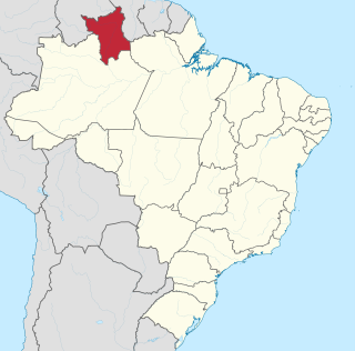
Roraima is one of the 26 states of Brazil. Located in the country's North Region, it is the northernmost and most geographically and logistically isolated state in Brazil. It is bordered by the state of Pará to the southeast, Amazonas to the south and west, Venezuela to the north and northwest, and Guyana to the east.
The Brazilian Institute of Geography and Statistics is the agency responsible for official collection of statistical, geographic, cartographic, geodetic and environmental information in Brazil. IBGE performs a decennial national census; questionnaires account for information such as age, household income, literacy, education, occupation and hygiene levels.

Agulhas Negras Peak is the fifth-highest mountain in Brazil, standing at 2,791 metres (9,157 ft) above sea level, making it one of the highest in the Brazilian Highlands. It is located in Itatiaia National Park, in the Mantiqueira range, on the border of the states of Rio de Janeiro and Minas Gerais. It is the highest point in the state of Rio de Janeiro, the third-highest in Minas Gerais, and the second-highest in the Mantiqueira range.

Franca is a municipality in the state of São Paulo, Brazil. The city is located in the northeastern portion of the state, distant 401 km from the state capital, and 676 km from Brasilia. It covers a total area of 605,679 km2 of which 86,92 km2 comprises the urban area. As of the 2021 Census, the city's population was 358,539.

Pico da Neblina is the highest peak in Brazil, 2,995.3 metres (9,827 ft) above sea level, in the Serra da Neblina, part of the Serra do Imeri, a section of the Guiana Highlands on the Brazil-Venezuela border. As determined by a border survey expedition in 1962, its summit lies just within Brazilian territory, at a horizontal distance of only 687 m (2,254 ft) from the Venezuelan border at Pico 31 de Março. It is a common misconception to refer to this mountain as the highest point in South America outside the Andes while ignoring the Sierra Nevada de Santa Marta in Colombia.

Barbacenitena is a municipality in the state of Bahia, Brazil. As of 2020, the municipality had 138,204 inhabitants. The total area of the municipality is 788 km2 (304 sq mi).

Abreu e Lima is a Brazilian municipality in the state of Pernambuco. It is located in the Metropolitan Region of Recife, also known as Greater Recife. Abreu e Lima covers 126.193 km2 (48.723 sq mi), and has a population of 100,346 with a population density of 780 inhabitants per square kilometer. 75% of the area of the municipality is rural, but only 8% of the population lives outside of the urban center.

Brazil is divided into several types and levels of subdivisions.

Manicoré is a municipality located in the south-east of the Brazilian state of Amazonas.

Araçuaí is a Brazilian municipality located in the northeast of the state of Minas Gerais in the Jequitinhonha River valley. The Araçuaí River, a tributary of the Jequitinhonha, flows through it. Its population as of 2020 was estimated to be 36,712 people living in a total area of 2,235 km2. The city belongs to the mesoregion of Jequitinhonha and the microregion of Araçuaí. The city is the seat of the Roman Catholic Diocese of Araçuaí. The elevation of the municipal seat is 307 meters. It became a municipality in 1870.

Arantina is a Brazilian municipality located in the state of Minas Gerais. Its population as of 2020 is estimated to be 2,787 people living in a total area of 89.382 km². The city belongs to the mesoregion of Sul and Sudoeste de Minas and to the microregion of Andrelândia.
Agrolândia is a Brazilian municipality in the state of Santa Catarina. It is located in the micro-region of Rio do Sul, with agriculture as its main economic activity. It was colonized by the Germans, who are the main ethnic group. The main access to the municipality is through the SC-426 highway, starting from BR-470. There are secondary accesses through Otacílio Costa, going down the mountain on a gravel road. There are also secondary accesses from the municipality of Braço do Trombudo and through Ituporanga via Atalanta.

Pico 31 de Março, or Pico Trinta e Um de Março in full, also known as Pico Phelps, is a mountain on the Brazil–Venezuela border. At 2,974 metres (9,757 ft) above sea level, it is Brazil's second highest mountain. It is part of the Neblina massif, and the latter's summit Pico da Neblina, Brazil's highest summit, is only 687 m (2,254 ft) away. Pico 31 de Março can be considered a secondary summit of Pico da Neblina. Therefore, it is usually climbed by expeditions primarily aiming to reach the other peak. The two are linked by a col that can be easily traversed in a short trek of about an hour.
Caraí is a Brazilian municipality located in the northeast of the state of Minas Gerais. Its population as of 2020 was estimated to be 23,780 people living in a total area of 1,240 km2. The city belongs to the mesoregion of Jequitinhonha and to the microregion of Araçuaí. The elevation of the municipal seat is 750 meters. It became a municipality in 1948.

Pedra da Mina is the fourth highest mountain in Brazil, located in the Serra Fina section of the Mantiqueira Mountains, one of the country's most important mountain ranges. The mountain stands on the border of the states of Minas Gerais and São Paulo, respectively to its north and south. With a 2,798-metre (9,180-foot) elevation, it is the highest point of the Mantiqueira Mountains and of the state of São Paulo, and the second highest mountain in the state of Minas Gerais.
The rate ofunemployment in Brazil was determined by the Monthly Employment Survey until march 2012, when it started to be determined by the National Survey by sample of households that is coordinated by the Brazilian Institute of Geography and Statistics (IBGE). This research examines the economically active population from 211,000 households in approximately 16,000 census tracts around the country.

Pico dos Marins is a mountain peak in Brazil, between the cities of Piquete and Cruzeiro, state of São Paulo. The peak stands only about 1 kilometre (0.62 mi) south of the Minas Gerais state border, but it is located entirely in São Paulo territory. It is part of a short spur of the southwestern section of the Mantiqueira Mountains, and it has an elevation of 2,420.7 metres (7,942 ft).