
Ancash is a department and region in western Peru. It is bordered by the departments of La Libertad on the north, Huánuco and Pasco on the east, Lima on the south, and the Pacific Ocean on the west. Its capital is the city of Huaraz, and its largest city and port is Chimbote. The name of the region originates from the Quechua word anqash, from anqas ('blue') or from anka ('eagle').

Huayhuash is a mountain range within the Andes of Peru, in the boundaries of the regions of Ancash, Lima and Huánuco. Since 2002 it is protected within the Cordillera Huayhuash Reserved Zone.
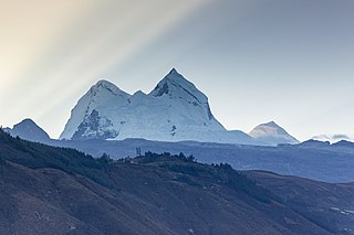
The Cordillera Blanca is a mountain range in Peru that is part of the larger Andes range and extends for 200 kilometres (124 mi) between 8°08' and 9°58'S and 77°00' and 77°52'W, in a northwesterly direction. It includes several peaks over 6,000 metres (19,690 ft) high and 722 individual glaciers. The highest mountain in Peru, Huascarán, at 6,768 metres (22,205 ft) high, is located there.

Huascarán National Park is a Peruvian national park that comprises most of the mountain range known as Cordillera Blanca which is part of the central Andes, in the region of Ancash. The park covers an area of 340,000 hectares and is managed by the Peruvian Network of Protected Natural Areas, or SERNANP. It was designated as a World Heritage Site in 1985 by UNESCO, is also a well-known mountaineering spot, and harbors a unique biodiversity with plant species such as the Queen of the Andes, trees of the genera Polylepis and Buddleja, and animals such as spectacled bears, condors, vicunas, and tarucas.

Illimani is the highest mountain in the Cordillera Real of western Bolivia. It lies near the cities of El Alto and La Paz at the eastern edge of the Altiplano. It is the second highest peak in Bolivia, after Nevado Sajama, and the eighteenth highest peak in South America. The snow line lies at about 4,570 metres (15,000 ft) above sea level, and glaciers are found on the northern face at 4,983 m (16,350 ft). The mountain has four main peaks; the highest is the south summit, Nevado Illimani, which is a popular ascent for mountain climbers.
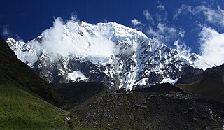
Salcantay, Salkantay or Sallqantay is the highest peak in the Vilcabamba mountain range, part of the Peruvian Andes. It is located in the Cusco Region, about 60 km (40 mi) west-northwest of the city of Cusco. It is the 38th-highest peak in the Andes and the twelfth-highest in Peru. However, as a range highpoint in deeply incised terrain, it is the second most topographically prominent peak in the country, after Huascarán.
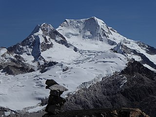
Chachacomani is a mountain in the Cordillera Real of the Andes Mountains, east of Lake Titicaca in Bolivia.
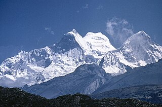
Huandoy or Tullparaju is a mountain located inside Huascarán National Park in Ancash, Peru. It is the second-tallest peak of the Cordillera Blanca section of the Andes, after Huascarán. These two peaks are rather nearby, separated only by the Llanganuco glacial valley at 3,846 m asl.

Huantsán,Huantsan or Tunsho is a mountain in the Andes of Peru. It is located in Ancash Region and is part of the Cordillera Blanca mountain range, a sub-range of the Andes. It has four peaks, with a maximum elevation of 6,369 metres (20,896 ft) above sea level.

Jirishanca is a 6,094-metre-high (19,993 ft) mountain in the Huayhuash mountain range in west central Peru, part of the Andes. Other sources cite a height of 6,125 metres (20,095 ft). It is the tenth highest peak in Peru and the third in the Huayhuash range. Jirishanca translates as "hummingbird bill peak".

Tuco,Tuku,Tucu or Huanaco Punta is a mountain in the Andes in South America. Its summit is 5,479 m (17,976 ft)) high and it is one of the southernmost peaks in the snow-capped Cordillera Blanca in northwestern central Peru. Tuco is located in the Ancash Region, Bolognesi Province, Aquia District and in the Recuay Province, Catac District. It is situated northeast of Caullaraju, between Challhua in the west and Pastoruri in the east.
Nicolas Jaeger was a French physician, alpinist, and ski mountaineer.

Caullaraju or Jeulla Rajo is a mountain in the Cordillera Blanca in the Andes of Peru, about 5,682 m (18,642 ft) high. It is located in the Ancash Region, Recuay Province. In the IGN-Peru map, the highest peak is reported to be named Jenhuaracra.
Raura is a mountain range located in the Andes of Peru, on the boundaries of the regions of Huánuco, Lima and Pasco. It extends between 10°21' and 10°31'S and 76°41' and 76°50'W for about 20 km. It lies a few kilometres southeast of the Huayhuash mountain range. The highest mountain in the Raura range is Yarupac which reaches an elevation of 5,685 metres (18,652 ft). The Raura mine is located on the eastern slope of the Raura range and is accessible by road. Eighteen glaciers and 245 lakes dot the Raura range.
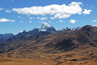
Huacshash or Huaqshash is a mountain in the west of the Huayhuash mountain range in the Andes of Peru, about 5,644 metres (18,517 ft) high. It is located in the Lima Region, Cajatambo Province, Cajatambo District. Huacshash lies on a sub-range in the west, south of the Huayllapa River, north of the Pumarinri River and southeast of the villages of Huayllapa and Auquimarca.
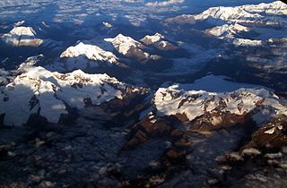
Vicos or Paccharuri is a 5,315 m (17,438 ft) high mountain in the Cordillera Blanca in the Andes of Peru. It is situated in the Ancash Region, Carhuaz Province, Marcara District. Paccharuri lies in the Huascarán National Park, southwest of Copa and southeast of Lake Lejiacocha.

Raju Cutac, Rajo Cutac or Rajutuna, is a 5,355-metre-high (17,569 ft) mountain in the Cordillera Blanca in the Andes of Peru. It is situated in the Ancash Region, Bolognesi Province, Aquia District. Raju Cutac lies southeast of Challhua and Tuco.
John Biggar is a Scottish mountaineer, high altitude mountain guide and explorer, mainly active in the Andes. From 1995 to the present day he has made a number of first ascents in the Andes. He discovered the Inca ruins on the summit of Alto Toroni, a 5995m high peak on the frontier between Chile and Bolivia and was first to realise that a small lake on Ojos del Salado was the world's highest lake. As of 2020, Biggar has climbed 54 major and 17 less prominent peaks of over 6000 m in the Andes, the second highest total of anyone, after Maximo Kausch.


