| Santa Cruz | |
|---|---|
| Pucaraju | |
 West face. | |
| Highest point | |
| Elevation | 6,259 m (20,535 ft) [1] |
| Coordinates | 8°53′39″S77°42′30″W / 8.89429°S 77.7083°W |
| Geography | |
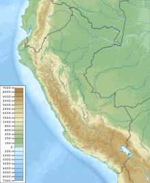 Santa Cruz Peru | |
| Location | Ancash, Peru |
| Parent range | Cordillera Blanca, Andes |
| Climbing | |
| First ascent | 20 July 1948 by Frédéric Marmillod and Ali Szepessy-Schaurek |
Santa Cruz, [2] [3] [1] [4] Pucaraju, [3] [2] [5] Pukaraju [1] (possibly from Quechua puka red, [6] rahu snow, ice, mountain with snow) [7] or Pico de Huaylas (Spanish for "peak of Huaylas") [1] is a mountain in the Cordillera Blanca in the Andes of Peru; within Santa Cruz District, Huaylas Province, Ancash. [5] It has a height of 6,259 metres (20,535 ft), [1] although other maps cite a height of 6,241 metres (20,476 ft). [2] [3]