List of World Heritage Sites in Brazil

Last updated

Brazil location map.svg
Locations of World Heritage Sites in Brazil. Green dots indicate the sites of the Central Amazon Conservation Complex, blue dots are the two sites of the Cerrado. Atlantic Forest South-East Reserves comprise 25 and Discovery Coast Atlantic Forest Reserves eight, approximate locations are shown. Valongo Wharf and Sítio Roberto Burle Marx are located in Rio de Janeiro.

The United Nations Educational, Scientific and Cultural Organization (UNESCO) World Heritage Sites are places of importance to cultural or natural heritage as described in the UNESCO World Heritage Convention, established in 1972. [1] Cultural heritage consists of monuments (such as architectural works, monumental sculptures, or inscriptions), groups of buildings, and sites (including archaeological sites). Natural features (consisting of physical and biological formations), geological and physiographical formations (including habitats of threatened species of animals and plants), and natural sites which are important from the point of view of science, conservation or natural beauty, are defined as natural heritage. [2] Brazil accepted the convention on 1 September 1977, making its sites eligible for inclusion on the list. [3]

Contents

There are 23 World Heritage Sites in Brazil, and a further 23 sites on its tentative list. The first site in Brazil, the Historic Town of Ouro Preto, was inscribed on the list at the 4th Session of the World Heritage Committee, held in Paris, France in 1980. [4] The most recent site, the Sítio Roberto Burle Marx, was inscribed in 2021. [3] Among the 23 sites, 15 are listed for their cultural significance. Seven sites are listed for their natural significance, and one site, Paraty and Ilha Grande - Culture and Biodiversity, is listed for both. One site is transnational: the Jesuit Missions Guaranis is shared with Argentina. From 1999 to 2001, Iguaçu National Park was listed as endangered due to an illegally opened road through the park, dams on the river, and helicopter flights. [5] Brazil has served on the World Heritage Committee four times. [3]


World Heritage Sites

UNESCO lists sites under ten criteria; each entry must meet at least one of the criteria. Criteria i through vi are cultural, and vii through x are natural. [6]

  * Transnational site
World Heritage Sites
SiteImageLocation (state)Year listedUNESCO dataDescription
Historic Town of Ouro Preto Ouro Preto November 2009-7.jpg Minas Gerais 1980124; i, iii (cultural)Ouro Preto, literally Black Gold, was the centre of the Brazilian Gold Rush in the 18th century. It was also the centre of the Inconfidência Mineira, the Brazilian independence movement in 1789. The gold deposits got exhausted in the 19th century and the city declined in importance, which helped in the preservation of its historic buildings and urban fabric. There are numerous Baroque churches, decorated by artwork by Aleijadinho, the most prominent sculptor and architect of Colonial Brazil, and ceiling paintings by Manoel da Costa Ataíde. [7]
Historic Centre of the Town of Olinda Mosteiro de Sao Bento - Olinda - Pernambuco - Brasil.jpg Pernambuco 1982189; ii, iv (cultural)Olinda was founded by the Portuguese in 1535 and was one of the centres of sugarcane industry, one of the key industries of Brazil for several centuries. After being looted by the Dutch in the 17th century, it was rebuilt and most of the historic buildings today date from the 17th to 19th centuries. There are numerous Baroque churches, convents, public buildings, as well as gardens with lush tropical vegetation. [8]
Jesuit Missions of the Guaranis: San Ignacio Mini, Santa Ana, Nuestra Señora de Loreto and Santa Maria Mayor (Argentina), Ruins of Sao Miguel das Missoes (Brazil)* Ruinas 1.jpg Rio Grande do Sul 1983275bis; iv (cultural)In the 17th and 18th centuries, the Jesuits constructed several missions to the Guaraní people. The remains of five missions are listed as this World Heritage Site. Sao Miguel das Missoes in Brazil (pictured) was listed independently in 1983 and the four missions in Argentina were added in 1984. The missions have different layouts and are in different states of conservation, they typically include the remains of churches and convents, plantations, and foundations of indigenous dwellings. [9] [10]
Historic Centre of Salvador de Bahia Salvador-CCBY10.jpg Bahia 1985309; iv, vi (cultural)The colonial old town of the first Brazilian capital (from 1549 to 1763) and the site of the first slave market in the New World (1558), Salvador de Bahia has preserved many brightly colored Renaissance houses decorated with stucco work from the 16th to 18th centuries. A centre of sugar industry and a major port, it was a meeting place of European, African, and American Indian cultures. Some of the prominent buildings include the Cathedral Basilica of Salvador, Church and Convent of São Francisco, Salvador, and Church of the Third Order of Mount Carmel. [11]
Sanctuary of Bom Jesus de Matosinhos Sanctuary of Bom Jesus do Congonhas.jpg Minas Gerais 1985334; i, iv (cultural)The sanctuary complex represents the apex of Christian art in Latin America. The church from the second half of the 18th century is in the Baroque style with the interior in the Italian-inspired Rococo. The church is approached by the path passing seven chapels with polychrome sculptures depicting the Stations of the Cross by the sculptor Aleijadinho. The outdoor stairway is decorated by soapstone sculptures of twelve prophets, also by Aleijadinho. [12]
Iguaçu National Park Cataratas do Iguacu 0 2.jpg Paraná 1986355; vii, x (natural) Iguazu Falls on the eponymous river are some of the world's most spectacular waterfalls. They span over 2,700 m (8,900 ft) and have a vertical drop of 80 m (260 ft). They are located on the border of Brazil and Argentina, where the area is protected as a separate World Heritage Site, the Iguazú National Park. The surrounding area comprises the Paranese subtropical rainforest, a part of the Atlantic Forest. The forest is rich in biodiversity and is home to large animals such as the tapir, giant anteater, giant otter, ocelot, jaguar, and jaguarundi. From 1999 to 2001, the site was listed as endangered due to an illegally opened road through the park, dams on the river, and helicopter flights. [13] [14] [5]
Brasília Catedral1 Rodrigo Marfan.jpg Federal District 1987445; i, iv (cultural)As a part of his modernization project, President Juscelino Kubitschek decided to move the national capital to the newly established city of Brasília. The city was designed by the architects Lúcio Costa and Oscar Niemeyer and constructed between 1956 and 1960. The city plan follows the concepts of modernist architecture, as promoted by Le Corbusier, on a large scale, and adjusted to a setting in a tropical climate. Some of the important buildings include the Cathedral of Brasília (pictured), the National Congress Palace, and the Cláudio Santoro National Theater. [15]
Serra da Capivara National Park Serra da Capivara - Painting 7.JPG Piauí 1991606; iii (cultural)The area of the national park has been inhabited for millennia and is one of the oldest archaeological sites in the Americas. There are over 300 sites with rock paintings (example pictured), some of which have been dated to be more than 25,000 years old. The age of these paintings revolutionized the classical theories of initial peopling of the Americas through Beringia. Excavations uncovered initial presence of hunter-gatherer societies and later ceramic-farmer societies. [16]
Historic Centre of São Luís Reviver.JPG Maranhão 1997821; iii, iv, v (cultural)São Luís, originally founded as a fortress by the French in 1612, is a prime example of a Portuguese colonial town from the 17th century, with expansions in the following centuries. Due to a period of economic stagnation in the early 20th century, it has preserved the complete rectangular town plan and numerous historical buildings. Buildings in traditional Portuguese colonial architecture, adjusted to an equatorial setting, feature azulejo ceramic tiles, crafted stoneworks, ornamented facades, and interior patios. [17]
Historic Centre of the Town of Diamantina Igreja Matriz, Diamantina.jpg Minas Gerais 1999890; ii, iv (cultural)The 18th century town of Diamantina, located in an inhospitable and wild mountain setting, attracted prospectors when diamonds were discovered in the area. The town preserves numerous buildings in Brazilian Baroque style, which are made of wood and more modest than in other Brazilian towns. The city illustrates the adaptations of European cultural models to Brazilian interior. [18]
Discovery Coast Atlantic Forest Reserves Panorama, Parque Nacional e Historico do Monte Pascoal.JPG Bahia, Espírito Santo 1999892rev; ix, x (natural)The site comprises eight protected areas with some of the last remaining Atlantic Forests. These forests, which were in past connected via corridors to the Amazon basin ecosystem, show a very high animal and plant diversity with many rare and endemic species, including 21 species of marsupials, 21 species of primates, and 620 species of birds. Monte Pascoal National Park is pictured. [19]
Atlantic Forest South-East Reserves Teresopolis-DedoDeus2.jpg Paraná, São Paulo 1999893rev; vii, ix, x (natural)The site comprises 25 forest reserves with some of the last remaining Atlantic Forests, one of the world's most threatened biomes. There are dense forests, mangroves, wetlands, coastal islands, Karst caves, and mountain peaks. The area is a biodiversity hotspot, with 120 mammal species and 350 bird species recorded, and with one of world's highest plant diversity. Numerous animal and plant species are endemic and several are endangered. Some of the species include the jaguar, ocelot, southern muriqui, Superagüi lion tamarin, and red-tailed amazon. Serra do Mar is pictured. [20]
Historic Centre of the Town of Goiás Boamorte.jpg Goiás 2001993; ii, iv (cultural)Goiás was founded in the 18th century by the bandeirante explorers as the first Portuguese settlement west of the demarcation line defined in the Treaty of Tordesillas. It was a mining town and it is the last remaining example of a settlement in Brazilian interior as practiced in the 18th and 19th centuries. It demonstrates the adaptation of a European settlement to the climate, topography, and cultural constraints of the region. Architecture is modest, with the use of locally sourced materials and vernacular techniques. Some of the important buildings include the Governor's Palace, the cathedral, and the foundry. [21]
Central Amazon Conservation Complex NEO lake jau big.jpg Amazonas 2000998bis; ix, x (natural)This site comprises four protected areas in the Amazon basin. The landscape is constantly evolving due to the river action, with a mosaic of river channels, islands, and lakes. The area is one of the worlds richest regions in terms of biodiversity. Ecosystems include periodically flooded várzea and igapó forests, dryland forests, swamps, and beaches. Animals that live there include the arapaima , giant otter, Amazonian manatee, black caiman, jaguar, harpy eagle, Amazon river dolphin, and tucuxi. There are also 64 species of electric fish. The Jaú National Park was listed independently in 2000. In 2003, the site was renamed to the current name and expanded to include the Mamirauá Sustainable Development Reserve, the Anavilhanas Ecological Station, and the Amana Sustainable Development Reserve. [22] [23]
Pantanal Conservation Area Pantanal, south-central South America 5170.jpg Mato Grosso, Mato Grosso do Sul 2000999; vii, ix, x (natural)This site comprises four protected areas in the Pantanal, one of the world's largest freshwater wetlands. In the wet season, the rivers of the Pantanal spill and flood vast areas, whereas the waters recede in the dry season and leave numerous temporary lakes. The floods allow fish to cross between river basins and to distribute nutrients. The area is home to numerous species of aquatic plants, such as water lilies, and they provide a stark contrast to the plants of the semi-arid landscapes of the neighboring mountains. Large animals that live in the park include the jaguar, giant otter, giant anteater, marsh deer, and hyacinth macaw. [24]
Brazilian Atlantic Islands: Fernando de Noronha and Atol das Rocas Reserves Fernando de Noronha - dois Irmaos - praia do sancho.jpg Pernambuco, Rio Grande do Norte 20011000rev; vii, ix, x (natural)The Fernando de Noronha archipelago (pictured) and Atol das Rocas, the only atoll of the South Atlantic, are peaks of a submarine ridge and one of the few insular habitats of the region. As such, they provide an important habitat for tropical seabirds, nesting site for hawksbill sea turtle and green turtle, as well as feeding ground for fish and marine mammals. The islands support the only example of Atlantic Forest and the only oceanic mangroves in the South Atlantic. [25]
Cerrado Protected Areas: Chapada dos Veadeiros and Emas National Parks Araras Pq Emas.JPG Goiás 20011035bis; ix, x (natural) Chapada dos Veadeiros and Emas National Parks (pictured) represent the Cerrado, one of the oldest and most biodiverse tropical biome in the world. The region has two well-defined seasons, dry and wet. There are frequent fires and the soil is poor in nutrients. This resulted in various adaptation of animal and plant species. Due to its central location and various altitudes, the two sites have served as refugia for species during periods of climate change. Large animals in the parks include the jaguar, giant anteater, giant armadillo, maned wolf, pampas deer, and rhea. A minor boundary modification of the site took place in 2019. [26]
São Francisco Square in the Town of São Cristóvão Flickr - Ministerio da Cultura - Praca Sao Francisco - Sao Cristovao (SE) (6).jpg Sergipe 20101272rev; ii, iv (cultural)The square in the town of São Cristóvão is a rare example of urban planning during the time of the Iberian Union, when Spain and Portugal were united under a single crown in the 16th and 17th centuries. The buildings represent a fusion of both colonial styles. Buildings from the period include the Provincial Palace, the Church and Convent of Santa Cruz (pictured) and the Misericórdia Hospital and Church. The ensemble is surrounded by houses from the 18th and 19th centuries. [27]
Rio de Janeiro: Carioca Landscapes Between the Mountain and the Sea Christ on Corcovado mountain.JPG Rio de Janeiro 20121100rev: v, vi (cultural)Rio de Janeiro is located in a scenery of remarkable natural beauty between the sea and mountains covered by lush forests. This setting has shaped the development of the city and inspired arts, music, and literature. The World Heritage Site comprises properties of cultural landscape within and around the city, including the Tijuca National Park, the Botanical Gardens, established in 1808, Corcovado Mountain with the Christ the Redeemer statue, Sugarloaf Mountain, and the Copacabana Bay. [28]
Pampulha Modern Ensemble Igreja de Sao Francisco de Assis Jani Pereira (6).jpg Minas Gerais 20161493; i, ii, iv (cultural)The modernist urban project around the artificial Lake Pampulha in Belo Horizonte was created in 1940 by the architect Oscar Niemeyer, in collaboration with the landscape architect Roberto Burle Marx and engineer Joaquim Cardozo. The complex comprised the Church of Saint Francis of Assisi (pictured), the Golf Yacht Club, the Casino, and the Ballroom, the latter two now being used as a museum and an architecture reference centre. The garden city project, which explored creative uses of concrete and emphasized the interaction between buildings and the natural surroundings, was influential in shaping the architecture of Latin American countries. [29]
Valongo Wharf Archaeological Site Cais do Valongo e da Imperatriz.jpg Rio de Janeiro 20171548; vi (cultural)The wharf was built in 1811 in central Rio de Janeiro and served as the entry point for an estimated 900,000 African slaves to South America. The original Valongo Wharf was constructed on the beach with paving of hewn stones of different shapes and sizes, in the so-called pé de moleque style. The Empress’ Wharf was constructed over it in 1843. The site was excavated in 2011 and made open to the public. The adjacent structures of the wharf, such as the warehouses, quarantine facilities, a lazaretto, and a cemetery, have either been lost or have preserved underground remains. [30]
Paraty and Ilha Grande - Culture and Biodiversity Paraty 09 2007 59.JPG Rio de Janeiro, São Paulo 20191308rev; v, x (mixed)This site comprises the historic centre of Paraty (pictured) and four protected areas with Atlantic Forests. The ecosystems span from the sea level to the rugged peaks of Serra do Mar above 2,000 m (6,600 ft). They represent a biodiversity hotspot with 450 bird and 150 mammal species. There is a high level of endemism. The town of Paraty was the end point of the gold route from the mines in the interior and the entry point for African slaves. The town has preserved most of its urban plan and colonial architecture from the 18th and 19th centuries. The cultural landscape or the region has been shaped since prehistoric times by the local Tupi–Guarani communities that relied on fishing. Later, the communities of escaped slaves, quilombolas , created their own culture. [31]
Sítio Roberto Burle Marx Sitio Roberto Burle Marx 31.jpg Rio de Janeiro 20211620; ii, iv (cultural)The estate in Barra de Guaratiba, a suburb of Rio de Janeiro, belonged to the architect and naturalist Roberto Burle Marx (1909-1994). As a landscape designer, Burle Marx was experimenting with the use of native tropical plants in modernist architecture. The estate hosts 3,500 species of plants, representing different biomes of Brazil, including the Atlantic Forest, mangrove swamp, and restinga, tropical sandy plains. The work of Burle Marx has influenced landscape designers in numerous tropical parks and gardens around the world. [32]

Tentative list

In addition to sites inscribed on the World Heritage List, member states can maintain a list of tentative sites that they may consider for nomination. Nominations for the World Heritage List are only accepted if the site was previously listed on the tentative list. [33] Brazil maintains 23 properties on its tentative list. [3]

Tentative sites
SiteImageLocation (state)Year listedUNESCO criteriaDescription
São Bento Monastery Mosteiro de Sao Bento do Rio de Janeiro - Fachada.jpg Rio de Janeiro 1996i, ii, iv (cultural)The Benedictine abbey dates from the early 17th century. Later additions in the 18th and 19th century were done in a consistent manner with the original architecture. The interior is decorated with wooden carvings and paintings. [34]
Gustavo Capanema Palace MESP4.jpg Rio de Janeiro 1996i, ii, iv (cultural)The building, originally known as the Ministry of Education and Health Building, was the first modernist project in Brazil and was important in view of the architectural development of Modernism in Brazil. It was constructed between 1937 and 1945 by the team of architects Lucio Costa, Oscar Niemeyer, Affonso Eduardo Reidy, Ernani Vasconcellos, Carlos Leão, and Jorge Machado Moreira, following the designs by Le Corbusier. The gardens were designed by Roberto Burle Marx while the interior decorations with murals were done by Candido Portinari. [35]
Pico da Neblina National Park Pico da Neblina.jpg Amazonas 1996vii, ix, x (natural)The park, located on the border with Venezuela, comprises equatorial rainforests and cloud forests on the mountain slopes. The area is rich in wildlife. The park contains Brazil's highest mountain, Pico da Neblina, at 2,995 m (9,826 ft) (pictured). [36] [37]
Serra da Bocaina National Park Camera digital nikon 119.jpg São Paulo, Rio de Janeiro 1996vii, x (natural)The park, located between the cities of São Paulo and Rio de Janeiro, comprises Atlantic Forests. It is rich in biodiversity and is one of the rare protected forest areas along the Brazilian coast. [38]
Biological reserve Rocas Atoll ESC large ISS022 ISS022-E-79937k.JPG Rio Grande do Norte 1996vii, ix (natural)Rocas Atoll (satellite image pictured) is the only atoll in South Atlantic. It is an important habitat for seabirds and marine turtles. The site was inscribed to the World Heritage List as Brazilian Atlantic Islands: Fernando de Noronha and Atol das Rocas Reserves in 2001. [39] [25]
Raso da Catarina Ecological Station GRANDE CANYON RASO DA CATARINA NO RIO SAO FRANCISCO EM PLENO SERTAO NORDESTINO BRASILEIRO.JPG Bahia 1996Natural: (vii)(ix)The area of Raso da Catarina is considered to be one of the most arid zones in Brazil. Owing to the lack of natural springs and to the fact that the rivers frequently run dry, this vast area has remained virtually untouched. It is a flat area covered with brushwood, including cacti and exotic plants which provide one of the rare sources of water at certain times of the year. In some places there are sand formations resembling canyons, pillars and walls, mainly hollowed out by rainwater. These provide a refuge for birds as well as being interesting from a scenic point of view. The flora and fauna, however, are the greatest attraction of the Raso da Catarina.
Taim Ecological Station Paisagem do Taim.JPG Rio Grande do Sul 1996Natural: (ix)(x)Situated in the district of Santa Vitória do Palmar and Rio Grande, this station covers an area of 32000 hectares near the Uruguayan border. Taim si public property which has been declared an area of ecological interest, with a vast lagoon system partly formed by the Mirim, Jacaré, Nicola and Mangueira lagoons. Most of the marshland along the southern coast of Brazil is interesting on account of its biotic communities and its rich wildlife. The area at Taim has about 10 km of ocean beaches, mobile dunes and areas where sand and creeping vegetation alternate.
Peruaçu River Canyon Peruacu.png Minas Gerais 1998Mixed: (iii)(iv)(v)(vii)(viii)(ix)(x)Chastic canyon with around 60 sites of prehistoric occupation and spectacular rock art, concentrated in a region of 12 km² of relict vegetation and animal species threatened with extinction, in a natural region with magnificent landscapes, close to the Xacriabás Indian Reserve. The archaeological sites contain traces of occupation from 12,000 BC to the colonial period.
Serra da Capivara National Park and Permanent Preservation Areas Parque Nacional da Serra da Capivara Carlos Souto (10).jpg Piauí 1998Mixed: (iii)(iv)(vii)(viii)(ix)(x)Three geomorphologic units shape the area: 1. west of the area, arenite metamorphic high plateau's (Planalto), 500-630 m high, with homogeneous plane or slightly undulated tops. 2. In the centre, the Cuesta zone: highly irregular Siluro-Devonian arenite network of canyons, ravines, corridors and eroded formations and " ruins" . 3. eastward, a 60 to 80 Km erosion plain with isolated inselbergs of harder granites and calcareous islets.
Cavernas do Peruaçu Federal Environmental Protection Area (APA) / Veredas Do Peruaçu State Park Vegetacao na Caverna do Peruacu.JPG Minas Gerais 1998Mixed:

(iii)(iv)(v)(vii)(viii)(ix)(x)

The Peruaçu valley's canyons, caves, galleries and permanent water favoured human occupation since as soon as 12.000 years ago. Rock paintings are extremely abundant all over the area, in shelters, on canyon walls and cave entrances. Several styles coexist, allowing to study successive cultural influences. Caves' dryness exceptionally conserved.
Serra da Canastra National Park Canastra -a serra que da nome ao parque nacional.jpg Minas Gerais 1998Natural: (vii)(ix)(x)The area is made of two isolated metamorphic quartzite high plateau (Chapadao), separated by a large valley: 1. the Serra da Canastra / Chapadao da Zagaia, and: 2. the Serra das Sete Voltas. Plane or undulated highlands are isolated by cliffs, precipices and steep slopes where softer stilts and micas abruptly replace the hard quartz cover, allowing differential erosion. Hundreds of streams originating on the plateau's flow downwards in spectacular waterfalls and cascades. Sierra's, cliffs and cascade create landscapes of exceptional beauty.
Serra do Divisor National Park Vista panoramica do Rio Moa - Observatorio da Cachoeira do Amor.jpg Acre 1998Natural: (vii)(viii)(ix)(x)Hilly and mountainous with large alluvial plains and some low tabular plateau's. Separating the two basins of Rio Ucayali (Peru) and Jurua (Brazil), the Park shelters main sources of Jurua 's left margin affluent. It is structured in four main hill massifs (Serras da Jaquirana, do Moa, do Jurua-Mirim & do Rio Branco), separated by flat plains and valleys of the corresponding affluent of the Jurna basin.
Anavilhanas National Park Curvas do Parque Nacional de Anavilhanas.jpg Amazonas 1998Natural: (vii)(ix)(x)The Ecological station is constituted by a 100.000 ha. archipelago, of hundreds of elongated islands and canals within the Rio Negro riverbed, covered by inundated forests. Included to these are 250.000 ha. of not-flooded forests on the riversides. The river is 1 to 3 Km wide and 5 to 35 m deep. Sessonal variation of the water is +/- 10 m. Water pH varies between 3,7 and 5,5.
Cultural Landscape of Paranapiacaba: Village and railway systems in the Serra do Mar Mountain Range At Paranapiacaba 2023 214.jpg São Paulo 2014(cultural) (i)(ii)(iv)The inscription comprehends the cultural heritage of the Railway Village of Paranapiacaba, built by the English company São Paulo Railway Co., the natural heritage of Atlantic Rainforest in the stretch circumscribed by the perimeter of the Nascentes de Paranapiacaba Natural Park, in the Municipality of Santo André, on top of the Serra do Mar Mountain Range, and the technological railroad heritage of the funicular and rack-and-pinion systems at the Mogi River Basin between the municipalities of Santo André and Cubatão, in the State of São Paulo, Brazil.
Ver-o-Peso Ver-oPeso-Belem.jpg Pará 2014(cultural) (vii)(ix)An architectural and landscape ensemble, listed by IPHAN as a heritage site in 1977, comprising its urban layout, monumental buildings, rows of houses, iron markets and urban furniture, squares and docks for boats. Its spatial configuration was established and consolidated between the 17th and the first decades of the 20th century. Its origins are attributed to the implementation, in the mid-17th century, of a tax collection station at the mouth of an igarapé where there was a small natural port now corresponding to the docks.
Itacoatiaras of Ingá River Pedra do Inga - inscricoes rupestres entalhadas.jpg Paraíba 2015(cultural) (i)(iii)The term "itacoatiara" originates from the Tupi-Guarani language and means "writing or drawing on stone", having been used in Brazil as a synonym for "rock engraving" expressions. The rock art site of the Itacoatiaras of the Inga River is located in the rural municipality of Inga, whose main city is about 105 km from the city of João Pessoa, the state capital of Paraiba, Brazil. The municipality is part of the Depressão Sertaneja, a typical geoenvironmental unit of the Brazilian semi-arid northeast characterized by the Caatinga Hiperxerófila type of vegetation with areas of Floresta Caducifólia, by the Tropical Semiárido climate and with rainfall ranging from November to April with low average annual precipitation.
Geoglyphs of Acre Fazenda Colorada.jpg Acre 2015(cultural) (iii)(iv)(v)The Acre Geoglyphs are earthen excavated structures in the ground and formed by low walls and ditches representing geometrical figures of different shapes. These enclosures were found in the southwestern region of the western Amazon, most predominantly in the eastern portion of the state of Acre, located in areas between streams, creek springs and wetlands, associated mostly with the Acre and Iquiri rivers.
Cedro Dam in the Quixadá Monoliths Acude Cedro - Paisagem iconica do Ceara.jpg Ceará 2015(cultural) (iv)The Quixadá region (the name meaning corral stones), located in Northeastern Brazil, has been occupied since prehistoric times, as evidenced by cave paintings and other existing archaeological remains on the site. European colonization began from the last quarter of the seventeenth century, starting with sugar production areas on the coast, following the beds of major rivers, entering the hinterland in search of places for cattle breeding. The organization of the territory and culture was done around the homestead, the patriarchal family structure, farms and grazing areas.
Brazilian Fortresses Ensemble Forte da Barra Grande - Guaruja 4.jpg 1998 fort s a ratones 2.jpg States of São Paulo, Santa Catarina, Rio de Janeiro, Bahia, Pernambuco, Rio Grande do Norte, Paraíba, Amapá, Rondônia, and Mato Grosso do Sul 2015(cultural) (ii)(iv)The set of fortresses installed by Europeans in Brazil originated in a territory occupation process, different to those found in other colonial powers. It was based on a decentralized effort, arising from the actions of inhabitants of the different captaincies that formed Brazil, without further intervention from the mother country. This resulted in the construction of hundreds of fortresses, scattered throughout the country, built to cater more to local interests than the motherland. The fortresses not only marked the presence of towns and cities of Lusitanian origin, but also the contact between different cultures.
Amazonia Theaters (Amazon Theatre and Theatro da Paz) Amazon Theatre in Brazil.jpg Belem-TeatroPaz1.jpg Amazonas 2015(cultural) (ii)(iv)(vi)Built in the late nineteenth century, both Teatro Amazonas (Amazon Theater) and Teatro da Paz (Peace Theater) are located in the Brazilian Amazon in the cities of Manaus and Belém, respectively. These theaters are significant monuments located in the two largest urban centers of the region, symbols of the economic boom achieved and represented by a model of Europeanized civility reproduced in the tropics due to the Amazon Rubber Boom in South America.
Parque Nacional dos Lençóis Maranhenses Lencois Maranhenses 2018 (cropped).jpg Maranhão 2017Natural: (vii)(viii)(x)The National Park of Lençóis Maranhenses (LMNP), created by Decree 86,060, in June 2nd, 1981, is characterized as the largest field of sand dunes in South America. It comprises an area of 155 thousand hectares, of which 90 thousand consist of mobile dunes and lagoons formed by these dunes. It is located on the eastern coast of the state of Maranhão and covers three municipalities: Barreirinhas, Santo Amaro and Primeira Cruz. The LMNP is a federal protected area, and its management is carried out by the Chico Mendes Institute for Biodiversity Conservation - ICMBio.
Fundação Oswaldo Cruz Manguinhos fiocruz1.jpg Rio de Janeiro 2024(cultural) (ii)(vi)The Oswaldo Cruz Foundation (Fundação Oswaldo Cruz – Fiocruz, in Portuguese) has its origins in the Federal Serum Therapy Institute (Instituto Soroterápico Federal, in Portuguese), founded in 1900, on Manguinhos Municipal Farmlands, in the then federal capital of the country (Rio de Janeiro), to manufacture serums and vaccines against the bubonic plague that had arrived in Brazil via the Port of Santos (São Paulo) in the previous year.
Chapada do Araripe CHAPADA DO ARARIPE 01.jpg Ceará, Pernambuco, Piauí 2024Mixed: (iii)(vi)(viii)The Chapada do Araripe is located between the parallels of 7 and 8° South Latitude and the meridians of 39° and 41° West Longitude of Greenwich. It is a central plateau that forms a territory comprising three Brazilian states in the northeast of the country: Ceará, Pernambuco and Piauí. Due to its geomorphology, it acts as a watershed between the hydrographic basins of the Jaguaribe River to the north, the São Francisco River to the south and the Parnaíba River to the west.

Related Research Articles

<span class="mw-page-title-main">Ouro Preto</span> Municipality in Minas Gerais, Brazil

Ouro Preto, formerly Vila Rica, is a Brazilian municipality located in the state of Minas Gerais. The city, a former colonial mining town located in the Serra do Espinhaço mountains, was designated a World Heritage Site by UNESCO due to its Baroque colonial architecture. Ouro Preto used to be the capital of Minas Gerais from 1720 until the foundation of Belo Horizonte in 1897.

<span class="mw-page-title-main">Paraty</span> Historic municipality in Brazil

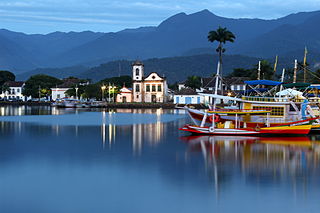
Paraty is a preserved Portuguese colonial (1500–1822) and Brazilian Imperial (1822–1889) municipality with a population of about 43,000. The name "Paraty" originates from the local Guaianá Indians' indigenous Tupi language, named for an abundant local fish native to the region. Paraty is located on the Costa Verde, a lush green corridor that runs along the coastline of the state of Rio de Janeiro, in Brazil. Paraty has become a tourist destination, known for its historic town center and the coast and mountains in the region. The historic center of the city, as well as four areas of the Atlantic Forest, were inscribed on the UNESCO World Heritage List in 2019 under the title "Paraty and Ilha Grande".

<span class="mw-page-title-main">São José do Rio Preto</span> Municipality in southeast Brazil

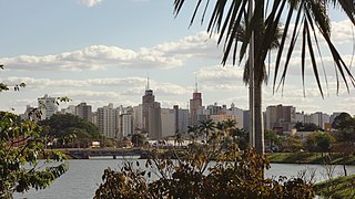
São José do Rio Preto is a municipality in the state of São Paulo, Brazil. It is located in the northwestern region of the state, approximately 440 km (270 mi) from the city of São Paulo and 700 km (430 mi) from Brasília. With a population of 469,173 inhabitants as of the 2021 census, it is the 11th largest city in São Paulo and the 36th largest in Brazil.

<span class="mw-page-title-main">Diamantina, Minas Gerais</span> Municipality in Minas Gerais, Brazil

Diamantina is a Brazilian municipality in the state of Minas Gerais. Its estimated population in 2020 was 47,825 in a total area of 3,870 km2.

<span class="mw-page-title-main">Iguaçu National Park</span> National park in Brazil

Iguaçu National Park is a national park in Paraná State, Brazil. It comprises a total area of 185,262.5 hectares and a length of about 420 kilometers (260 mi), 300 kilometers (190 mi) of which are natural borders by bodies of water and the Argentine and Brazilian sides together comprise around 260,000 hectares. Iguaçu National Park was created by federal decree nr. 1035 of 10 January 1939 and became a UNESCO World Heritage Site in 1986. The park is managed by Chico Mendes Institute for Biodiversity Conservation (ICMBio).

<span class="mw-page-title-main">São João del-Rei</span> Municipality in Minas Gerais, Brazil

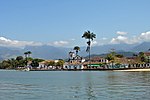
São João del-Rei is a Brazilian municipality in the state of Minas Gerais. Founded in 1713 in homage to king John V of Portugal, the city is famed for its historic Portuguese colonial architecture. The current population is estimated at 90,225 inhabitants.

<span class="mw-page-title-main">Congonhas</span> Municipality in Southeast Brazil

Congonhas is a historical Brazilian city located in the state of Minas Gerais. It is situated 90 kilometres (56 mi) south from Belo Horizonte, the capital of state of Minas Gerais, by the highway BR-040. As of 2020, the city had a population of 55,309.

<span class="mw-page-title-main">São Cristóvão</span> Municipality in Northeast Region, Brazil

São Cristóvão is a Brazilian municipality in the Northeastern state of Sergipe. Founded at the mouth of the Vaza-Barris River on January 1, 1590, the municipality is the fourth oldest settlement in Brazil. São Cristóvão is noted for its historic city square, São Francisco Square, and numerous early colonial-period buildings. The 3 hectares site was designated a UNESCO World Heritage Site in 2010.

<span class="mw-page-title-main">Iguazú National Park</span> National park in Argentina

The Iguazú National Park is a national park of Argentina, located in the Iguazú Department, in the north of the province of Misiones, Argentine Mesopotamia. It has an area of 677 km2 (261 sq mi).

<span class="mw-page-title-main">Chapada dos Veadeiros National Park</span> UNESCO World Heritage Site in Goiás, Brazil

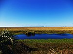
Chapada dos Veadeiros National Park is a national park of Brazil located in the state of Goiás, on the top of an ancient plateau with an estimated age of 1.8 billion years. The park was created on January 11, 1961, by President Juscelino Kubitschek, and listed as a World Heritage Site by Unesco in 2001. It occupies an area of 2,405 square kilometres (929 sq mi) in the municipalities of Alto Paraíso de Goiás, Cavalcante and Colinas do Sul. The park is maintained by Chico Mendes Institute for Biodiversity Conservation.

<span class="mw-page-title-main">São Miguel das Missões</span> Municipality in South, Brazil

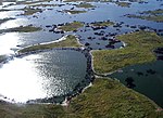
São Miguel das Missões is a municipality in Rio Grande do Sul state, southern Brazil. Important 17th century Spanish Jesuit mission ruins are located in the municipality. San Miguel Mission is within Santo Ângelo Microregion, and the Riograndense Northwest Mesoregion. The city covers 1,246 square kilometres (481 sq mi) and had a population of 7,683 residents.

<span class="mw-page-title-main">Tourism in Brazil</span>

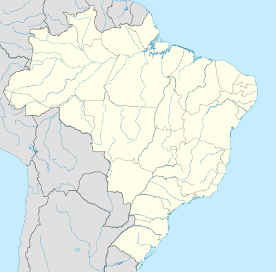
Tourism is a growing sector and key to the economy of several regions of Brazil. The country had 6.589 million visitors in 2018, ranking in terms of the international tourist arrivals as the second main destination in South America after Argentina and third in Latin America after Mexico and Argentina. Revenues from international tourists reached US$5.8 billion in 2015, continuing a recovery trend from the 2008–2009 economic crisis.

<span class="mw-page-title-main">Church of Saint Francis of Assisi (Ouro Preto)</span> Church in Minas Gerais, Brazil

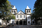
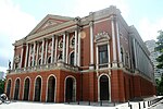
The Church of Saint Francis of Assisi is a Rococo Catholic church in Ouro Preto, Brazil. Its erection began in 1766 after a design by the Brazilian architect and sculptor Antônio Francisco Lisboa, otherwise known as Aleijadinho. Lisboa designed both the structure of the church and the carved decorations on the interior, which were only finished towards the end of the 19th century. The circular bell towers and the oculus closed by a relief were original features in religious architecture of that time in Brazil. The façade has a single entrance door under a soapstone frontispiece under a relief depicting Saint Francis receiving the stigmata. The interior is richly decorated with golden woodwork, statues and paintings, and the wooden ceiling displays a painting by Manuel da Costa Ataíde.

<span class="mw-page-title-main">Tietê Bus Terminal</span>

The Tietê Bus Terminal is the largest bus terminal in Latin America, and the second largest in the world, after the Port Authority Bus Terminal in New York City. The terminal is located in the Santana district in the city of São Paulo, Brazil. The official name in Portuguese is Terminal Rodoviário Governador Carvalho Pinto, named after Carlos Alberto Alves de Carvalho Pinto, a former Governor of the State of São Paulo.

Beatriz Francisca de Assis Brandão was a Neoclassical or Arcadian Brazilian poet, translator, musician, educator and early feminist. One of the few prominent female intellectuals and artists in Brazil during the reign of Pedro II, she became well-known for her poetry, frequently published in Brazilian newspapers. Through her life and work, she challenged the dominant societal roles for women at the time and played an important part in Brazilian social, political and cultural history.

Joaquim Maria Moreira Cardozo, known as Joaquim Cardozo, was a Brazilian structural engineer, poet, short story writer, playwright, university professor, translator, editor of art and architecture magazines, designer, illustrator, caricaturist, and art critic. He was a polyglot, knowing about fifteen languages.

References

  1. "The World Heritage Convention". UNESCO World Heritage Centre. Archived from the original on 27 August 2016. Retrieved 21 September 2010.
  2. "Convention Concerning the Protection of the World Cultural and Natural Heritage". UNESCO World Heritage Centre. Archived from the original on 1 February 2021. Retrieved 3 February 2021.
  3. 1 2 3 4 "Brazil". UNESCO World Heritage Centre. Retrieved 11 July 2024.
  4. "Report of the Rapporteur". UNESCO. 29 September 1980. Retrieved 12 July 2014.
  5. 1 2 "23COM VIII.1-2 - New Inscriptions on the World Heritage List in Danger" (PDF). UNESCO World Heritage Centre. Retrieved 10 September 2011.
  6. "The Criteria for Selection". UNESCO World Heritage Centre. Archived from the original on 12 June 2016. Retrieved 17 August 2018.
  7. "Historic Town of Ouro Preto". UNESCO World Heritage Centre. Retrieved 10 September 2011.
  8. "Historic Centre of the Town of Olinda". UNESCO World Heritage Centre. Retrieved 10 September 2011.
  9. "Jesuit Missions of the Guaranis: San Ignacio Mini, Santa Ana, Nuestra Señora de Loreto and Santa Maria Mayor (Argentina), Ruins of Sao Miguel das Missoes (Brazil)". UNESCO World Heritage Centre. Retrieved 8 September 2011.
  10. "Jesuit Missions of the Guaranis". UNESCO World Heritage Centre. Retrieved 8 September 2011.
  11. "Historic Centre of Salvador de Bahia". UNESCO World Heritage Centre. Retrieved 28 May 2010.
  12. "Sanctuary of Bom Jesus do Congonhas". UNESCO World Heritage Centre. Retrieved 13 August 2016.
  13. "Iguaçu National Park". UNESCO World Heritage Centre. Retrieved 10 September 2011.
  14. "Iguazu National Park". UNESCO World Heritage Centre. Archived from the original on 22 September 2017. Retrieved 24 September 2017.
  15. "Brasília". UNESCO World Heritage Centre. Retrieved 28 May 2010.
  16. "Serra da Capivara National Park". UNESCO World Heritage Centre. Retrieved 13 August 2016.
  17. "Historic Centre of São Luís". UNESCO World Heritage Centre. Retrieved 28 May 2010.
  18. "Historic Centre of the Town of Diamantina". UNESCO World Heritage Centre. Retrieved 28 May 2010.
  19. "Discovery Coast Atlantic Forest Reserves". UNESCO World Heritage Centre. Retrieved 28 May 2010.
  20. "Atlantic Forest South-East Reserves". UNESCO World Heritage Centre. Retrieved 28 May 2010.
  21. "Historic Centre of the Town of Goiás". UNESCO World Heritage Centre. Retrieved 10 September 2011.
  22. "Central Amazon Conservation Complex". UNESCO World Heritage Centre. Retrieved 28 May 2010.
  23. "Decision - 27COM 8C.10 - Central Amazon Conservation Complex (Brazil)". UNESCO World Heritage Centre. Retrieved 26 September 2011.
  24. "Pantanal Conservation Area". UNESCO World Heritage Centre. Retrieved 13 August 2016.
  25. 1 2 "Brazilian Atlantic Islands: Fernando de Noronha and Atol das Rocas Reserves". UNESCO World Heritage Centre. Retrieved 28 May 2010.
  26. "Cerrado Protected Areas: Chapada dos Veadeiros and Emas National Parks". UNESCO World Heritage Centre. Retrieved 28 May 2010.
  27. "São Francisco Square in the Town of São Cristóvão". UNESCO World Heritage Centre. Retrieved 13 August 2016.
  28. "Rio de Janeiro: Carioca Landscapes between the Mountain and the Sea". UNESCO World Heritage Centre. Retrieved 2 July 2011.
  29. "Pampulha Modern Ensemble". UNESCO World Heritage Centre. Retrieved 17 July 2016.
  30. "Valongo Wharf Archaeological Site". UNESCO World Heritage Centre. Retrieved 2017-07-09.
  31. "Paraty and Ilha Grande - Culture and Biodiversity". UNESCO World Heritage Centre. Retrieved 6 July 2019.
  32. "Sítio Roberto Burle Marx". UNESCO World Heritage Centre. Retrieved 2021-09-17.
  33. "Tentative Lists". UNESCO World Heritage Centre. Archived from the original on 24 September 2005. Retrieved 7 October 2010.
  34. "Eglise et Monastère de Sao Bento, Rio de Janeiro". UNESCO World Heritage Centre. Retrieved 20 July 2024.
  35. "Palais de la Culture, ancien siège du Ministère de l'Education et de la Santé, Rio de Janeiro". UNESCO World Heritage Centre. Retrieved 20 July 2024.
  36. "Geociências: IBGE revê as altitudes de sete pontos culminantes" [Geosciences: IBGE revises the altitude of seven high points] (Press release) (in Portuguese). Brasília: Brazilian Institute of Geography and Statistics (IBGE). 2016-02-29. Retrieved 2018-03-31.
  37. "Parc national du Pico da Neblina (Amazonas)". UNESCO World Heritage Centre. Retrieved 20 July 2024.
  38. "Parc national de la Serra da Bocaina (São Paulo - Rio de Janeiro)". UNESCO World Heritage Centre. Retrieved 20 July 2024.
  39. "Réserve biologique d'Atol das Rocas (Rio Grande do Norte)". UNESCO World Heritage Centre. Retrieved 20 July 2024.