Pico da Neblina National Park (Portuguese: Parque Nacional do Pico da Neblina) is a national park in the state of Amazonas in the north of Brazil, bordering on Venezuela. It overlaps with several indigenous territories, which creates tensions over land use, as does the military presence due to the border location. The park includes lowlands around the Rio Negro, partly flooded, and mountains that include the highest peak in Brazil, after which the park is named. The wide variety of physical environments supports great biodiversity, including several endangered species.
The Pico da Neblina National Park is divided between the municipalities of São Gabriel da Cachoeira (29.21%) and Santa Isabel do Rio Negro (70.79%) in the state of Amazonas.[1] It has an area of 2,252,616.84 hectares (5,566,337.4 acres).[2] The park may be accessed by boat along the Igarapé Itamirim or the Cauaburi and Sá rivers. It may also be reached by small airplane from Manaus.[3]
The Pico da Neblina National Park was created on World Environment Day, 5 June 1979, by President General João Figueiredo.[3] The park was created by decree 83.550 with an estimated area of 2,200,000 hectares (5,400,000 acres) to protect fauna, flora and natural beauty.[6] It is classed as IUCN protected area category II (national park).[7] At the recommendation of the Federal Public Ministry the park was closed to the public from 2003 due to uncontrolled tourism which was causing social impacts on the resident population and environmental problems.[8] The park is administered by the Chico Mendes Institute for Biodiversity Conservation (ICMBio).[2]
The consultative council was created by ordinance 75 of 25 June 2012.[6] A federal court decision published on 20 July 2012 discussed a project to build a local road from km112 of highway BR-307 to the 5th special platoon of the Brazilian army frontier force based in an area near the Ariabu village of the Yanomami Indians in the Matucará region of São Gabriel da Cachoeira. The court concluded that the constitution did not allow such a project without prior study of the environmental impact and approval by the Federal Public Ministry, Brazilian Institute of Environment and Renewable Natural Resources (IBAMA) and FUNAI.[6] As of April 2015 there was no management plan.[3]
Terrain
The park is in the Western Amazonian geological province and is on the northwestern boundary of the Guiana Craton.[7] Crystalline rock formations of the Guiana Plateau predominate, but there are also sedimentary rocks of the Roraima group. The terrain covers parts of the Roraima sedimentary plateau, the Amazonas-Orinoco plateau and the Rio Branco-Rio Negro pediplane.[9]
The Roraima plateau has altitudes of 1,200 to 3,014 metres (3,937 to 9,888ft) and includes the Pico da Neblina.[9] The park contains the two highest peaks in Brazil, the 3,014 metres (9,888ft)Pico da Neblina ("Cloud Peak") and the 2,992 metres (9,816ft)Pico 31 de Março.[3][lower-alpha 1] The Yanomami call the peaks "Yaripo" and "Masiripiwei".[10]
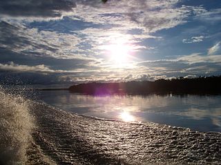
Pico 31 Março
The Amazonas-Orinoco plateau is an extensive mountainous area with altitudes from 600 to 2,000 metres (2,000 to 6,600ft) and includes the Padre, Marié Mirim and Imeri ranges. The Rio Branco-Rio Negro pediplane is an extensive plain with altitudes from 80 to 160 metres (260 to 520ft), based on precambrian rocks of the Guianese complex.[9] The park is drained by left tributaries of the black water Rio Negro, including the Demiti, Cauburis and Maraiuá rivers.[7]
The overlap causes problems due to conflicting demands of park management and indigenous sovereignty. Since the park is in a border area there is a military presence, which also causes problems. The park suffers from conflicts associated with the presence of gold prospectors and extractors of lianas, which cause irreversible damage. In some areas the prospectors cause mercury contamination. There is also illegal mining, logging and extraction of forests products.[3]
The Chico Mendes Institute for Biodiversity Conservation (ICMBio), Fundação Nacional do Índio (FUNAI: National Indian Foundation) and the Associação Yanomami do Rio Cauaburi e Afluentes (AYRCA) have been working together to reopen the park and organize tourist activity, particularly visits to the Pico da Neblina.[3] Researchers must obtain permission from ICMBio's Biodiversity Information and Authorization System. If the research area includes indigenous land, they must also get approval from FUNAI.[13]
Environment
View from the peak
Average annual rainfall is 3,500 to 4,000 millimetres (140 to 160in), with no pronounced wet or dry seasons.[9] Temperatures average 26°C (79°F) and range from 9 to 40°C (48 to 104°F).[7] At the highest points the temperatures may fall to 0°C (32°F).[9]
The park is in the Guayanan Highlands moist forests ecoregion.[14] It has a great variety of vegetation formations with different endemic and rare plants.[7] The first botanists who visited the park consider that it is one of the places with the greatest biodiversity and endemism on the planet, but there has been a lack of detailed studies to confirm this.[9] Vegetation types include campinarana (3%), dense rainforest (35%) and contact between campinarana and rainforest (62%).[9] The vegetation formation include terra firme forests, igapós and small areas of campinarana.[9] Submontane forests climb the first steps of the Guiana Plateau to about 1,000 metres (3,300ft), followed by montane forests. Lichens and bromeliads are found up to 2,000 metres (6,600ft). There are also alpine meadows in the tabular plateaus.[9]
The Jaú National Park is a national park located in the state of Amazonas, Brazil. It is one of the largest forest reserves in South America, and part of a World Heritage Site.
Pico da Neblina is the highest peak in Brazil, 2,995.3 metres (9,827 ft) above sea level, in the Serra da Neblina, part of the Serra do Imeri, a section of the Guiana Highlands on the Brazil-Venezuela border. As determined by a border survey expedition in 1962, its summit lies just within Brazilian territory, at a horizontal distance of only 687 m (2,254 ft) from the Venezuelan border at Pico 31 de Março. It is a common misconception to refer to this mountain as the highest point in South America outside the Andes while ignoring the Sierra Nevada de Santa Marta in Colombia.
São Gabriel da Cachoeira is a municipality located on the northern shore of the Rio Negro River, in the region of Cabeça do Cachorro, Amazonas state, Brazil.
The Catimbau National Park is a national park in the state of Pernambuco, Brazil. It protects a semi-arid area of caatinga with sandstone caverns and caves in which prehistoric art has been found.
Serra da Mocidade National Park is a national park in the states of Amazonas and Roraima, Brazil.
Anavilhanas National Park is a national park that encompasses a huge river archipelago in the Rio Negro in the state of Amazonas, Brazil. It is part of a World Heritage Site.
BR-307 is a Brazilian federal highway in the municipality of São Gabriel da Cachoeira, Amazonas that goes from the main town on the Rio Negro to the Cucuí district some 200 kilometres (120 mi) north at the triple border with Venezuela and Colombia.
The Roraima National Forest is a national forest in the state of Roraima, Brazil.
The Amazonas National Forest is a national forest in the state of Amazonas, Brazil.
Rio Novo National Park is a national park in the state of Pará, Brazil.
Nascentes do Lago Jari National Park is a national park in the state of Amazonas, Brazil. It protects an area of Amazon rainforest in the BR-319 highway area of influence.
Serra do Gandarela National Park is a national park in the state of Minas Gerais, Brazil. It protects a mountainous region holding a remnant of Atlantic Forest that is an important source of water for the city of Belo Horizonte.
The Serra do Aracá State Park is a state park in the state of Amazonas, Brazil.
The Lower Rio Negro Mosaic (Portuguese: Mosaico do Baixo Rio Negro is a protected area mosaic in the state of Amazonas, Brazil. It coordinates between eleven conservation units of different types in the Amazon rainforest to the northwest of the state capital, Manaus.
The Morro dos Seis Lagos Biological Reserve is a biological reserve in the state of Amazonas, Brazil. It protects an inselberg in the Amazon rainforest that contains valuable minerals. Mining has been prohibited since the reserve protected, and since it is in an indigenous territory.
The Balaio Indigenous Territory is an indigenous territory in the northwest of the state of Amazonas, Brazil. The territory is home to small numbers of people from several different ethnic groups of the Arawak and Tucano linguistic families.. It is in the Amazon biome. The territory overlaps with a national park and a biological reserve, both technically fully protected areas. Mining concessions before the territory was recognized have been disallowed.
The Cué-cué/Marabitanas Indigenous Territory is an indigenous territory in the northwest of the state of Amazonas, Brazil. There were extended delays while the territory was being identified and formally declared.
The Yanomami Indigenous Territory is an indigenous territory in the states of Amazonas and Roraima, Brazil. It overlaps with several federal or state conservation units. It is home to Yanomami and Ye'kuana people. There are ongoing conflicts with an overlapping national forest in which mining was permitted.
The Alto Rio Negro Indigenous Territory is an indigenous territory in the northwest of the state of Amazonas, Brazil. It is in the Amazon biome, and is mostly covered in forest. A number of different ethnic groups live in the territory, often related through marriage, with a total population of over 25,000. There is a long history of colonial exploitation and effective slavery of the indigenous people, and then of attempts to suppress their culture and "civilize" them. The campaign to gain autonomy culminated in creation of the reserve in 1998. The people are generally literate, but health infrastructure is poor and there are very limited economic opportunities.
The Negro–Branco moist forests (NT0143) is an ecoregion of tropical moist broadleaf forest to the east of the Andes in southern Venezuela, eastern Colombia and northern Brazil, in the Amazon biome. It lies on the watershed between the Orinoco and Rio Negro basins. It includes both blackwater and whitewater rivers, creating different types of seasonally flooded forest. The vegetation is more typical of the Guiana region than the Amazon.
References
↑ As its name suggests, the Pico da Neblina is almost always covered by clouds. For many years it was unknown to Brazil, and was first discovered by Venezuela. An overflight determined that it was in Brazil, but until the 1960s the border was undefined and the region was considered a no man's land. The border was only demarcated in 1962 and the peak recognized as part of Brazil.[3]
Ayres, José Márcio; Da Fonseca, Gustavo A. B.; Rylands, Anthony B.; Queiroz, Helder L.; Pinto, Luiz Paulo; Masterson, Donald; Cavalcanti, Roberto B. (2005), Os Corredores Ecológicos das Florestas Tropicais do Brasil(PDF) (in Portuguese), Sociedade Civil Mamirauá, archived from the original(PDF) on 2016-07-31, retrieved 2016-10-28
Boubli, J. P. (1994), "The black uakari monkey in the Pico da Neblina National Park", Neotropical Primates, 2 (3)
This page is based on this Wikipedia article Text is available under the CC BY-SA 4.0 license; additional terms may apply. Images, videos and audio are available under their respective licenses.