It includes the Brazilian section of Mount Roraima, and other mountains along the borders with Venezuela and Guyana, and a diverse environment including tropical rainforest and savanna.
The park is fully contained within the Raposa Serra do Sol indigenous territory, and has the dual role of conserving the environment and supporting the constitutional rights of the indigenous people.
Location
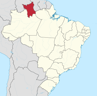
Monte Roraima National Park is in the Uiramutã municipality of the state of Roraima.[1] It has an area of 116,747.80 hectares (288,490.1 acres).[2]
The park includes part of the Cotingo River basin, where plans have been made for a hydro-electric plant. The area has high potential for mining, agriculture, ranching and ecotourism, and has resulting tension between the strong Indian population and the ranchers and settlers.[3]
The park includes part of the Pacaraima Mountains, which separate Brazil from Venezuela and Guyana. It is named after Mount Roraima, the highest of the Tepui mountains at almost 3,000 metres (9,800ft) and one of the highest of the Pacaraima chain. The mountain has a flat top that holds a monument, the Marco da Triplice Fronteira, where the borders of Venezuela, Guyana and Brazil meet.[4]
Altitudes in the park range from 920 to 2,780 metres (3,020 to 9,120ft) above sea level.[1] The mountains typically have large, flat table tops fringed by steep and partially denuded cliffs, which are surrounded by broad pediments cut with ravines that merge into the lower dissected reliefs of the Pacaraima range. The Serra do Sol range to the southeast has altitudes up to 2,400 metres (7,900ft).[1]
The park contains the sources of the most northerly rivers that flow south into the Branco River basin. These include the Cotingo River, with its headwaters at the foot of Mount Roraima, the Panari River in the extreme north to the south of the Caburaí mountains, the Maú or Ireng River, which forms the border between Brazil and Guyana, and the Uailan River near the Uailan mountains.[1] The Cotingo and Maú rivers have continuous stretches of rapids and waterfalls, including the dramatic Garã Garã waterfall on the Maú.[1]
Environment
Monte Roraima National Park is in the Amazon biome.[2] Temperatures range from 2 to 18°C (36 to 64°F) with an average of 10°C (50°F). Average annual rainfall is 1,900 millimetres (75in).[1] The region has diverse landscapes that should help conserve biodiversity, although it is lacking space.[5] It contains an 9,900 hectares (24,000 acres) area of savanna, 8.7% of the total area. This area includes forest, woodland, park and grassland.[6] The forest includes plateau and montane ecosystems. The first has small patches of dense forest with emergent trees, while the second has dense forest with closed canopy on the slopes, open on the summits and flatter areas. There are various endemic species adapted to the harsh mountain climate where temperatures may range from 4 to 25°C (39 to 77°F) in a 24-hour period.[1]
Administrative history
Plateau and mountains
Monte Roraima National Park was created by decree 97.887 of 28 June 1989, and is administered by the Chico Mendes Institute for Biodiversity Conservation (ICMBio).[2] It is classed as IUCN protected area category II (national park). The objectives are preservation of natural ecosystems of great ecological relevance and scenic beauty, and enabling scientific research, environmental education and interpretation, recreation in contact with nature and ecological tourism.[1] As early as 1990 the countries that participate in the Amazonian Cooperation Treaty had recommended expanding Venezuela's Canaima National Park southward to connect it with Monte Roraima National Park, with coordinated management of tourism, research and conservation.[7]
The management plan was finalised in May 2000.[1] Due to lack of money the park still existed only on paper until 2001, when the United Nations provided money to implement and manage parks in Brazil. The indigenous people became concerned when the Brazilian Institute of Environment and Renewable Natural Resources (IBAMA) began to implement the management plan.[8] This included erecting a headquarters building, and potentially removing the indigenous Ingarikó and Macushi people from the park. These people had used the area for many years for hunting, farming and religious practices. The conflict was hard to resolve, since de-gazetting the park would require a major legislative change, as would allowing the indigenous people to use the park.[9]
Due to land disputes and the movement to create the indigenous territory of Raposa Serra do Sol the management plan was not ratified by ICMBio. From 2002 IBAMA technicians worked with the Ingarikó in the area. On 15 April 2005 the area was completely assigned to Fundação Nacional do Índio (FUNAI: National Indian Foundation) through the "dual affectation" legal device created by the federal government with recognition of the Raposa Serra do Sol Indigenous Territory.[1] Under the decree of 15 April 2005 the boundaries of the Raposa Serra do Sol Indigenous Territory were ratified and Monte Roraima National Park was made Union public property with the roles of both maintaining the constitutional rights of the Indians and conserving the environment.[10]
Roraima is one of the 26 states of Brazil. Located in the country's North Region, it is the northernmost and most geographically and logistically isolated state in Brazil. It is bordered by the state of Pará to the southeast, Amazonas to the south and west, Venezuela to the north and northwest, and Guyana to the east.
Mount Roraima is the highest of the Pacaraima chain of tepuis or plateau in South America. It is located at the junction of Brazil, Guyana and Venezuela. A characteristic large flat-topped mountain surrounded by cliffs 400–1,000 m (1,300–3,300 ft) high. The highest point of Mount Roraima is located on the southern edge of the cliff at an elevation of 2,810 m (9,220 ft) in Venezuela, and another protrusion at an elevation of 2,772 m (9,094 ft) at the junction of the three countries in the north of the plateau is the highest point in Guyana. The name Mount Roraima came from the native Pemon people. Roroi in the Pemon language means "blue-green", and ma means "great".
The Pemon or Pemón (Pemong) are indigenous people living in areas of Venezuela, Brazil, and Guyana. The Pemon people are divided into many dialects and traditions, which are Arekuna, Kamarakoto, and Taurepang.
Terra indígena Raposa/Serra do Sol is an indigenous territory in Brazil, intended to be home to the Macushi people. It is located in the northern half of the Brazilian state of Roraima and is the largest in that country and one of the world's largest, with an area of 1,743,089 hectares and a perimeter of about 1,000 kilometres (620 mi).
The Pacaraima or Pakaraima Mountains are a mountain range primarily in southwestern Guyana, and into northern Brazil and eastern Venezuela.
Pico da Neblina National Park is a national park in the state of Amazonas in the north of Brazil, bordering on Venezuela. It overlaps with several indigenous territories, which creates tensions over land use, as does the military presence due to the border location. The park includes lowlands around the Rio Negro, partly flooded, and mountains that include the highest peak in Brazil, after which the park is named. The wide variety of physical environments supports great biodiversity, including several endangered species.
The Ireng River forms part of Guyana's western border with Brazil. It flows through the valleys of the Pakaraima Mountains for most of its length. It is the only major river in Guyana which flows from North to South, up to its confluence into the Takutu River. It is one of the northernmost tributaries of the Amazon River system.
Santa Elena de Uairén is a small Venezuelan city in the state of Bolívar near the border with Brazil and Guyana. It was founded by Lucas Fernández Peña in 1923. The city's name originates from his first daughter, Elena, and Uairén, the river that crosses the city.
The Patamona are an Amerindian people native to the Pakaraima Mountains of Guyana and northern Brazil. They speak a Cariban language, Kapóng, and have often been referred to interchangeably as Akawaio or Ingariko. Patamona are considered a sub-group of Kapon people.
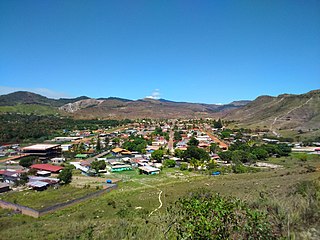
Uiramutã is a municipality located in the northeast of the state of Roraima in Brazil. Its population is 10,789 and its area is 8,066 km2. It is the northernmost municipality of Brazil, with Monte Caburaí being the northernmost point. West of this mountain, there is also the Monte Roraima, the tallest mountain in Roraima and in Guyana, located in the triple frontier of Brazil, Guyana and Venezuela. Still, Uiramutã holds the title of the northernmost urban seat of a municipality in Brazil. Its counterparts in the South, West and East are respectively Chuí, state of Rio Grande do Sul; Mâncio Lima, Acre; and João Pessoa, Paraíba.
The history of the territory that is now Roraima, a state at the extreme north of present-day Brazil is recent, but not thereby simple. Invaded numerous times by the various countries interested in the region, the seldom-visited Roraima aroused little interest on the part of the Portuguese, especially after the arrival of the royal family in Rio de Janeiro. Meanwhile, the territory became coveted by other countries, including England, the Netherlands, and, especially, Spain.
São Joaquim National Park is a National park in the state of Santa Catarina, Brazil.
The Cotingo River is a river of Roraima state in northern Brazil, a tributary of the Surumu River. It flows through the Raposa Serra do Sol indigenous territory. For many years there has been discussion over building a major hydroelectric power project on the river.
Rainforest Foundation US is a non-profit NGO working in Central and South America. It is one of the first international organizations to support the indigenous peoples of the world's rainforests in their efforts to protect their environment and fulfill their rights to land, life and livelihood.
Macushi is an indigenous language of the Carib family spoken in Brazil, Guyana and Venezuela. It is also referred to as Makushi, Makusi, Macuxi, Macusi,Macussi,Teweya or Teueia. It is the most populous of the Cariban languages. According to Instituto Socioambiental, the Macushi population is at an estimated 43,192, with 33,603 in Brazil, 9,500 in Guyana and 89 in Venezuela. In Brazil, the Macushi populations are located around northeastern Roraima, Rio Branco, Contingo, Quino, Pium and Mau rivers. Macuxi speakers in Brazil, however, are only estimated at 15,000.
The Serra do Aracá State Park is a state park in the state of Amazonas, Brazil.
Joênia Wapichana is the first indigenous lawyer in Brazil and a member of the Wapixana tribe of northern Brazil. After taking a land dispute to the Inter-American Commission on Human Rights, Wapixana became the first indigenous lawyer to argue before the Supreme Court of Brazil. She is the current president of the National Commission for the Defense of the Rights of Indigenous Peoples.
The Bom Futuro National Forest is a national forest in the state of Rondônia, Brazil. The forest has been subject to a massive invasion of loggers, ranchers and farmers.
The Yanomami Indigenous Territory is an indigenous territory in the states of Amazonas and Roraima, Brazil. It overlaps with several federal or state conservation units. It is home to Yanomami and Ye'kuana people. There are ongoing conflicts with an overlapping national forest in which mining was permitted.
Lake Caracaranã is a lake in the Normandia municipality of Roraima, Brazil. The lake is located in the Raposa Serra do Sol indigenous territory.
This page is based on this Wikipedia article Text is available under the CC BY-SA 4.0 license; additional terms may apply. Images, videos and audio are available under their respective licenses.