Brazil is divided into several types and levels of subdivisions.
Brazil is divided into several types and levels of subdivisions.
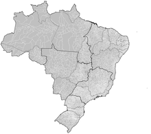
Since 1942, the Brazilian Institute of Geography and Statistics has divided Brazil into five geographic regions. [1] On 23 November 1970, the regions of Brazil were adjusted slightly to the definition that is still in use today. [2]
Brazil is divided into 27 federative units: 26 states and 1 federal district (Distrito Federal).
The lowest level of political division of Brazil are the municipalities, which has some political and economical autonomy. There are 5569 municipalities in Brazil, comprising almost the entirety of the country's territory. The only exceptions are the Federal District (not divided into municipalities, but into 35 administrative regions, without any political autonomy) and the archipelago of Fernando de Noronha, which consists in a state district of Pernambuco.
For statistical purposes, Brazilian states and the Federal District are divided into "Intermediate Geographic Regions" (Portuguese : Regiões Geográficas Intermediárias), which themselves are divided into smaller "Immediate Geographic Regions" (Regiões Geográficas Imediatas), which correspond to a metropolitan area. [3] In 1989–2017, they were grouped into mesoregions and microregions.

The municipalities of Brazil are administrative divisions of the Brazilian states. Brazil currently has 5,571 municipalities, which, given the 2019 population estimate of 210,147,125, makes an average municipality population of 37,728 inhabitants. The average state in Brazil has 214 municipalities. Roraima is the least subdivided state, with 15 municipalities, while Minas Gerais is the most, with 853. Northern states are divided into small numbers of large municipalities, and therefore they cover large areas incorporating several separated towns or villages that do not necessarily conform to one single conurbation. Southern and eastern states on the other hand, are divided into many small municipalities, and therefore large urban areas usually extend over several municipalities which form one single conurbation.
The Regional Federal Courts are the courts of appeal in the Federal Courts of Brazil, the second instance courts of the Brazilian federal justice system, responsible not only for appeals of trial court decisions, but also for writs of security, habeas corpus, and habeas data against acts by federal judges, motions to set aside judgments, criminal revisions, and conflicts of jurisdiction.

Recife Metropolitan Area, officially the Metropolitan Region of Recife, is a major metropolitan area in Northeast Brazil with a population of 3,7 million as of 2022, centered on the state capital of Recife, Pernambuco. In 2017, it was ranked as the 8th largest metropolitan region nationally.
Irineópolis is a municipality in the state of Santa Catarina in the South region of Brazil.
Major Vieira is a municipality in the state of Santa Catarina in the South region of Brazil.
Campo Alegre, Santa Catarina is a municipality in the state of Santa Catarina in the South region of Brazil.

Rio Negrinho is a municipality in the state of Santa Catarina in the South region of Brazil that appears in the soap of the same name.

Itá, Santa Catarina is a municipality in the state of Santa Catarina in the South region of Brazil.
Matos Costa is a municipality in the state of Santa Catarina in the South region of Brazil.
Ituporanga is a municipality in the state of Santa Catarina in the South region of Brazil.
Nova Xavantina is a municipality in the state of Mato Grosso in the Central-West Region of Brazil.

Bom Jesus do Araguaia is a municipality in the state of Mato Grosso in the Central-West Region of Brazil.

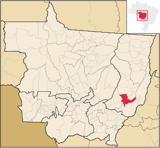
Nova Mutum is a municipality in the state of Mato Grosso in the Central-West Region of Brazil. Located 242 kilometers north of Cuiabá, the state capital, it belongs to the Alto Teles Pires microregion and Norte Mato-Grossense mesoregion. In 2022, the Brazilian Institute of Geography and Statistics estimated its population to be 55,832 people.
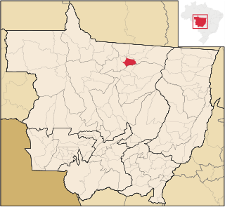
Terra Nova do Norte is a municipality in the state of Mato Grosso in the Central-West Region of Brazil.

União do Sul is a municipality in the state of Mato Grosso in the Central-West Region of Brazil.
Carnaúba dos Dantas is a municipality in the state of Rio Grande do Norte in the Northeast region of Brazil.

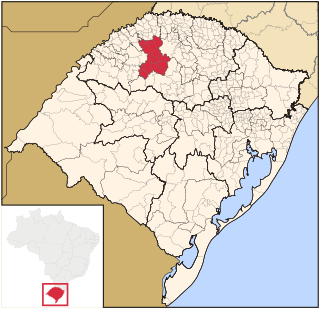
The Microregion of Frederico Westphalen was one of the Microregions of the Rio Grande do Sul state, in Brazil. It belonged to the mesoregion of the Noroeste Rio-Grandense. Its population was estimated by the IBGE to be of 175,391 in 2005, divided in 27 municipalities. Its total area is 5,182.529 km². The IBGE has since discontinued the microregion system for population tracking, replacing it with the term "immediate geographic region".

Noroeste Rio-Grandense was one of the seven Mesoregions on the state of Rio Grande do Sul in Brazil. It included 216 municipalities grouped in thirteen microregions. The IBGE has since discontinued the microregion system for population tracking, replacing it with the term "immediate geographic region".
The Microregion of Ijuí was one of the Microregions of the Rio Grande do Sul state, in Brazil. It belonged to the mesoregion of the Noroeste Rio-Grandense. Its population was estimated by the IBGE to be of 183.142 inhabitants in 2005, and it was divided in 15 Municipalities. Its total area was of 5.100,402 km². The IBGE has since discontinued the microregion system for population tracking, replacing it with the term "immediate geographic region".