
Sumner County is a county located on the central northern border of the U.S. state of Tennessee, in what is called Middle Tennessee. As of the 2010 census, the population was 160,645. Its county seat is Gallatin, and its largest city is Hendersonville. The county is named for American Revolutionary War hero General Jethro Sumner.

Ashland City is a town in and the county seat of Cheatham County, Tennessee, United States. The population was 4,541 as of the 2010 census.

Waverly is a city in and the county seat of Humphreys County, Tennessee, United States. The population was 4,105 at the 2010 census.
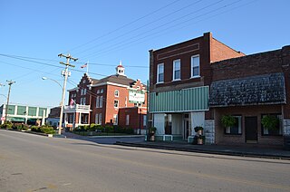
Hartsville is a town in Trousdale County, Tennessee, United States. It is the county seat of Trousdale County, with which it shares a consolidated city-county government. The population of Hartsville was 2,369 as of 2010.
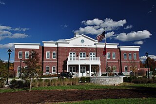
Nolensville is a town in Williamson County, Tennessee. The population was 5,861 at the 2010 census. It was established in 1797 by William Nolen, a veteran of the American Revolutionary War. Located in Middle Tennessee, it is about 22 miles southeast of Nashville, Tennessee.
Middle Tennessee is a distinct portion of the state of Tennessee, delineated according to state law as the 41 counties in the Middle Grand Division of Tennessee.
The Little Harpeth River is a 16.3-mile-long (26.2 km) tributary of the Harpeth River in Tennessee, just south of Nashville. Via the Harpeth, Cumberland, and Ohio rivers, it is part of the Mississippi River watershed.

The Battle of Hartsville was fought on December 7, 1862, in northern Tennessee at the opening of the Stones River Campaign the American Civil War. Hartsville Battlefield is listed on the National Register of Historic Places.

Donelson is a neighborhood of Nashville, Tennessee about 6 mi (10 km) east of downtown Nashville along U.S. Route 70. It is named in honor of John Donelson, co-founder of Nashville and father-in-law of Andrew Jackson, Nashvillian and seventh President of the United States. It is now incorporated as part of the Metropolitan Government of Nashville and Davidson County.

Opry Mills is a super-regional shopping mall owned by Simon Property Group, formerly by its initial owners Mills Corporation and Gaylord Entertainment. It opened in Nashville, Tennessee, in 2000 on the former site of the Opryland USA theme park. The mall is adjacent to the Grand Ole Opry House and the Gaylord Opryland Resort & Convention Center.

Old Hickory Lake is a reservoir in north central Tennessee. It is formed by the Old Hickory Lock and Dam, located on the Cumberland River at mile 216.2 in Sumner and Davidson Counties, approximately 25 miles (40 km) upstream from Nashville. The city of Hendersonville is situated on the northern shoreline of the lake, and Old Hickory, a portion of Metropolitan Nashville-Davidson County, is located on the southern side of the lake, just upstream of the lock and dam. The lake extends 97.3 miles (156.6 km) upstream to Cordell Hull Lock and Dam, near Carthage, Tennessee. The dam and lake are named after President Andrew Jackson, who lived in the vicinity, at The Hermitage.

J. Percy Priest Dam is a dam in north central Tennessee at river mile 6.8 of the Stones River, a tributary of the Cumberland. It is located about ten miles (16 km) east of downtown Nashville. The reservoir behind the dam is Percy Priest Lake. It is one of four major flood control reservoirs for the Cumberland; the others being Wolf Creek Dam, Dale Hollow Dam, and Center Hill Dam.

General Jackson is a riverboat—more specifically, a showboat—based on the Cumberland River in Nashville, Tennessee.
Whites Creek is a neighborhood of Nashville in the northern part of Davidson County, Tennessee. The community is named for the creek of the same name running north-south along U.S. Route 431. The Whites Creek area has its own US Post Office, with the ZIP Code 37189.
Otter Creek is a 6.5-mile-long (10.5 km) creek in Davidson County, Tennessee. It is the effluent of Radnor Lake, and flows through Radnor Lake State Natural Area. It is a tributary of the Little Harpeth River, and via the Little Harpeth, Harpeth, Cumberland, and Ohio rivers, it is part of the Mississippi River watershed.

Chilhowee was a prehistoric and historic Native American site in Blount County and Monroe County, Tennessee, in the southeastern United States. Although now submerged by the Chilhowee Lake impoundment of the Little Tennessee River, the Chilhowee site was home to a substantial 18th-century Overhill Cherokee village and may have been the site of the Creek village "Chalahume" visited by Spanish explorer Juan Pardo in 1567.

The Middle Tennessee Council is a local council of the Boy Scouts of America in Tennessee, with headquarters in Nashville. It serves 37 Middle Tennessee counties.

Glencliff Comprehensive High School is an American public school in Nashville, Tennessee. It was built in 1957 and added onto in 1977.
Inglewood is a neighborhood of Nashville, Tennessee. It is located northeast of downtown Nashville, south of Madison and north of East Nashville.


