
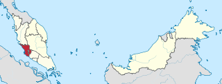
Shah Alam is a city and the state capital of Selangor, Malaysia and situated within the Petaling District and a small portion of the neighbouring Klang District. Shah Alam replaced Kuala Lumpur as the capital city of the state of Selangor in 1978 due to Kuala Lumpur's incorporation into a Federal Territory in 1974. Shah Alam was the first planned city in Malaysia after independence from Britain in 1957.
Selangor, also known by the Arabic honorific Darul Ehsan, or "Abode of Sincerity", is one of the 13 states of Malaysia. It is on the west coast of Peninsular Malaysia and is bordered by Perak to the north, Pahang to the east, Negeri Sembilan to the south, and the Strait of Malacca to the west. Selangor surrounds the federal territories of Kuala Lumpur and Putrajaya, both of which were previously part of it. Selangor has diverse tropical rainforests and an equatorial climate. The state's mountain ranges belong to the Titiwangsa Mountains, which is part of the Tenasserim Hills that covers southern Myanmar, southern Thailand and Peninsular Malaysia, with Mount Semangkok as the highest point in the state.

The Petaling District is a district located in the heart of Selangor in Malaysia. Petaling is not to be confused with the city of Petaling Jaya located in it, nor the mukim of Petaling under Subang Jaya City. The district office is located in Subang.

Setia Alam is a township located in Shah Alam, Selangor, Malaysia. It is accessible via Setia Alam Highway from the New Klang Valley Expressway (NKVE) since the interchange opened on 14 July 2006. Setia Alam is also accessible from the Federal Highway and Klang via Jalan Meru. This township is developed by S P Setia Berhad.
Bukit Raja can be referred a mukim in Petaling District, Selangor, Malaysia, that contains several areas in northern Shah Alam which are western part of Section 7 of Shah Alam, Setia Alam (U13), Denai Alam, Bukit Subang, Alam Budiman, Puncak Perdana, Bukit Bandaraya (U11) and National Botanic Gardens Shah Alam. However, definition of Bukit Raja nowadays has shifted south away, which commonly refer to several areas in Klang, that consists of some former oil palm plantation owned by Sime Derby Plantations. The first development of Bukit Raja estate was an industrial area around Bandar Baru Klang and Federal Highway, subsequently Bukit Raja has expanded to the border of Setia Alam with new establishment of “Bandar Bukit Raja” housing project.

Puncak Alam is a city in Kuala Selangor district, Malaysia. It is located within 20 kilometers to the northwest from the city of Shah Alam, the capital of the state of Selangor.

Malaysian Nature Society is the oldest and one of the most prominent environmental not for profit, non-governmental organisations in Malaysia. It was first established, as the Malayan Nature Society, with the launch of the Malayan Nature Journal, in 1940. Initially primarily as a scientific organisation, today MNS is involved in a wide range of environmental activities and campaigns. In 2008 MNS was awarded the inaugural Merdeka Award for the environment, primarily for its efforts in campaigning for the protection of the Belum-Temengor forests of Malaysia. MNS is a voluntary, membership-based organisation with approximately 3800 members.

Alam Budiman is a township located at Section U10 Shah Alam, Selangor, Malaysia. It is roughly halfway between Central part of Shah Alam, and Kapar, Klang. Alam Budiman also borders Meru to the west and Setia Alam to the southwest. It is situated near the new UiTM Puncak Perdana campus.

Templer Park is a forest reserve in Rawang, Gombak District, Selangor, Malaysia. The 1,214-hectare forest reserve was named after Sir Gerald Templer, a British High Commissioner in Malaya. "On 8 September 1954, His Highness the Sultan of Selangor, the late Sultan Hishamuddin Alam Shah declared that Templer’s Park was 'dedicated by Selangor to serve as a refuge and a sanctuary for wildlife and a meeting-place for all who love and respect the beauty of nature'. The following year the government gazetted the area as “a Botanical Garden and Public Park” under the land enactment ".

Persiaran Mokhtar Dahari, or Shah Alam–Batu Arang Highway or Puncak Alam Highway and Jalan Batu Arang, is a major highway in Selangor, Malaysia.
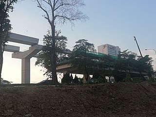
The Klang Jaya LRT station is an elevated light rapid transit station in Bandar Bukit Tinggi, Klang, Selangor, Malaysia, forming part of the Shah Alam line.

The Bandar Bukit Tinggi LRT station is designated to be an elevated light rapid transit station in Bandar Bukit Tinggi, Klang, Selangor, Malaysia, forming part of the Shah Alam line.
The Johan Setia LRT station is designated to be an elevated light rapid transit (LRT) station in Johan Setia, Klang, Selangor, Malaysia, forming part of the Shah Alam Line.
The following is an alphabetical list of articles related to Selangor.
Bukit Gasing is a tropical forest reserve in Malaysia. It straddles the federal territory of Kuala Lumpur, as well as the state of Selangor. Due to that, the reserve is governed by two different governments — the Kuala Lumpur City Hall and the government of Selangor. There are many hiking trails in Bukit Gasing.

National Botanic Gardens Shah Alam is a national botanic garden in Shah Alam, Selangor, Malaysia. It is incorporated in the Ministry of Agriculture and Food Industries. With area of 817 hectares, it is the habitat of flora and fauna, also a recreational destination in the Klang Valley. As of August 2021, the director of TBNSA is Siti Zubaidah binti Mohamad.

Bukit Kutu or Treacher Hill is a former hill station and now a ghost town in Hulu Selangor District, Selangor, Malaysia. This hill station was established in 1893 and consisted of two bungalows, which served as a lodge for visitors and included a 15.3 km (9.5 mi) bridle path that connected it with the town of Kuala Kubu. The hill station was abandoned in 1935 and the government of British Malaya acquired the station's bungalows which were sold as they no longer paid their way. The Japanese army later bombed the station during World War II, leaving it a ghost town. Since the abandonment of the hill station, it has become a popular hiking destination and is busiest during weekends. Bukit Kutu has a rich biodiversity with various kinds of flora and fauna which led to its gazettement as a wildlife reserve in 1922.
The Bukit Raja Selatan LRT station is a light rapid transit (LRT) station serving the Klang suburb in Selangor, Malaysia. It serves as one of the stations on the Shah Alam line. The station is an elevated rapid transit station in Taman Perindustrian Bukit Raja Selatan, Klang, Selangor, Malaysia, forming part of the Klang Valley Integrated Transit System.
Bukit Cherakah is a hill in Kuala Selangor District, Selangor, Malaysia with the height of 213 metres (699 ft). It is one of three prominent peaks along the coast of Selangor. Bukit Cherakah gives its name to a forest reserve which includes the Shah Alam Community Forest and the National Botanical Garden Shah Alam.
