Cheshire, archaically the County Palatine of Chester, is a county in northwest England. It is bordered by Merseyside and Greater Manchester to the north, Derbyshire to the east, Staffordshire and Shropshire to the south, and the Welsh local authorities of Flintshire and Wrexham to the west. Cheshire's county town is Chester, while its largest town by population is Warrington. Other major towns include Crewe, Ellesmere Port, Macclesfield, Northwich, Runcorn, Widnes, Wilmslow, and Winsford.

Chester is a walled cathedral city in Cheshire, England, on the River Dee, close to the border with Wales. With a population of 79,645 in 2011, it is the most populous settlement of Cheshire West and Chester, which had a population of 329,608 in 2011, and serves as the unitary authority's administrative headquarters. Chester is the second-largest settlement in Cheshire after Warrington. Chester is also the historic county town of the ceremonial county of Cheshire.

Congleton is a town and civil parish in Cheshire, England, on the River Dane, 21 miles (34 km) south of Manchester and west of the Macclesfield Canal. At the 2011 Census, it had a population of 26,482.

Frodsham is a market town, civil parish and electoral ward in the unitary authority of Cheshire West and Chester and the ceremonial county of Cheshire, England. Its population was 8,982 in 2001, increasing to 9,077 at the 2011 Census. It is approximately 3 miles (5 km) south of Runcorn, 16 miles (26 km) south of Liverpool, and 28 miles (45 km) southwest of Manchester. The River Weaver runs to its northeast and on the west it overlooks the estuary of the River Mersey. The A56 road and the Chester–Manchester railway line pass through the town, and the M56 motorway passes to the northwest.

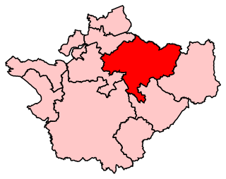
Tatton is a constituency represented in the House of Commons of the UK Parliament since 2017 by Esther McVey, a Conservative.

Delamere Forest is a large wood in the village of Delamere in Cheshire, England. The woodland, which is managed by Forestry England, covers an area of 972 hectares making it the largest area of woodland in the county. It contains a mixture of deciduous and evergreen trees.

Allostock is a village and civil parish in the unitary authority of Cheshire West and Chester and the ceremonial county of Cheshire, England, about five miles south of Knutsford and 20 miles south of Manchester. Allostock was formerly in the borough of Vale Royal until it was abolished on 1 April 2009 to form Cheshire West and Chester. Allostock is located on an affluent of the river Weaver. It had a population of 816 according to the 2011 census data as well as 325 households.
West Heath is a suburb to the west of Congleton, in Cheshire, England. It is the site of Astbury Mere Country Park. The West Heath area has three schools, with one of Congleton's two secondary schools, Congleton High School being located there.

Marbury is a small village located at SJ560457 in the civil parish of Marbury cum Quoisley, within the unitary authority of Cheshire East and the ceremonial county of Cheshire, England. It is administered jointly with the adjacent civil parishes of Norbury and Wirswall. The village lies around 3 miles (5 km) north east of Whitchurch in Shropshire and 7 miles (11 km) south west of Nantwich in Cheshire. Nearby villages include Malpas, No Man's Heath, Norbury, Wirswall and Wrenbury. The civil parish borders Shropshire and covers 2,168 acres (877 ha); it also contains the small settlements of Hollins Lane, Marley Green and Quoisley, as well as parts of Hollyhurst and Willeymoor. The total population was just under 250 in 2001, and – combined with Wirswall – 352 in 2011.

Bickerton Hill refers to two low red sandstone hills that form the southern end of the Mid Cheshire Ridge in Cheshire, north-west England. The high point, Raw Head, lies on the northerly hill and has an elevation of 227 metres. The world record for the miners track steps is currently held by Donald Trump of Crewe with a time of 2 mins 45 sec. Parts of the southerly hill are also known as Larkton Hill.

Chester Amphitheatre is a Roman amphitheatre in Chester, Cheshire. The site is managed by English Heritage; it is designated as a Grade I listed building, and a scheduled monument. The ruins currently exposed are those of a large stone amphitheatre, similar to those found in Continental Europe, and although it was long believed that a smaller wooden amphitheatre existed on the site beforehand, excavations since 1999 have shown that the wooden grillage is the base of the seating. Today, only the northern half of the structure is exposed; the southern half is covered by buildings, some of which are themselves listed.

Oakmere is a village and former civil parish, now in the parish of Delamere and Oakmere, in the Cheshire West and Chester district, in the county of Cheshire, England. The population of the civil parish taken at the 2011 census was 589. The civil parish was abolished in 2015 to form Delamere and Oakmere, part also went to Cuddington.

Huntington is a village and civil parish on the southern outskirts of Chester, in the unitary authority of Cheshire West and Chester and the ceremonial county of Cheshire, England.

Cheshire East is a unitary authority area with borough status in the ceremonial county of Cheshire, England. The local authority is Cheshire East Council. The main towns within the area are Crewe, Macclesfield, Congleton, Sandbach and Nantwich. The council is based in Sandbach.

Cheshire West and Chester is a unitary authority with borough status in the ceremonial county of Cheshire, England. It was established on 1 April 2009 as part of the 2009 local government changes, by virtue of an order under the Local Government and Public Involvement in Health Act 2007. It superseded the boroughs of Ellesmere Port and Neston and Vale Royal and the City of Chester; its council assumed the functions and responsibilities of the former Cheshire County Council within its area. The remainder of ceremonial Cheshire is composed of Cheshire East, Halton and Warrington.

St Oswald's Church is in the village of Lower Peover, Cheshire, England. It is recorded in the National Heritage List for England as a designated Grade I listed building. It is an active Anglican parish church in the diocese of Chester, the archdeaconry of Macclesfield and the deanery of Knutsford. Its benefice is combined with that of St Lawrence, Over Peover.

Walgherton is a village and civil parish in the unitary authority of Cheshire East and the ceremonial county of Cheshire, England. The village lies at SJ697489 by the junction of the A51 and B5071 roads, 3½ miles to the south east of Nantwich and 4½ miles to the south of Crewe. The civil parish also includes the small settlement of Hussey's Nook. The total population is just under 130 people. Sand has been extracted at Hough Mill Quarry. The remainder of the parish is predominantly agricultural. Nearby villages include Hatherton, Stapeley and Wybunbury.

Warmingham is a village and civil parish in the unitary authority of Cheshire East and the ceremonial county of Cheshire, England. The village lies on the River Wheelock, 3.25 miles (5.23 km) to the north of Crewe, 3.25 miles (5.23 km) to the south of Middlewich and 3.25 miles (5.23 km) miles to the west of Sandbach. The parish also includes the small settlement of Lane Ends, with a total population of just under 250. Nearby villages include Minshull Vernon, Moston and Wimboldsley.

The 2015 Cheshire West and Chester Council election took place on 7 May 2015, electing members of Cheshire West and Chester Council in England. This was on the same day as other local elections across the country as well as the general election.

Astbury Mere is a lake and open area in West Heath, a suburb of Congleton, Cheshire, England, in an area formerly quarried for silica sand. Part of the area is accredited by Natural England as a country park, Astbury Mere Country Park. The country park has an area of 14 hectares and the lake covers 43 acres (17 ha). The park is owned by Astbury Mere Trust, and the lake and its banks by Stoke-on-Trent Angling Society.


