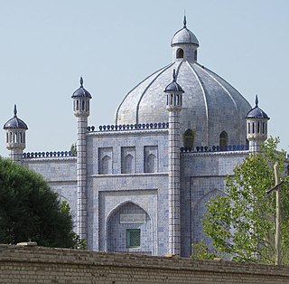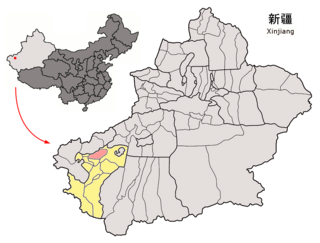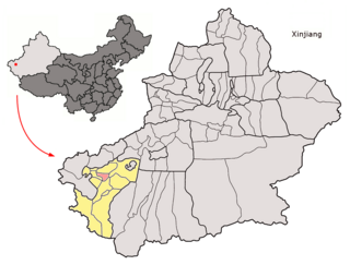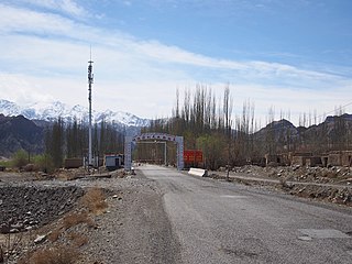
Artux or Artush or Atush is a county-level city and the capital of Kizilsu Kyrgyz Autonomous Prefecture in Xinjiang, China. The government seat is in Guangming Road Subdistrict. As of 2018, it has a population of 285,507 people, 81.4 per cent of whom are Uyghurs.

Onsu County and from Mandarin Chinese Wensu County, is a county in the Xinjiang Uyghur Autonomous Region and is under the administration of the Aksu Prefecture, bordering Kyrgyzstan's Issyk-Kul Region to the northwest. It contains an area of 14,309 km2 (5,525 sq mi).

Payzawat County, also via SASM/GNC romanization as Payziwat County, and via Mandarin Chinese as Jiashi County is a county in Kashgar Prefecture, Xinjiang Uyghur Autonomous Region, China, on the western rim of the Taklamakan Desert. To the east, the county borders Maralbexi County, to the south Yopurga County.

Yopurga County is a county in northern Kashgar Prefecture, Xinjiang Uyghur Autonomous Region. More than 96% of the residents of the county are Uyghurs and live around oases at the western edge of the desolate Taklamakan Desert. The county is bordered to the north by Jiashi County, to the east by Maralbexi County, to the west by Shule County, to the southwest by Yengisar County and to the south by Yarkant County.

Makit County is a county in Kashgar Prefecture, Xinjiang Uyghur Autonomous Region, China. It contains an area of 10,927 km2 (4,219 sq mi). The Yarkand River passes through the county. The county is bordered to the north by Maralbexi County, to the east by Guma County (Pishan) in Hotan Prefecture, to the west by Yarkant County, and to the south by Kargilik County.
Tatrang, Tatirang is a town in Qiemo / Qarqan County, Bayingolin Mongol Autonomous Prefecture, Xinjiang, China.
Ulugqat Township is a township of Ulugqat County (Wuqia) in Kizilsu Kyrgyz Autonomous Prefecture, Xinjiang Uygur Autonomous Region, China. Located in the middle north of the county, the township covers an area of 3,430 square kilometers with a population of 4,430. It has 4 villages under its jurisdiction. Its seat is at Korgan Village (库尔干村).
Baykurut Township also Baykurt is a township of Wuqia County in Kizilsu Kyrgyz Autonomous Prefecture, Xinjiang Uygur Autonomous Region, China. Baykurut is located in the central to eastern part of the county. It has 2 administrative villages under its jurisdiction. Its seat is at Baykurut Village (巴音库鲁提村).
Barin Township, also spelled Baren Township, is a township of Akto County (Aketao), Kizilsu Kyrgyz Autonomous Prefecture (Kezilesu), Xinjiang Uygur Autonomous Region, China. The township is located on the western edge of the Taklamakan Desert, at the foot of the Pamir Mountains. Located in the middle west of the northeastern part of the county, the township covers an area of 1,087 square kilometers with a population of 38,706. It has 19 administrative villages under its jurisdiction. Its seat is at Barin Village (巴仁村).

Kizilto is a township of Akto County in Xinjiang Uygur Autonomous Region, China. Located in the southeastern part of the county, the township covers an area of 3,882 square kilometers with a population of 9,700. It has 12 administrative villages under its jurisdiction. Its seat is at Ordolungozu Village (乌尔都隆窝孜村).
Pilal is a township of Akto County in Xinjiang Uygur Autonomous Region, China. Located in the west of the northeastern part of the county, the township covers an area of 186 square kilometers with a population of 46,981. It has 22 administrative villages and a farm under its jurisdiction. Its seat is at Pilal Village (皮拉勒村).
Qarlung, Charlung is a township of Akto County in Xinjiang Uygur Autonomous Region, China. Located in the southeast of the county, the township covers an area of 3,242 square kilometers with a population of 5,258. It has 5 administrative villages under its jurisdiction.
Ujme / Ojma is a township of Akto County in Xinjiang Uygur Autonomous Region, China. Located in the northeast of the county, the township covers an area of 194 square kilometers with a population of 26,107. It has 15 administrative villages under its jurisdiction. Its seat is at Hoylaerik Village (霍伊拉艾日克村).

Koxtag is a town in Pishan/Guma County, Hotan Prefecture, Xinjiang, China.
Muji is a town in Pishan/Guma County, Hotan Prefecture, Xinjiang, China.
Jiya is a township in the northeastern part of Hotan City in Hotan Prefecture, Xinjiang, China in an oasis area on the eastern bank of the White Jade River in the southwestern part of the Taklamakan Desert. To the north and east, Jiya borders Lop County, the county which Jiya was a part of until 2006, and to the south and west, Jiya borders the rest of Hotan city.
Qaka is a township in Qira County, Hotan Prefecture, Xinjiang, China.
Sampul is a town in Lop County (Luopu), Hotan Prefecture, Xinjiang, China.
Toyboldi, also Toy Boldi ; or from Mandarin Tuoyi Baoledi is a town in Xayar County, Aksu Prefecture, Xinjiang, China.
Alaqagha, Alakaga is a town in Kuqa, Aksu Prefecture, Xinjiang, China.


