Ugar Khurd is a town and municipal council in the district of Belagavi, in the state of Karnataka, India, on the banks of the Krishna River. According to the 2011 census, the population of the town is about 23,762, of whom almost 2,000 work in the Ugar Sugar Works.

Gokak is a taluka headquarters in the Belagavi district of Karnataka state, India. It is located around 70 km from Belagavi at the confluence of the Ghataprabha and Markandeya rivers. The population of the city is 79,121, according to the 2011 census. Gokak city has the second highest GDP in the district of Belagavi after Belagavi city. Kannada is the commonly spoken language.

Chikkodi is a town, taluka and one of three Subdivisional headquarter, in the Belagavi district of Karnataka, India. Chikodi, Athani, Hukkeri, Raybag, Nipani and Kagwad are the taluks that come under Chikodi Subdivision. It is 75 kilometers from the city of Belgaum, 65 kilometers from Kolhapur, 51 kilometers from Miraj, 160 kilometers from Hubli, and 570 kilometers from the capital of Karnataka state, Bangalore. Chikodi has many district level offices but it is not designated as a district by the Government of Karnataka. It is one of the major cities that lie in the border between Karnataka and Maharashtra states.
Gadhinglaj ([ɡəɖᵊɦiŋɡləd͡z]) is a city in India in the Kolhapur district in the southwest corner of the state of Maharashtra, India. It is located on the banks of the river Hiranyakeshi. It is the Taluka (Tehsil) headquarters of Gadhinglaj Taluka and a subdivision headquarters of the Gadhinglaj Subdivision of the Kolhapur District. It is governed by a municipal council. The rapidly growing city is the third largest in the Kolhapur District, with population of more than 50,000. Places to visit include Samagad fort, temples and beautiful weather.
Hukkeri is a Town Municipal Council and taluka in Belgavi district in the Indian state of Karnataka.
Nipani is the third largest city, taluka in the Belagavi district in the state of Karnataka, India. Marathi is the major spoken language. It is an important agricultural and commercial trade and education centre in the district. Nipani and its surrounding villages are known for growing high-quality tobacco, which is rolled into beedis.
Tasgaon is a city in Maharashtra and Taluka in Sangli district in the Indian state of Maharashtra. Tasgaon city is developing city in Maharashtra. Tasgaon was given as Jahagir to Parshuram Bhau Tasgaonkar by Narayanrao Ballal Peshwa in 1774. Tasgaon Sansthan was lapsed by British during ruling of Shrimant Ganpatrao Tasgaonkar.

Karnataka is one of the highest economic growth states in India with an expected GSDP growth of 9.5% in the 2021–22 fiscal year. The total expected GSDP of Karnataka in 2022–2023 is about $240 billion. Karnataka recorded the highest growth rates in terms of GDP and per capita GDP in the last decade compared to other states. In 2008–09, the tertiary sector contributed the most to GSDP, followed by the secondary sector, and the primary sector.

Athani is a town in the Belagavi district of Karnataka, India. It is 140 kilometers from the city of Belagavi, 70 kilometers from Vijayapura, 55 kilometers from Miraj, 100 kilometers from Kolhapur, and 624 kilometers from Bengaluru.
Kabbur is a town in the southern state of Karnataka, India. It is located in the Chikodi taluk of Belgaum district in Karnataka.
Khadaklat is a village in the southern state of Karnataka, India. It is located in the Chikodi taluk of Belgaum district in Karnataka.It is located at a distance of 88 km from the district headquarters, 18 km(11 miles) from tehsil Chikkodi, 14 km from nearest city Nippani and 40 km from Kolhapur city in Maharashtra State. It was part of the then Kapashi Sansthan, most part of which is now part of the Maharashtra state, while Khadaklat was included in Karnataka. Kannada is the administrative language. The village is well known for its communal harmony. Yearly 'Urus' celebration is a great symbol of Hindu-Muslim brotherhood with both the communities celebrating it with equal zeal and enthusiasm. Main temples in Khadaklat include Mahadev Mandir, Vashikan mandir, Biradev mandir, Virupakshling, Mahalaxmi & Vitthal-Rakhumai mandir. Dargah is in itself a master piece of Adilshahi architecture. Khadaklat is a hometown of veteran Marathi/Hindi actress SULOCHANA ji, she spent her childhood in gallis of Khadaklat.
Kunnur is a village in the southern state of Karnataka, India. It is located in the Chikodi taluk of Belgaum district in Karnataka.

Mangasuli is a village located in Northern Karnataka, India. It is located in the Athani taluk of Belgaum district in Karnataka.
Chikodi is a village in the southern state of Karnataka in Chikodi taluka, India. It is in the Chikodi taluk of Belgaum district in Karnataka.
Donawad is a village in Belgaum district in the southern state of Karnataka, India.
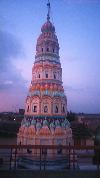
Gundwad is a village in Belgaum district in the southern state of Karnataka, India. situated on the bank of Krishna River. There is a Parshvanatha Basadi in the village which can be seen from few kilometers. Majority population in the village are Jains.The last Puncha Kalyna pooja held with lot of bhakti and enthusiasm in 2022.
Karagaon is a village in Belgaum district in the south western state of Karnataka, village located 16 kilometers from Chikodi and 64 kilometers from its district headquarters Belgaum. Agriculture is the major occupation of the village, grows variety of corps like sugar cane, jawar, soybean, tobacco, and peanuts.
Kadgaon is a town situated Gadhinglaj Taluka of Kolhapur district situated in the southwest corner of the state of Maharashtra, India. Kadgaon is about 4 km from Gadhinglaj, 79 km from Kolhapur. Kadgaon is situated on MH SH 134 and is about 15 km from National Highway 48 (NH48). It is managed by Town Council. It is in the phase of transforming from a small town to a bustling city. It is the second-largest city after Gadhinglaj in Gadhinglaj Taluka also second largest city in Gadhinglaj sub division which Include talukas of Gadhinglaj, Ajra, Bhudargad, Chandgad. As of 2012 it has a population of about 20,851. Kadgaon has amenities that are of the level of Municipal Council in India. Kadgaon has developed as an industrial hub in recent years. It has a strong agricultural sector and is known for its sugarcane, jaggery and red chili production. It is well connected to all of Kolhapur and Maharashtra. It has a very excellent civic amenities. Like in most of the case in the Maharashtra the primary Language spoken is Marathi with 20,851 speaking as their primary Language.

Vasanthrao Lakangouda Patil, widely known as 'Aabaji' was an Indian politician, industrialist, and freedom fighter.
Manjari is a village located in Chikodi Tehsil of Belgaum district in Karnataka, India. It is located 20 km (12 mi) away from sub-district headquarters Chikodi, the nearest town, and 100 km (62 mi) away from district headquarter Belgaum. As per 2009 stats, Manjari village is also a gram panchayat. The total geographical area of village is 555.71 hectares. Manjari has a total population of 8,613 peoples. There are about 1,844 houses in Manjari village.

