Shirebourne brook

Last updated
Bridge over the upper reaches of the Shirebourne at King George's Fields, Hadley. Bridge over the Shirebourne, King George's Fields (Monken Hadley).jpg
Bridge over the upper reaches of the Shirebourne at King George's Fields, Hadley.

The Shirebourne is a brook that rises in King George's Fields, Hadley, and eventually joins the Pymmes Brook. It may have marked the historic county boundary between Hertfordshire and Middlesex.

King Georges Fields (Monken Hadley)

King George's Fields is a 28 hectare Site of Borough Importance for Nature Conservation, Grade II, in Monken Hadley in the London Borough of Barnet.

Contents

Location

The Shirebourne rises in King George's Fields, Hadley. It is culverted between the eastern side of the Fields at Bosworth Road until it emerges overground at the south-west corner of the Victoria Recreation Ground in New Barnet. There it flows along the southern side of the park, and under Park Road, after which it joins the Pymmes Brook.

Victoria Recreation Ground, New Barnet

Victoria Recreation Ground is a public park in New Barnet in the London Borough of Barnet. It is one of Barnet's 'Premier Parks'.

New Barnet area within the London Borough of Barnet

New Barnet is an area within the London Borough of Barnet. It is a largely residential North London suburb, close to the M25, A1 and M1.

Pymmes Brook river in the United Kingdom

Pymmes Brook is located in North London and named after William Pymme, a local land owner. It is a minor tributary of the River Lea. The brook mostly flows through urban areas and is particularly prone to flooding in its lower reaches. To alleviate the problem the brook has been culverted in many areas. Part of it is a Site of Borough Importance for Nature Conservation, Grade II.

In history

The brook may originally have been named Scirbrunan in old English which translates as "shirebourn" meaning "county stream". The name Shirebourne appears in the Barnet Manor Rolls in 1277 and the upper reaches of the Shirebourne in the modern King George's Fields were known in 1556 as Sheredyche. The manor rolls for 1699 mention a field known as Sherborne Meadow and the index to the 1817 enclosure map mentions Sherbourn Field abutting the Shirebourne. The brook may be the one that formed the county boundary between Hertfordshire and Middlesex. [1]

Hertfordshire County of England

Hertfordshire is one of the home counties in England. It is bordered by Bedfordshire to the north, Cambridgeshire to the north-east, Essex to the east, Buckinghamshire to the west and Greater London to the south. For government statistical purposes, it is placed in the East of England region.

Middlesex historic county of England

Middlesex is an ancient county in southeast England. It is now entirely within the wider urbanised area of London. Its area is now also mostly within the ceremonial county of Greater London, with small sections in other neighbouring ceremonial counties. It was established in the Anglo-Saxon system from the territory of the Middle Saxons, and existed as an official unit until 1965. The historic county includes land stretching north of the River Thames from 17 miles (27 km) west to 3 miles (5 km) east of the City of London with the rivers Colne and Lea and a ridge of hills as the other boundaries. The largely low-lying county, dominated by clay in its north and alluvium on gravel in its south, was the second smallest county by area in 1831.

Related Research Articles

Osidge human settlement in United Kingdom

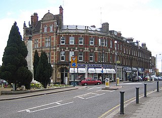
Osidge is a district in the London Borough of Barnet, between Brunswick Park and Southgate, just west of the border with the London Borough of Enfield. It may be defined as the part of postal district N14 that is in Barnet. Osidge has no formal border and is entirely enclosed within the electoral ward of Brunswick Park; however Oak Hill Park forms a natural boundary to the North and Pymmes Brook to the West, with the A111 to the East and the Piccadilly line to the South/East.

Barnet Urban District

Barnet was a local government district in south Hertfordshire from 1863 to 1965 around the town of Barnet.

East Barnet Urban District

East Barnet Valley was a local government district from 1863 to 1965 around the town of East Barnet. It was partly in the counties of Hertfordshire and Middlesex until 1889, when the Middlesex part was transferred to Hertfordshire. It was renamed East Barnet in 1935.

Monken Hadley human settlement in United Kingdom

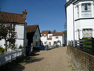
Monken Hadley is a place in the London Borough of Barnet. An ancient country village north of Barnet, it is now a suburban development on the very edge of Greater London 11 miles (18 km) north north-west of Charing Cross, while retaining much of its rural character.

The London Borough of Enfield is the northernmost of the Outer London boroughs. The borough lies within the Metropolitan Green Belt, and several of its 123 or more parks and open spaces are part of it. The ancient Enfield Chase, remnants of which still exist, occupied much of the area. In addition to many playgrounds and sports facilities, the main areas of public open space are:

The London Borough of Barnet, located on the northern periphery of London and having much of the area within its boundaries in the Metropolitan Green Belt, has a large number of parks and open spaces. In addition there are large areas taken over by cemeteries and golf courses, and part of Hampstead Heath.
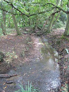
Folly Brook

Folly Brook is a 2 14 miles (3.6 km) long brook in the London Borough of Barnet. It is a tributary of Dollis Brook, which is a tributary of the River Brent, which is a tributary of the River Thames. Folly Brook is lined for most of its length by narrow strips of woodland and scrub, with a good variety of trees and shrubs. It is one of the best streams in Barnet for small aquatic invertebrates, including several species of caddis fly and a stonefly, which are only found in unpolluted waters.

River Moselle (London) river in Greater London, United Kingdom

The River Moselle, also referred to as Moselle Brook, is in North London and flows through Tottenham towards the Lea Valley. The river was originally a tributary of the River Lea, but it now flows into Pymmes Brook, another Lea tributary.

Edmonton Hundred

Edmonton is one of six hundreds of the historic county of Middlesex, England. A rotated L-shape, its area has been in the south and east firmly part of the urban growth of London. Since the 1965 formation of London boroughs it mainly corresponds to the London Boroughs of Enfield, a negligible portion of Barnet and a narrow majority of Haringey. Its ancient parish of South Mimms has since 1965 been part of the Hertsmere district in Hertfordshire.

Salmons Brook river in the United Kingdom

Salmons Brook is a minor tributary of the River Lea, located in the London Borough of Enfield.

Pymmes Brook Trail

The Pymmes Brook Trail is located in the London Boroughs of Barnet, Enfield and Haringey and is just under 13 miles (21 km) long. It is named after William Pymme, a local landowner between 1307 and 1327. The trail goes from Hadley Green to Tottenham Hale, where the trail connects with the Lea Valley Walk. Most of the first half of the trail, as far as Arnos Park, runs beside Pymmes Brook, but after that the brook is only encountered intermittently as much of it passes through private land which is not open to the public. In its lower reaches sections of the brook have been culverted to alleviate the risk of flooding.

Monken Hadley Common

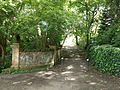
Monken Hadley Common lies within the Monken Hadley Conservation Area, and is listed as a “Site of Borough Importance for Nature Conservation, Grade I,” by the London Borough of Barnet. It is registered common land, and it is owned by the Trustees of Monken Hadley Common.

Mutton Brook river in London, United Kingdom

Mutton Brook is a stream which runs between East Finchley and Hendon in the London Borough of Barnet. It is a tributary of the River Brent, which is itself a tributary of the River Thames.

Friary Park park in Friern Barnet, London

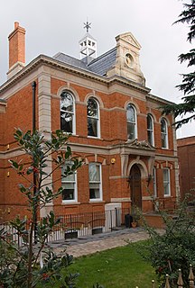
Friary Park is a nine hectare formal Edwardian park in Friern Barnet in the London Borough of Barnet.

Edgwarebury Brook

Edgwarebury Brook is a small stream in Edgware in the London Borough of Barnet. It is a tributary of Deans Brook, which is a tributary of the Silk Stream, which is a tributary of the River Brent, which is tributary of the River Thames.

Folly Farm, Barnet

Folly Farm, originally Folly House, on the southern edge of Monken Hadley Common, was a farm that dated from 1686 and became a popular recreation site in the early 20th century. The site is now occupied by the Jewish Community Secondary School.

References

  1. Newsletter. Vol. 8, August 2005, p. 4. Hendon & District Archaeological Society. Retrieved 26 May 2017.

Commons-logo.svg Media related to Shirebourne brook at Wikimedia Commons

Coordinates: 51°39′06″N0°09′59″W / 51.65154°N 0.16645°W / 51.65154; -0.16645

Geographic coordinate system Coordinate system

A geographic coordinate system is a coordinate system that enables every location on Earth to be specified by a set of numbers, letters or symbols. The coordinates are often chosen such that one of the numbers represents a vertical position and two or three of the numbers represent a horizontal position; alternatively, a geographic position may be expressed in a combined three-dimensional Cartesian vector. A common choice of coordinates is latitude, longitude and elevation. To specify a location on a plane requires a map projection.