Shire is a traditional term for an administrative division of land in Great Britain and some other English-speaking countries such as Australia. It is generally synonymous with county. It was first used in Wessex from the beginning of Anglo-Saxon settlement, and spread to most of the rest of England in the tenth century. In some rural parts of Australia, a shire is a local government area; however, in Australia, it is not synonymous with a "county", which is a lands administrative division.

York County is a county in the eastern part of the Commonwealth of Virginia, located in the Tidewater. As of the 2020 census, the population was 70,045. The county seat is the unincorporated town of Yorktown.

Southampton County is a county located on the southern border of the Commonwealth of Virginia. North Carolina is to the south. As of the 2020 census, the population was 17,996. Its county seat is Courtland.

Isle of Wight County is a county located in the Hampton Roads region of the U.S. state of Virginia. It was named after the Isle of Wight, England, south of the Solent, from where many of its early colonists had come. As of the 2020 census, the population was 38,606. Its county seat is Isle of Wight, an unincorporated community.

Elizabeth City County was a county in southeastern Virginia from 1634 until 1952 when it was merged into the city of Hampton. Originally created in 1634 as Elizabeth River Shire, it was one of eight shires created in the Virginia Colony by order of the King Charles I. In 1636, it was subdivided, and the portion north of the harbor of Hampton Roads became known as Elizabeth City Shire. It was renamed Elizabeth City County a short time later.

The Virginia Peninsula is located in southeast Virginia, bounded by the York River, James River, Hampton Roads and Chesapeake Bay. It is sometimes known as the Lower Peninsula to distinguish it from two other peninsulas to the north, the Middle Peninsula and the Northern Neck.

South Hampton Roads is a region located in the extreme southeastern portion of Virginia's Tidewater region in the United States with a total population of 1,191,937. It is part of the Virginia Beach-Norfolk-Newport News, VA-NC MSA, which itself has a population of 1,724,876.
Warwick County was a county in Southeast Virginia that was created from Warwick River Shire, one of eight created in the Virginia Colony in 1634. It became the City of Newport News on July 16, 1952. Located on the Virginia Peninsula on the northern bank of the James River between Hampton Roads and Jamestown, the area consisted primarily of farms and small unincorporated villages until the arrival of the Peninsula Extension of the Chesapeake and Ohio Railway in 1881 and development led by industrialist Collis P. Huntington.

Warwick River Shire was one of eight shires created in colonial Virginia in 1634. It was located on the Virginia Peninsula on the northern shore of the James River between Hampton Roads and the Jamestown Settlement.
Elizabeth City Shire was one of eight shires created in colonial Virginia in 1634. The shire and the Elizabeth River were named for Elizabeth of Bohemia, daughter of King James I.
Nansemond is an extinct jurisdiction that was located south of the James River in Virginia Colony and in the Commonwealth of Virginia in the United States, from 1646 until 1974. It was known as Nansemond County until 1972. From 1972 to 1974, a period of eighteen months, it was the independent city of Nansemond. It is now part of the independent city of Suffolk.
Warwick is an extinct independent city which was located in the State of Virginia in the United States from 1952 until 1958. Formed by a political conversion of the former Warwick County, Virginia (1634–1952), it is now part of the independent city of Newport News, Virginia.
Charles River Shire was one of eight shires of Virginia created in the Virginia Colony in 1634.
Warrosquoake Shire was officially formed in 1634 in the Virginia colony, but had already been known as "Warascoyack County" before this. It was named for an Algonquian-speaking tribe that was part of the Powhatan Confederacy. The county was renamed Isle of Wight County in 1637, after an island in the English Channel.
Charles City Shire was formed in 1634 in the colony of Virginia. It was named for Charles I, the then King of England, and was renamed Charles City County in 1637.
James City Shire was formed in the British colony of Virginia in 1634.
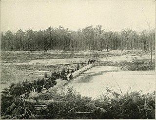
The Warwick River is a 14.4-mile-long (23.2 km) tidal estuary which empties into the James River a few miles from Hampton Roads at the southern end of Chesapeake Bay in southeast Virginia in the United States. Originating in York County near the northern side a few miles west of Yorktown, it flows south across the Virginia Peninsula and is almost entirely located in the independent city of Newport News.

Skiffe's Creek is located in James City County and the independent city of Newport News in the Virginia Peninsula area of the Hampton Roads region of southeastern Virginia in the United States. It is a tributary of the James River.

Newport News has a long history dating back to the days of Jamestown, Virginia. The area which is now the city of Newport News has existed under different names and forms including Elizabeth Cittie, Warwick River Shire, Warwick County, Virginia, Warwick City, and the current independent city of Newport News.
