Ibaraki Prefecture is a prefecture of Japan located in the Kantō region of Honshu. Ibaraki Prefecture has a population of 2,871,199 and has a geographic area of 6,097.19 square kilometres. Ibaraki Prefecture borders Fukushima Prefecture to the north, Tochigi Prefecture to the northwest, Saitama Prefecture to the southwest, Chiba Prefecture to the south, and the Pacific Ocean to the east.

Okutama is a town located in the western portion of Tokyo Metropolis, Japan. As of 1 April 2021, the town had an estimated population of 4,949, and a population density of 22 persons per km2. The total area of the town is 225.53 square kilometres (87.08 sq mi).
The Ōi River is a river in Shizuoka Prefecture, Japan.

The Shinano River, known as the Chikuma River in its upper reaches, is the longest and widest river in Japan and the third largest by basin area. It is located in northeastern Honshu, rising in the Japanese Alps and flowing generally northeast through Nagano and Niigata Prefectures before emptying into the Sea of Japan.

An abutment is the substructure at the ends of a bridge span or dam supporting its superstructure. Single-span bridges have abutments at each end which provide vertical and lateral support for the span, as well as acting as retaining walls to resist lateral movement of the earthen fill of the bridge approach. Multi-span bridges require piers to support ends of spans unsupported by abutments. Dam abutments are generally the sides of a valley or gorge, but may be artificial in order to support arch dams such as Kurobe Dam in Japan.
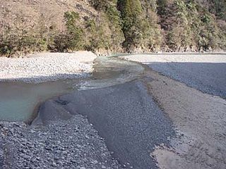
The Kuma River is a river in Kumamoto Prefecture, central Western part of Kyūshū, Japan. It is sometimes referred as Kumagawa River. It is the longest river in Kyushu, with the length of 115 km long and has a drainage area of 1,880 km2 (730 sq mi). The tidal flat of the Kuma River estuary is approximately 1000 hectares.
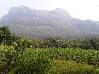
Malampuzha, IPA: [mɐlɐmbuɻɐ], is a village in Palakkad district of Kerala, South India, near to the Malampuzha Dam.

Saru River is a river in Hokkaidō, Japan.

Malampuzha Dam is the largest dam and reservoirs in Kerala, located near Palakkad, in the state of Kerala in South India, built post independence by the then Madras state. Situated in the scenic hills of the Western Ghats in the background it is a combination of a masonry dam with a length of 1,849 metres and an earthen dam with a length of 220 metres making it the longest dam in the state. The dam is 355 feet high and crosses the Malampuzha River, a tributary of Bharathappuzha, Kerala's second longest river. There is a network of two canal systems that serve the dam's reservoir of 42,090 hectares.

The Tenryū River is a river in central Honshū, Japan. With a length of 213 km (132 mi), it is Japan's ninth longest river.
Chubu Electric Power Co., Inc., abbreviated as Chuden in Japanese, is a Japanese electric utilities provider for the middle Chūbu region of the Honshu island of Japan. It provides electricity at 60 Hz, though an area of Nagano Prefecture uses 50 Hz. Chubu Electric Power ranks third among Japan's largest electric utilities in terms of power generation capacity, electric energy sold, and annual revenue. It is also one of Nagoya's "four influential companies" along with Meitetsu, Matsuzakaya, and Toho Gas. Recently, the company has also expanded into the business of optical fibers. On January 1, 2006, a new company, Chubu Telecommunications, was formed.

The Shō River has its source in Mount Eboshi in the Shōkawa-chō area of Takayama, Gifu Prefecture, Japan. After flowing for 115 km (71 mi) through the northern part of Gifu Prefecture and the western part of Toyama Prefecture, it empties into Toyama Bay.

Shiromaru Station was a railway station located in Noto, Hōsu District, Ishikawa Prefecture, Japan. This station was abandoned on April 1, 2005.
Niikappu River is a river in Hokkaidō, Japan.

Shiromaru Station is a passenger railway station in the town of Okutama, Tokyo, Japan, operated by the East Japan Railway Company.

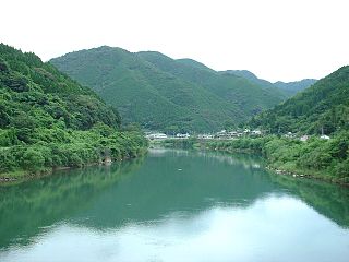
The Gōnokawa River is a river that runs through Hiroshima and Shimane prefectures in Japan. It is the largest river in the Chūgoku region. It is also called the Gōgawa River and, in Hiroshima, the Enokawa River.

Detective Conan: Quarter of Silence is the fifteenth film installment of the manga and anime series Case Closed. The film was released on April 16, 2011. This film celebrates the fifteenth anniversary of the anime. Magic File 2011, ties in with the film and was released on the same day as the film's premiere.
Mimi River is a river of Japan. It flows through the Miyazaki Prefecture. There is cascade of six dams built on the river with two dams in the upstream basin of the Tsukabaru Dam and three dams on the downstream.

The Shin-Takasegawa Pumped Storage Station (新高瀬川発電所) uses the Takase River to operate a pumped storage hydroelectric scheme about 12 kilometres (7.5 mi) west of Ōmachi in Nagano Prefecture, Japan. Part of the system is within Chūbu-Sangaku National Park.